Digital elevation model
From Wikipedia, the free encyclopedia
A digital elevation model (DEM) is a digital representation of ground surface topography or terrain. It is also widely known as a digital terrain model (DTM). A DEM can be represented as a raster (a grid of squares) or as a triangular irregular network. DEMs are commonly built using remote sensing techniques, however, they may also be built from land surveying. DEMs are used often in geographic information systems, and are the most common basis for digitally-produced relief maps.
Contents |
[edit] Production
Digital elevation models may be prepared in a number of ways, but they are frequently obtained by remote sensing rather than direct survey. One powerful technique for generating digital elevation models is interferometric synthetic aperture radar; two passes of a radar satellite (such as RADARSAT-1) suffice to generate a digital elevation map tens of kilometers on a side with a resolution of around ten meters. One also obtains an image of the surface cover.
Another powerful technique for generating a Digital Elevation Model is using the digital image correlation method. It implies two optical images acquired with different angles taken from the same pass of an airplane or an Earth Observation Satellite (such as the HRS instrument of SPOT5).
Older methods of generating DEMs often involve interpolating digital contour maps that may have been produced by direct survey of the land surface; this method is still used in mountain areas, where interferometry is not always satisfactory. Note that the contour line data or any other sampled elevation datasets (by GPS or ground survey) are not DEMs, but may be considered digital terrain models. A DEM implies that elevation is available continuously at each location in the study area.
The quality of a DEM is a measure of how accurate elevation is at each pixel (absolute accuracy) and how accurately is the morphology presented (relative accuracy). Several factors play an important role for quality of DEM-derived products:
- terrain roughness;
- sampling density (elevation data collection method);
- grid resolution or pixel size;
- interpolation algorithm;
- vertical resolution;
- terrain analysis algorithm;
[edit] Methods for obtaining elevation data to used to create DEMs
- Real Time Kinematic GPS
- stereo photogrammetry
- LIDAR
- Topographic Maps
- Theodolite or total station
- Doppler,
- Inertial surveys
[edit] Uses
Common uses of DEMs include:
- extracting terrain parameters
- modeling water flow or mass movement (for example avalanches and landslides)
- creation of relief maps
- rendering of 3D visualizations.
- creation of physical models (including raised-relief maps)
- rectification of aerial photography or satellite imagery.
- reduction (terrain correction) of gravity measurements (gravimetry, physical geodesy).
- terrain analyses in geomorphology and physical geography
- Geographic Information Systems (GIS)
- Engineering and infrastructure design
- Global positioning systems (GPS)
- Line-of-sight analysis
- Base mapping
- Flight simulation
- Precision farming and forestry
- Surface analysis
- Intelligent transportation systems (ITS)
- Auto safety / Advanced Driver Assistance Systems (ADAS)
[edit] Differences between DEMs and DSMs
A digital elevation model — also sometimes called a digital terrain model (DTM) — generally refers to a representation of the Earth's surface (or subset of this), excluding features such as vegetation, buildings, bridges, etc. The DEM often comprises much of the raw dataset, which may have been acquired through techniques such as photogrammetry, LiDAR, IfSAR, land surveying, etc. A digital surface model (DSM) on the other hand includes buildings, vegetation, and roads, as well as natural terrain features. [1] The DEM provides a so-called bare-earth model, devoid of landscape features. While a DSM may be useful for landscape modeling, city modeling and visualization applications, a DEM is often required for flood or drainage modeling, land-use studies, geological applications, and much more.[2]
[edit] Sources
A free DEM of the whole world called GTOPO30 (30 arcsecond resolution, approx. 1 km) is available, but its quality is variable and in some areas it is very poor. A much higher quality DEM from the Shuttle Radar Topography Mission (SRTM) is also freely available for most of the globe and represents elevation at a 3 arc-second resolution (around 90 metres). It has also been developed at 1 arc-second (30 m) resolution, but this has only been declassified for United States territory. The limitation with both datasets is that they cover continental landmasses only, and SRTM does not cover the polar regions and has mountain and desert no data (void) areas. Submarine elevation (known as bathymetry) data is generated using ship-mounted depth soundings. The SRTM30Plus dataset (used in NASA World Wind) attempts to combine GTOPO30, SRTM and bathymetric data to produce a truly global elevation model.[3]
The most usual grid (raster) is between 50 and 500 meters. In gravimetry e.g., the primary grid may be 50 m, but is switched to 100 or 500 meters in distances of about 5 or 10 kilometers.
Many national mapping agencies produce their own DEMs, often of a higher resolution and quality, but frequently these have to be purchased, and the cost is usually prohibitive to all except public authorities and large corporations.
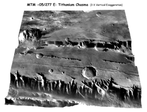
Free DEMs are also available for Mars: the MEGDR, or Mission Experiment Gridded Data Record, from the Mars Global Surveyor's Mars Orbiter Laser Altimeter (MOLA) instrument; and NASA's Mars Digital Terrain Model (DTM).[4]
[edit] United States
The US Geological Survey produces the National Elevation Dataset, a seamless DEM for the contiguous United States, Hawaii and Puerto Rico based on 7.5' topographic mapping. As of the beginning of 2006, this replaces the earlier DEM tiled format (one DEM per USGS topographic map).[5][6]
[edit] References
- Paula Messina. "Terrain Analysis Home Page". Spatial Analysis and Remote Sensing Lab at Hunter College. http://www.geo.hunter.cuny.edu/terrain. Retrieved on 2007-02-16.
- Wilson, J.P.; Gallant, J.C. (2000). "Chapter 1". in Wilson, J.P., and Gallant, J.C. (Eds.). Terrain Analysis: Principles and Applications. pp. 1–27. ISBN 0471321885.
- ^ "Intermap Technologies: Digital Surface Models". http://www.intermap.com/right.php/pid/3/sid/15/tid/15.
- ^ "Appendix A – Glossary and Acronyms". Severn Tidal Tributaries Catchment Flood Management Plan – Scoping Stage. UK: Environment Agency. http://www.environment-agency.gov.uk/commondata/acrobat/app_a_1243533.pdf.
- ^ see Martin Gamache's paper on free sources of global data, http://www.terrainmap.com/downloads/Gamache_final_web.pdf
- ^ A basic guide for using Digital Elevation Models with Terragen
- ^ http://eros.usgs.gov/DEMNotice.html
- ^ see Herbert Glarner's paper on using USGS data, http://herbert.gandraxa.com/herbert/dem.asp

