Ogallala Aquifer
From Wikipedia, the free encyclopedia


The Ogallala Aquifer, also known as the High Plains Aquifer, is a vast yet shallow underground water table aquifer located beneath the Great Plains in the United States. One of the world's largest aquifers, it covers an area of approximately 174,000 mi² (450,000 km²) in portions of the eight states of South Dakota, Nebraska, Wyoming, Colorado, Kansas, Oklahoma, New Mexico, and Texas. It was named in 1898 by N.H. Darton from its type locality near the town of Ogallala, Nebraska.[1] About 27 percent of the irrigated land in the United States overlies this aquifer system, which yields about 30 percent of the nation's ground water used for irrigation. In addition, the aquifer system provides drinking water to 82 percent of the people who live within the aquifer boundary. [2]
Contents |
[edit] General characteristics
The deposition of the aquifer material dates back 2 to 6 million years to late Miocene to early Pliocene age when the southern Rocky Mountains were still tectonically active. From the uplands to the west, rivers and streams cut channels in a generally west to east or southeast direction. Erosion of the Rockies provided alluvial and aeolian sediment that filled the ancient channels and eventually covered the entire area of the present-day aquifer, forming the water-bearing Ogallala Formation. The depth of the formation varies with the shape of the pre-Ogallala surface, being deepest where it fills ancient valleys and channels. The Ogallala Formation consists mostly of coarse sedimentary rocks in its lower sections, which grade upward into finer-grained lithologies.[3]
The water-permeated thickness of the Ogallala Formation ranges from a few feet to more than 1000 feet (300 m) and is generally greater in the northern plains.[4] The depth of the water below the surface of the land ranges from almost 400 feet (122 m) in parts of the north to between 100 to 200 feet (30 to 61 m) throughout much of the south. Present-day recharge of the aquifer with fresh water occurs at a slow rate; this implies that much of the water in its pore spaces is paleowater, dating back to the last ice age.
[edit] Aquifer water balance
An aquifer is a groundwater storage reservoir in the water cycle. While groundwater is a renewable source, reserves replenish relatively slowly. The USGS has performed several studies of the aquifer, to determine what is coming in (groundwater recharge from the surface), what is leaving (pumping and baseflow to streams) and what the net changes in storage are (rise, fall or no change — see figure above). Simply put, water in, minus the water out, is equal to the change in water stored in the aquifer. This type of mass-balance "accounting" is how hydrologic budgets are performed, and is a crucial first step in sustainable management of any natural resource.
The Ogallala Aquifer is being depleted at a rate of 12 cubic km (420,000 million ft3 or 9.7 million acre feet) per year, which is about two thirds of the historical discharge rate of the Colorado River. As of 2005, the total depletion amounted to 253 million acre-feet (312 cubic km)[5]. Some estimates say it will dry up in as little as 25 years. Many farmers in the Texas High Plains, which rely particularly on the underground source, are now turning away from irrigated agriculture as they become aware of the hazards of overpumping.[6]
[edit] Groundwater recharge
The rate at which recharge water enters the aquifer is limited by several factors. Much of the plains region is semi-arid with steady winds that hasten evaporation of surface water and precipitation. In many locations, the aquifer is overlain, in the vadose zone, with a shallow layer of caliche that is practically impermeable; this limits the amount of water able to recharge the aquifer from the land surface. However, the soil of the playa lakes is different and not lined with caliche, making these some of the few areas where the aquifer can recharge. The destruction of playas by farmers and development then decreases the available recharge area. The prevalence of the caliche is partly due to the ready evaporation of soil moisture and the semi-arid climate; the aridity increases the amount of evaporation which increases the amount of caliche in the soil. Both mechanisms reinforce the difficulty recharge has in reaching the water table.
[edit] Groundwater discharge
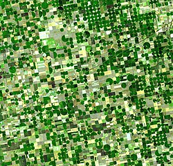
The regions overlying the Ogallala aquifer are some of the most productive regions for ranching livestock, and growing corn, wheat and soybeans in the United States (often called the "breadbasket of America"). The success of large-scale farming in areas which do not have adequate precipitation and do not always have perennial surface water for diversion depends heavily on pumping groundwater for irrigation.
Early settlers of the semi-arid High Plains were plagued by crop failures due to cycles of drought, culminating in the disastrous Dust Bowl of the 1930s. The aquifer was first tapped for irrigation in 1911. Large scale use for irrigation began in the 1930s and continued through the 1950s, due to the availability of electric power to rural farming communities and the development of cheap and efficient electric turbine pumps. It was only after World War II that affordable technology became available to substantially extract water. This transformed the High Plains into one of the most agriculturally productive regions in the world. During the early years, this source of water was thought to be inexhaustible, and its hydrology a mystery. However, because the rate of extraction exceeds the rate of recharge, water level elevations are decreasing. At some places the water table was measured to drop more than five feet (1.5 m) per year at the time of maximum extraction. In extreme cases, the deepening of wells was required to reach the steadily falling water table; and it has even been drained (dewatered) in some places such as Northern Texas. Utilizing treated recycled sources of water in agriculture is one approach at vouchsafing the future of the aquifer. Another method to reducing the amount of water use is changing to a crop that requires less water, such as sunflowers.[7]
Several of the rivers in the region, such as the Platte, are below the water level of the aquifer and therefore the rivers actually receive groundwater flow (baseflow) rather than supply recharge to the aquifer.
[edit] Change in groundwater storage
The USGS estimated that total water storage was about 2,925 million acre feet (3,608 km³) in 2005. This is a decline of about 253 million acre feet (312 km³) (or 9%) since substantial ground-water irrigation development began, in the 1950s.[8]
Water conservation practices (terracing and crop rotation), more efficient irrigation methods (center pivot and drip), and simply reduced area under irrigation have helped to slow depletion of the aquifer, but levels are generally still dropping. See the figure above for an illustration of the places where large drops in water level have been observed (i.e., the red areas in Texas and southern Kansas). In the more humid areas water levels have actually risen since 1980 (i.e., eastern and central Nebraska and south of Lubbock).
[edit] Other mentions of Ogallala aquifer
The importance of this aquifer has been recognized recently in many works, ranging from increased attention from journalism[9][10][11] to a mention in a plot for world domination in the Amazing Spider-Man comic book made by Marvel Comics.[12] It also figures prominently in the novel That Old Ace in the Hole by E. Annie Proulx, and as part of the historical background of the plot of the Canadian television mini-series H2O.
In the 1980s, Texas Panhandle organic foods farmer and spokesman Frank Ford successfully prevented the location of a nuclear waste repository in his native Deaf Smith County on the grounds that the material could poison the Ogallala Aquifer. The repository was instead located in Yucca Mountain in Nevada.
[edit] See also
[edit] References
- ^ Darton, N.H. 1898. Preliminary report on the geology and water resources of Nebraska west of the one hundred and third meridian. In: Walcott, C.D. (ed), Nineteenth Annual Report of the United States Geological Survey, 1897-1898, Part IV, pp. 719-785.
- ^ Dennehy, K.F. (2000). "High Plains regional ground-water study: U.S. Geological Survey Fact Sheet FS-091-00". USGS. http://co.water.usgs.gov/nawqa/hpgw/factsheets/DENNEHYFS1.html. Retrieved on 2008-05-07.
- ^ North Plains Groundwater Conservation District
- ^ High Plains Underground Water Conservation District #1 (Texas) retrieved April 9, 2007.
- ^ {V.L. Mcguire (2007). "Ground Water Depletion in the High Plains Aquifer - Water Levels in Some Areas Have Declined Over 150 Feet". http://geology.com/usgs/high-plains-aquifer.shtml. Retrieved on 2009-04-23.
- ^ "Ogallala aquifer - Water hot spots". BBC News. ?. http://news.bbc.co.uk/1/shared/spl/hi/world/03/world_forum/water/html/ogallala_aquifer.stm.
- ^ Farmers' tower of power. Jeremy P. Meyer, Denver Post. October 2, 2006. Last accessed October 24, 2006.
- ^ USGS Fact Sheet 2007-3029: Changes in Water Levels and Storage in the High Plains Aquifer, Predevelopment to 2005
- ^ Shrinking aquifer looms as big problem for farms. Nancy Cole, Arkansas Democrat-Gazette. September 24, 2006. Last accessed October 24, 2006.
- ^ Column - Mansel Phillips: Too many thirsty industries, not nearly enough water. Mansel Phillips, Amarillo Globe News. October 4, 2006. Last accessed October 24, 2006.
- ^ Another sign of long-term water worries. Lincoln Star Journal. October 8, 2006. Last accessed October 24, 2006.
- ^ Amazing Spider-Man #519-524
[edit] External links
- "The Ogallala Aquifer" Manjula V. Guru, Agricultural Policy Specialist and James E. Horne, President & CEO, The Kerr Center for Sustainable Agriculture, Poteau, Oklahoma
- USGS High Plains Regional Groundwater Study
- A Legal Fight in Texas over the Ogallala Aquifer
- Kansas Geological Survey information on the High Plains / Ogallala Aquifer
- Rapid Recharge of Parts of the High Plains Aquifer Indicated by a Reconnaissance Study in Oklahoma
Coordinates: [[pt:Aquífero de Ogallala]

