Burkina Faso
From Wikipedia, the free encyclopedia
|
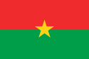
Burkina Faso
|
||||||
|---|---|---|---|---|---|---|
|
||||||
| Motto: "Unité, Progrès, Justice" (French) "Unity, Progress, Justice" |
||||||
| Anthem: Une Seule Nuit (French) One Single Night - Thomas Sankara |
||||||
 |
||||||
| Capital (and largest city) |
Ouagadougou |
|||||
| Official languages | French | |||||
| Recognised regional languages | Mòoré, Dioula | |||||
| Demonym | Burkinabè | |||||
| Government | Semi-presidential republic | |||||
| - | President | Blaise Compaoré | ||||
| - | Prime Minister | Tertius Zongo | ||||
| Independence | from France | |||||
| - | Date | August 5, 1960 | ||||
| Area | ||||||
| - | Total | 274,000 km2 (74th) 105,792 sq mi |
||||
| - | Water (%) | 0.1% | ||||
| Population | ||||||
| - | 2005 estimate | 13,228,000 (66th) | ||||
| - | 1996 census | 10,312,669 | ||||
| - | Density | 48/km2 (145th) 124/sq mi |
||||
| GDP (PPP) | 2007 estimate | |||||
| - | Total | $16.561 billion[1] (117th) | ||||
| - | Per capita | $1,206[1] (163rd) | ||||
| GDP (nominal) | 2007 estimate | |||||
| - | Total | $6.751 billion[1] | ||||
| - | Per capita | $491[1] | ||||
| Gini (2003) | 39.5 (medium) | |||||
| HDI (2007) | ▲ 0.372 (low) (173rd) | |||||
| Currency | West African CFA franc (XOF) |
|||||
| Time zone | GMT | |||||
| Drives on the | right | |||||
| Internet TLD | .bf | |||||
| Calling code | 226 | |||||
| 1 | The data here is an estimation for the year 2005 produced by the International Monetary Fund in April 2005. | |||||

Burkina Faso (pronounced /bɚˌkiːnə ˈfɑːsoʊ/ burr-KEE-nə FAH-soh), also known by its short-form name Burkina, is a landlocked nation in West Africa. It is surrounded by six countries: Mali to the north, Niger to the east, Benin to the south east, Togo and Ghana to the south, and Côte d'Ivoire to the south west. Its size is 274,000 km² with an estimated population of more than 13,200,000. Formerly called the Republic of Upper Volta, it was renamed on August 4, 1984, by President Thomas Sankara to mean "the land of upright people" in Moré and Dioula, the major native languages of the country. Literally, "Burkina" may be translated, "men of integrity," from the Moré language, and "Faso" means "father's house" in Dioula. The inhabitants of Burkina Faso are known as Burkinabè (pronounced /bɚˈkiːnəbeɪ/ burr-KEE-nə-bay).
Burkina Faso's capital is Ouagadougou. After gaining independence from France in 1960, the country underwent many governmental changes until arriving at its current form, a semi-presidential republic. The president is Blaise Compaoré.
Contents |
[edit] History
[edit] Early history
Burkina Faso was populated early, between 12000 and 5000 BCE, by hunter-gatherers in the northwestern part of the country, whose tools, such as scrapers, chisels and arrowheads, were discovered in 1973. Settlements appeared between 3600 and 2600 BCE with farmers. Based on traces of the farmers' structures, the settlements appear to have been permanent. The use of iron, ceramics and polished stone developed between 1500 and 1000 BCE, as well as a preoccupation with spiritual matters, as shown by burial remains.
Relics of the Dogon are found in Burkina Faso's north and northwest regions. The Dogon left the area between the fifteenth and sixteenth centuries to settle in the cliffs of Bandiagara. Elsewhere, the remains of high walls are localized in the southwest of Burkina Faso (as well as in the Côte d'Ivoire), but the people who built them have not been identified.
The central part of Burkina Faso included a number of Mossi kingdoms, the most powerful of which were that of Wagadogo (Ouagadougou) and Yatenga. These kingdoms emerged probably in the early sixteenth century from obscure origins veiled by legend featuring a heterogeneous set of warrior figures.[2]
[edit] From colony to independence
After a decade of intense rivalry and competition between the English and the French, waged through treaty-making expeditions under military or civilian explorers, the Mossi kingdom of Ouagadougou was defeated by French colonial forces and became a French protectorate in 1896. The eastern region and the western region, where a standoff against the forces of the powerful ruler Samori Ture complicated the situation, came under French occupation in 1897. By 1898, the majority of the territory corresponding to Burkina Faso today was nominally conquered; however, control of many parts remained uncertain. The French and English convention of 14 June 1898 ended the scramble between the two colonial powers and drew the borders between the countries' colonies. On the French side, a war of conquest against local communities and political powers continued for about five years. In 1904, the largely pacified territories of the Volta basin were integrated into the Upper Senegal and Niger colony of French West Africa as part of the reorganization of the French West African colonial empire. The colony had its capital in Bamako.
Draftees from the territory participated in the European fronts of World War I in the battalions of the Senegalese Rifles. Between 1915 and 1916, the districts in the western part of what is now Burkina Faso and the bordering eastern fringe of Mali became the stage of one of the most important armed oppositions to colonial government, known as the Volta-Bani War.[3] The French government finally suppressed the movement, but only after suffering defeats and being forced to gather the largest expeditionary force of its colonial history up to that point. Armed opposition also wracked the Sahelian north when the Tuareg and allied groups of the Dori region ended their truce with the government. French Upper Volta was established on March 1, 1919. This move was a result of French fears of the recurrence of armed uprising along with economic considerations, and the colonial government separated the present territory of Burkina Faso from Upper Senegal and Niger to bolster its administration. The new colony was named Haute Volta and François Charles Alexis Édouard Hesling became its first governor. Hesling initiated an ambitious road-making program and promoted the growth of cotton for export. The cotton policy, based on coercion, failed, and revenue stagnated. The colony was later dismantled on September 5, 1932, being split up between the Côte d’Ivoire, French Sudan and Niger. Côte d'Ivoire received the largest share, which contained most of the population as well as the cities of Ouagadougou and Bobo-Dioulasso.

The decision was reversed during the intense anti-colonial agitation that followed the end of World War II. After World War II, on September 4, 1947, the colony was revived as a part of the French Union, with its previous boundaries. On 11 December 1958, it achieved self-government and became the Republic of Upper Volta and a member of the Franco-African Community. A revision in the organization of French Overseas Territories began with the passage of the Basic Law (Loi Cadre) of July 23, 1956. This act was followed by reorganizational measures approved by the French parliament early in 1957 that ensured a large degree of self-government for individual territories. Upper Volta became an autonomous republic in the French community on December 11, 1958. Full independence from France was attained in 1960.
[edit] Upper Volta
|
|||||||||||||||||||||||||||||||||||||||||||||||||||||


The Republic of Upper Volta (French: République de Haute-Volta) was established on December 11, 1958, as a self-governing colony within the French Community. The name Upper Volta indicated that the country contains the upper part of the Volta River. The river is divided into three parts, called the Black Volta, White Volta and Red Volta, and the colors of the national flag corresponded to the parts of the river.
Before attaining autonomy it had been French Upper Volta and part of the French Union. On August 5, 1960 it attained full independence from France. The first president, Maurice Yaméogo, was the leader of the Voltaic Democratic Union (UDV). The 1960 constitution provided for election by universal suffrage of a president and a national assembly for 5-year terms. Soon after coming to power, Yaméogo banned all political parties other than the UDV. The government lasted until 1966 when after much unrest—mass demonstrations and strikes by students, labor unions, and civil servants—the military intervened.
The military coup deposed Yaméogo, suspended the constitution, dissolved the National Assembly, and placed Lt. Col. Sangoulé Lamizana at the head of a government of senior army officers. The army remained in power for 4 years, and on June 14, 1970, the Voltans ratified a new constitution that established a 4-year transition period toward complete civilian rule. Lamizana remained in power throughout the 1970s as president of military or mixed civil-military governments. After conflict over the 1970 constitution, a new constitution was written and approved in 1977, and Lamizana was reelected by open elections in 1978.
Lamizana's government faced problems with the country's traditionally powerful trade unions, and on November 25, 1980, Col. Saye Zerbo overthrew President Lamizana in a bloodless coup. Colonel Zerbo established the Military Committee of Recovery for National Progress as the supreme governmental authority, thus eradicating the 1977 constitution.
Colonel Zerbo also encountered resistance from trade unions and was overthrown two years later, on November 7, 1982, by Maj. Dr. Jean-Baptiste Ouédraogo and the Council of Popular Salvation (CSP). The CSP continued to ban political parties and organizations, yet promised a transition to civilian rule and a new constitution.
Factional infighting developed between moderates in the CSP and the radicals, led by Capt. Thomas Sankara, who was appointed prime minister in January 1983. The internal political struggle and Sankara's leftist rhetoric led to his arrest and subsequent efforts to bring about his release, directed by Capt. Blaise Compaoré. This release effort resulted in yet another military coup d'état on August 4, 1983.
After the coup, Sankara formed the National Council for the Revolution (CNR), with himself as president. Sankara also established Committees for the Defense of the Revolution (CDRs) to "mobilize the masses" and implement the CNR's revolutionary programs. The CNR, whose exact membership remained secret until the end, contained two small intellectual Marxist-Leninist groups. Sankara, Compaore, Capt. Henri Zongo, and Maj. Jean-Baptiste Lingani—all leftist military officers—dominated the regime.
Under the direction of Sankara the name of the state was changed on August 4, 1984, from Upper Volta to Burkina Faso, meaning "the country of honorable people".
[edit] In popular culture
West German chancellor Helmut Schmidt liked to describe the Soviet Union of the 1980s as "Upper Volta with missiles", according to David Halberstam in an article published in an August 2007 Vanity Fair magazine. The phrase "Upper Volta with rockets" was also used to describe the Soviet Union (in quotes, but with no attribution) in a survey on the Soviet economy in The Economist on April 9, 1988. According to Perry Anderson, the phrase was popular among foreign diplomats in the 1970s. He suggests the modern Russia might be "Saudi Arabia with Rockets".[4]
[edit] Politics
The constitution of 2 June 1991 established a semi-presidential government with a parliament which can be dissolved by the President of the Republic, who is elected for a term of seven years. In 2000, however, the constitution was amended to reduce the presidential term to five years. The amendment took effect during the 2005 elections. The amendment also would have prevented the sitting president, Blaise Compaoré, from being reelected; however, notwithstanding a challenge by other presidential candidates, the constitutional council ruled in October 2005 that because Compaoré was the sitting president in 2000, the amendment would not apply to him until the end of his second term in office. This cleared the way for his candidacy in the 2005 election. On 13 November, Compaoré was reelected in a landslide due to a divided political opposition.
The parliament consists of two chambers: the lower house, known as the National Assembly, and the upper house, the House of Representatives. There is also a constitutional chamber, composed of ten members, and an economic and social council whose roles are purely consultative.
[edit] Regions, provinces, and departements

Burkina Faso is divided into thirteen regions, forty-five provinces, and 301 departements. The regions are:
- Boucle du Mouhoun
- Cascades
- Centre
- Centre-Est
- Centre-Nord
- Centre-Ouest
- Centre-Sud
- Est
- Hauts-Bassins
- Nord
- Plateau-Central
- Sahel
- Sud-Ouest
[edit] Geography and climate

Burkina Faso is made up of two major types of countryside. The larger part of the country is covered by a peneplain, which forms a gently undulating landscape with, in some areas, a few isolated hills, the last vestiges of a Precambrian massif. The southwest of the country, on the other hand, forms a sandstone massif, where the highest peak, Ténakourou, is found at an elevation of 749 meters (2,450 feet). The massif is bordered by sheer cliffs up to 150 meters (490 ft) high. The average altitude of Burkina Faso is 400 meters (1,300 ft) and the difference between the highest and lowest terrain is no greater than 600 meters (2,000 ft). Burkina Faso is therefore a relatively flat country.
The country owes its former name of Upper Volta to three rivers which cross it: the Black Volta (or Mouhoun), the White Volta (Nakambé) and the Red Volta (Nazinon). The Black Volta, along with the Komoé, which flows to the southwest, is one of the country's only two rivers which flow year-round. The basin of the Niger River also drains 27% of the country's surface. Its tributaries, the Béli, the Gorouol, the Goudébo and the Dargol, are seasonal streams and only flow for four to six months a year. They still, however, can cause large floods. The country also contains numerous lakes. The principal lakes are Tingrela, Bam and Dem. The country also contains large ponds, such as Oursi, Béli, Yomboli and Markoye. Water shortages are often a problem, especially in the north of the country.

Burkina Faso has a primarily tropical climate with two very distinct seasons. In the rainy season, the country receives between 600 and 900 millimeters (24-35 inches) of rainfall, and in the dry season, the harmattan, a hot dry wind from the Sahara, blows. The rainy season lasts approximately four months, May/June to September, and is shorter in the north of the country. Three climatic zones can be defined: the Sahel, the Sudan-Sahel, and the Sudan-Guinea. The Sahel in the north typically receives less than 600 millimeters (24 inches)[5] of rainfall per year and has high temperatures, 5–47 °C (40–115 °F). A relatively dry tropical savanna, the Sahel extends beyond the borders of Burkina Faso, from the Horn of Africa to the Atlantic Ocean, and borders the Sahara to its north and the fertile region of the Sudan to the South. Situated between 11°3' and 13°5' north latitude, the Sudan-Sahel region is a transitional zone with regards to rainfall and temperature. Further to the south, the Sudan-Guinea zone receives more than 900 millimeters (35 inches)[5] of rain each year and has cooler average temperatures.
Burkina Faso's natural resources include manganese, limestone, marble, phosphates, pumice, salt and small deposits of gold.
Burkina Faso's fauna and flora are protected in two national parks and several reserves, see List of national parks in Africa.
[edit] Economy
Burkina Faso has one of the lowest GDP per capita incomes in the world: $1,200.[6] Agriculture represents 32% of its gross domestic product and occupies 80% of the working population. It consists mostly of livestock but also, especially in the south and southwest, of growing sorghum, pearl millet, maize (corn), peanuts, rice and cotton.
Unemployment causes a high rate of emigration. For example, three million citizens of Burkina Faso live in Côte d'Ivoire. According to the Central Bank of West African States, these migrants send substantial amounts of money back to Burkina Faso each year. Since the 1967 expulsions from Ghana, this situation has provoked tensions in the recipient countries. The most recent crisis occurred owing to the events of 2003 in Côte d'Ivoire, which led to the return of 300,000 migrants.
A large part of the economic activity of the country is funded by international aid.
The currency of Burkina Faso is the CFA franc.
There is mineral exploitation of copper, iron, manganese and, above all, gold.
Burkina Faso also hosts the International Art and Craft Fair, Ouagadougou, better known by its French name as SIAO, Le Salon International de l' Artisanat de Ouagadougou, one of the most important African handicraft fairs.
Burkina Faso is a member of the Organization for the Harmonization of Business Law in Africa (OHADA).[7]
[edit] Demographics

Burkina Faso's 15.3 million people belong to two major West African cultural groups--the Voltaic and the Mande (whose common language is Dioula). The Voltaic Mossi make up about one-half of the population. The Mossi claim descent from warriors who migrated to present-day Burkina Faso from Ghana and established an empire that lasted more than 800 years. Predominantly farmers, the Mossi kingdom is still led by the Mogho Naba, whose court is in Ouagadougou.[8]
Burkina Faso is an ethnically integrated, secular state. Most of Burkina's people are concentrated in the south and center of the country, sometimes exceeding 48 per square kilometer (125/sq. mi.). Hundreds of thousands of Burkinabe migrate to Cote d'Ivoire and Ghana, many for seasonal agricultural work. These flows of workers are obviously affected by external events; the September 2002 coup attempt in Cote d'Ivoire and the ensuing fighting there have meant that hundreds of thousands of Burkinabe returned to Burkina Faso.[8]
Burkina Faso has an estimated life expectancy at birth of 52.55 years of age. The median age of its inhabitants is 16.7. The estimated population growth rate is 3.109%. [9]
[edit] Religion
While exact statistics on religion in Burkina Faso are not available and vary widely, the Government of Burkina Faso estimated in its most recent census (1996) that approximately 60 percent of the population practice Islam, and that the majority of this group belong to the Sunni branch, while remaining minorities adhere to the Shi'a branch, and significant numbers of Sunni Muslims identify with the Tijaniyah Sufi, or Salafi traditions.[10] The Government also estimated that 24 percent of the population maintains traditional indigenous beliefs, 17 percent practices Roman Catholicism, and 3 percent are members of various Protestant denominations.[10]
A common proverb in Burkina Faso claims that "50% are Muslim, 50% are Christian, and 100% are Animist". This shows the large level of acceptance of the various religions amongst each other. Even for Muslims and Christians, ancient Animist rites are still highly valued. The Great Mosque of Bobo-Dioulasso was built by people of all faiths working together.
[edit] Culture

Literature in Burkina Faso is based on the oral tradition, which remains important.[11] In 1934, during French occupation, Dim-Dolobsom Ouedraogo published his Maximes, pensées et devinettes mossi (Maximes, Thoughts and Riddles of the Mossi), a record of the oral history of the Mossi people.[11] The oral tradition continued to have an influence on Burkinabè writers in the post-independence Burkina Faso of the 1960s, such as Nazi Boni and Roger Nikiema.[12] The 1960s saw a growth in the number of playwrights being published.[11] Since the 1970s, literature has developed in Burkina Faso with many more writers being published.[13]
The theatre of Burkina Faso combines traditional Burkinabè performance with the colonial influences and post-colonial efforts to educate rural people to produce a distinctive national theatre. Traditional ritual ceremonies of the many ethnic groups in Burkina Faso have long involved dancing with masks. Western-style theatre became common during colonial times, heavily influenced by French theatre. With independence came a new style of theatre inspired by forum theatre aimed at educating and entertaining Burkina Faso's rural people.
The cuisine of Burkina Faso, typically of west African cuisine, is based around staple foods of sorghum, millet, rice, maize, peanuts, potatoes, beans, yams and okra.[14] The most common sources of protein are chicken, chicken eggs and fresh water fish. A typical Burkinabè beverage is Banji or Palm Wine, which is fermented palm sap. Especially the town of Banfora is known for its good quality Banji, though you should be wary of the Banji sold by hawkers as it is often not very fresh may contain added water.
The cinema of Burkina Faso is an important part of West African and African film industry.[15]
[edit] Education
Education in Burkina Faso is divided into primary, secondary and higher education.[16] However schooling is not free. Secondary school costs approximately CFA 50,000 ($97 USD) per year, which is far above the means of most Burkinabè families. Boys receive preference in schooling; as such, girls' education and literacy rates are far lower than their male counterparts. An increase in girls' schooling has been observed due to the government's policy of making school cheaper for girls and granting them more scholarships. In order to proceed from elementary to middle school, middle to high school or high school to college, national exams must be passed. Institutions of higher education include the University of Ouagadougou, The Polytechnical University in Bobo-Dioulasso and the University of Koudougou, which is also a teacher training institution. There are private colleges in the capital city of Ouagadougou but these are affordable by only a small portion of the population.
There is also an International School of Ouagadougou (ISO), which is an American-based private school located in Ouagadougou.
The United Nations Development Program Report ranks Burkina Faso as the country with the lowest level of literacy in the world, despite a concerted effort to double its literacy rate from 12.8% in 1990 to 25.3% in 2008.[2]
[edit] See also
|
|
[edit] References
- ^ a b c d "Burkina Faso". International Monetary Fund. http://www.imf.org/external/pubs/ft/weo/2008/02/weodata/weorept.aspx?sy=2004&ey=2008&scsm=1&ssd=1&sort=country&ds=.&br=1&c=748&s=NGDPD%2CNGDPDPC%2CPPPGDP%2CPPPPC%2CLP&grp=0&a=&pr1.x=66&pr1.y=16. Retrieved on 2008-10-09.
- ^ Michel Izard, Moogo. L'émergence d'un espace étatique ouest-africain au XVIe siècle
- ^ Mahir Saul and Patrick Royer, West African Challenge to Empire, 2001
- ^ Anderson, Perry. London Review of Books, Vol 29, No.2, 25 January 2007
- ^ a b "SIM Country Profile: Burkina Faso". http://www.sim.org/country.asp?fun=1&CID=18. Retrieved on August 5 2006.
- ^ "CIA World Factbook, GDP Per Capita Rank Order". https://www.cia.gov/library/publications/the-world-factbook/rankorder/2004rank.html.
- ^ OHADA.com: The business law portal in Africa, http://www.ohada.com/index.php, retrieved on 2009-03-22
- ^ a b "Burkina Faso". U.S. Department of State (June 2008). This article incorporates text from this source, which is in the public domain.
- ^ CIA World Factbook, Burkina Faso [1]
- ^ a b International Religious Freedom Report 2007: Burkina Faso. United States Bureau of Democracy, Human Rights and Labor (September 14, 2007). This article incorporates text from this source, which is in the public domain.
- ^ a b c Salhi, Kamal (1999). Francophone Voices. Intellect Books. pp. 37. ISBN 1902454030. http://books.google.co.uk/books?id=G9u9TeDegXMC.
- ^ Allan, Tuzyline Jita (1997). Women's Studies Quarterly: Teaching African Literatures in a Global Literary. Feminist Press. pp. 86. ISBN 155861169X. http://books.google.co.uk/books?id=QD8TgZVWugYC.
- ^ Marchais, Julien (in French). Burkina Faso. Petit Futé. pp. 91–92. ISBN 2746916010. http://books.google.co.uk/books?id=6jsBLSzJWYsC.
- ^ "Oxfam's Cool Planet - Food in Burkina Faso". Oxfam. http://www.oxfam.org.uk/coolplanet/ontheline/explore/journey/burkina/food.htm. Retrieved on 2008-05-21.
- ^ Spaas, p.232
- ^ http://www.nationsencyclopedia.com/Africa/Burkina-Faso-EDUCATION.html
[edit] External links
![]() Textbooks from Wikibooks
Textbooks from Wikibooks
![]() Quotations from Wikiquote
Quotations from Wikiquote
![]() Source texts from Wikisource
Source texts from Wikisource
![]() Images and media from Commons
Images and media from Commons
![]() News stories from Wikinews
News stories from Wikinews
- Government
- Premier Ministère official government portal (in French)
- Chief of State and Cabinet Members
- General information
- Burkina Faso entry at The World Factbook
- Burkina Faso from UCB Libraries GovPubs
- Burkina Faso at the Open Directory Project
- Wikimedia Atlas of Burkina Faso
- News media
- Travel
|
||||||||||||||||||||||||||||||||


