Suez Canal
From Wikipedia, the free encyclopedia
| Suez Canal | |
|---|---|
 |
|
| Original Owner | Suez Canal Company (Compagnie Universelle du Canal Maritime de Suez) |
| Principal Engineer | Alois Negrelli |
| Construction Began | December 1858 |
| Date Completed | November 1869 |
| Date Closed | 0 |
| Locks | 0 |
| Status | Open |
| Navigation Authority | Suez Canal Authority |
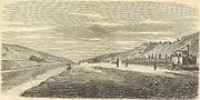
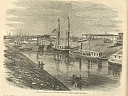
The Suez Canal is a canal in Egypt. Opened in November 1869, it allows water transportation between Europe and Asia without navigating around Africa or carrying goods overland between the Mediterranean and the Red Sea. The northern terminus is Port Said, with the southern terminus being near Suez. Ismailia is located halfway between Port Said and Suez.
The canal is 192 km (119 mi) long. The maximum depth of the canal is 38 feet (12 m). It is single-lane with 4 passing places[1][2] north and south of the Great Bitter Lake, and links the Mediterranean Sea to the Gulf of Suez on the Red Sea. It contains no locks; seawater flows freely through the canal into the Great Bitter Lake from both the Red Sea in the south and the Mediterranean in the north, replacing evaporation.[3]
The canal is owned and maintained by the Suez Canal Authority (SCA) of the Arab Republic of Egypt.
[edit] History
Two ancient west-east canals are documented as having facilitated travel from the Nile to the Red Sea.[4][5][6] One smaller canal was constructed under the auspices of either Senusret III or Ramesses II.[4][5][6] The other larger canal incorporated a portion of the first[4][5] but was located farther south[6] and was constructed under the reign of Necho II.[4][5][6]
[edit] 2nd millennium BCE
Perhaps as early as the 12th Dynasty, Pharaoh Senusret III (1878 BCE–1839 BCE) may have had a west-east river dug through the Wadi Tumilat, joining the River Nile with the Red Sea. This allowed direct trade with Punt, and, indirectly, linked the Red Sea and the Mediterranean. (In ancient times the Red Sea reached northward to the Bitter Lakes[4][5] and Lake Timsah.[7][8])
The reliefs of the Punt expedition under Hatshepsut 1470 BCE depict seagoing vessels carrying the expeditionary force returning from Punt. This has given rise to the theory that, at the time, a navigable link existed between the Red Sea and the Nile.[9]
Evidence indicates its existence by the 13th century BC during the time of Ramesses II.[4][10][11][12][13]
This ancient west-east canal was discovered in the early 1860s, running through the ancient Egyptian cities of Pi-Ramesses, Bubastis and Pithom, during the construction of the Sweet Water Canal.[5][14][15]
[edit] Repair by Necho, Darius I and Ptolemy
The waterway fell into disrepair, and according to the Histories of the Greek historian Herodotus,[16] about 600 BC, Necho II undertook re-excavation. Accounts are varied, however, as we are told that Necho endeavoured to either deepen the older canal between Bubastis and Heroopolis[5] and/or between the Heroopolite Gulf and the Red Sea.[4] Regardless, Necho is reported as having never completed his project.[4][5]
Herodotus was told that 120,000 men perished in this undertaking.[17] According to Pliny the Elder, Necho's extension to the canal was approximately 57 English miles,[5] equal to the total distance between Bubastis and the Great Bitter Lake, allowing for winding through valleys that it necessarily had to pass through.[5] The length that Herodotus tells us, of over 1000 stadia (i.e., over 114 miles), must be understood to include the entire distance between the Nile and the Red Sea[5] at that time.
With Necho's death, work was discontinued. Herodotus tells us that the reason the project was abandoned was because of a warning received from an oracle that others would benefit by its successful completion.[5][18]
Necho's project was finally completed by Darius I of Persia, who conquered Egypt. We are told that by Darius's time a natural[5] waterway passage which had existed[4] between the Heroopolite Gulf and the Red Sea[19] in the vicinity of the Egyptian town of Shaluf[5] (alt. Chalouf[20] or Shaloof[8]), located just south of the Great Bitter Lake,[5][8] had become so blocked[4] with silt[5] that Darius necessarily needed to clear it out so as to allow navigation[5] once again.
According to Herodotus, Darius's canal was wide enough that two triremes could pass each other with oars extended, and required four days to traverse. Darius commemorated his achievement with a number of granite stelae that he set up on the Nile bank, including one near Kabret, 130 miles (209 km) from Suez. The Darius Inscriptions read:
| “ | Saith King Darius: I am a Persian. Setting out from Persia, I conquered Egypt. I ordered this canal dug from the river called the Nile that flows in Egypt, to the sea that begins in Persia. When the canal had been dug as I ordered, ships went from Egypt through this canal to Persia, even as I intended.[21] | ” |
The canal left the Nile at Bubastis. An inscription on a pillar at Pithom records that in 270 or 269 BC it was again reopened, by Ptolemy II Philadelphus.[22] In Arsinoe,[5] Ptolemy constructed a navigable lock, with sluices, between the Heroopolite Gulf and the Red Sea[19] which allowed the passage of vessels but prevented salt water from the Red Sea from mingling with the fresh water in the canal.[5]
[edit] Receding Red Sea and the dwindling Nile
The Red Sea gradually receded over the centuries, its coastline slowly moving farther and farther southward away from Lake Timsah[7][8] and the Great Bitter Lake[4][5] to its present coastline today. Coupled with persistent accumulations of Nile silt, maintenance and repair of Ptolemy's canal became increasingly cumbersome over each passing century.
Two hundred years after the construction of Ptolemy's canal, Cleopatra seems to have had no west-east waterway passage,[4][5] because the Pelusiac branch of the Nile River, which had fed Ptolemy's west-east canal, had by that time dwindled, having choked up with silt.[4][5]

Over the next 1,000 years the Suez Canal was successively modified, destroyed and rebuilt, until finally it was put out of commission in the 8th century by the Abbasid Caliph al-Mansur about 750 AD.
[edit] Old Cairo to the Red Sea
By the 8th century, we are told, a navigable canal existed between Old Cairo and the Red Sea,[4][5] but accounts vary as to who ordered its construction -- either 'Amr ibn al-'As,[4] Omar the Great,[5] or Trajan.[4][5] This canal reportedly linked to the River Nile at Old Cairo[5] and ended near modern Suez.[4][23]
The Abbasid Caliph al-Mansur is said to have ordered this canal closed so as to prevent supplies from reaching Arabian detractors.[4][5]
[edit] Repair by Tāriqu l-Ḥākim
Al-Hakim bi-Amr Allah is claimed to have repaired the Old Cairo to Red Sea passageway,[4][5] but only briefly, circa 1000 AD,[4][5] as it soon "became choked with sand."[5] However, we are told that parts of this canal still continued to fill in during the Nile's annual inundations.[4][5]
Mehemet Ali is said to have ordered this canal closed[4][5] in 1811.[4]
[edit] Napoleon discovers an ancient canal
Napoleon Bonaparte's interest in finding the remnants of an ancient waterway passage[24] culminated in a cadre of archaeologists, scientists, cartographers and engineers scouring the area beginning in the latter months of 1798.[25] Their findings, recorded in the Description de l'Égypte, include detailed maps that depict the discovery of an ancient canal extending northward from the Red Sea and then westward toward the Nile.[24]
Later, in the second half of the 19th century,[26] French cartographers would again record the discovery of the remnants of yet another ancient north-south canal running past the east side of Lake Timsah and ending near the north end of the Great Bitter Lake.This second canal followed a course along the ancient shoreline of the Red Sea when the Red Sea once extended north to Lake Timsah.[8][26] Unknown, however, are exactly when these two ancient canals were constructed and by whom.
Napoleon had contemplated the construction of another, modern, north-south canal to join the Mediterranean and Red Sea. But his project was abandoned after the preliminary survey erroneously concluded that the Red Sea was 10 metres (33 ft) higher than the Mediterranean, making a locks-based canal too expensive and very long to construct. The Napoleonic survey commission's error came from fragmented readings mostly done during wartime, which resulted in imprecise calculations.[citation needed]

Though by this time unnavigable,[5] the ancient route from Bubastis to the Red Sea still channeled water in spots as late as 1861[5] and as far east as Kassassin.
[edit] Re-construction by Suez Canal Company
In 1854 and 1856 Ferdinand de Lesseps obtained a concession from Said Pasha, the viceroy of Egypt, to create a company to construct a canal open to ships of all nations, according to plans created by Austrian engineer Alois Negrelli. The company was to operate the canal by leasing the relevant land, for 99 years from its opening. De Lesseps had used his friendly relationship with Said, which he had developed while he was a French diplomat during the 1830s. The Suez Canal Company (Compagnie Universelle du Canal Maritime de Suez) came into being on 15 December, 1858.
The excavation took nearly 11 years using forced labour of Egyptian workers. Some sources estimate that over 30,000 people were forced to work on the canal. [27]
The British recognised the canal as an important trade route and perceived the French project as a threat to their geopolitical and financial interests. The British Empire was the major global naval force and officially condemned the forced work and sent armed bedouins to start a revolt among workers. Involuntary labour on the project ceased, and the viceroy condemned the slavery, halting the project.[28]
Angered by the British opportunism, de Lesseps sent a letter to the British government remarking on the British lack of remorse a few years earlier when forced workers died in similar conditions building the British railway in Egypt.
Initially international opinion was sceptical and Suez Canal Company shares did not sell well overseas. Britain, the United States, Austria and Russia did not buy any shares. All French shares were quickly sold in France. A contemporary British sceptic claimed:
| “ | "One thing is sure... our local merchant community doesn't pay practical attention at all to this grand work, and it is legitimate to doubt that the canal's receipts... could ever be sufficient to recover its maintenance fee. It will never become a large ships accessible way in any case." (reported by German historian Uwe A. Oster) | ” |

The canal opened to shipping on 17 November, 1869. Although numerous technical, political, and financial problems had been overcome, the final cost was more than double the original estimate.[29]
The canal had an immediate and dramatic effect on world trade. Combined with the American transcontinental railroad completed six months earlier, it allowed the entire world to be circled in record time. It played an important role in increasing European penetration and colonisation of Africa. External debts forced Said Pasha's successor, Isma'il Pasha, to sell his country's share in the canal for £4,000,000 to the United Kingdom in 1875, but France still remained the majority shareholder. Prime minister Benjamin Disraeli was accused by William Gladstone of undermining Britain's constitutional system, due to his lack of reference or consent from Parliament when purchasing the shares with funding from the Rothschilds. [30]
The Convention of Constantinople in 1888 declared the canal a neutral zone under the protection of the British; British troops had moved in to protect it during a civil war in Egypt in 1882. They were later to defend the strategically important passage against a major Ottoman attack in 1915.[31] Under the Anglo-Egyptian Treaty of 1936, the United Kingdom insisted on retaining control over the canal. In 1951 Egypt repudiated the treaty, and in 1954 the UK agreed to remove its troops, and withdrawal was completed in July 1956.
[edit] Suez Crisis
After the United Kingdom and the United States withdrew their pledge to support the construction of the Aswan Dam due to Egyptian overtures towards the Soviet Union, Egyptian President Gamal Abdel Nasser nationalised the canal in 1956, intending to finance the dam project using revenue from the canal, while at the same time closing the Gulf of Aqaba to all Israeli shipping by closure of the Straits of Tiran. This provoked the Suez Crisis, in which the UK, France and Israel colluded to invade Egypt. The intention was for Israel to invade on the ground, and for the Anglo-French partnership to give air and other support, later to intervene to resolve the crisis and control the canal.
To stop the war from spreading and to save the British from what he thought was a disastrous action, Canadian Secretary of State for External Affairs, Lester B. Pearson, proposed the creation of the very first United Nations peacekeeping force to ensure access to the canal for all and an Israeli withdrawal from the Sinai. On 4 November 1956, a majority of nations at the United Nations voted for Pearson's peacekeeping resolution, which mandated the UN peacekeepers to stay in the Sinai Peninsula unless both Egypt and Israel agreed to their withdrawal. The United States backed this proposal by putting financial pressure on the British government, which then agreed to withdraw its troops. Pearson was later awarded the Nobel Peace Prize.
As a result of damage and ships intentionally sunk under orders from Nasser[32] the canal was closed until April 1957, when it was cleared with UN assistance. A UN force (UNEF) was established to maintain the neutrality of the canal and the Sinai Peninsula.
[edit] Arab-Israeli wars of 1967 and 1973
In May 1967 President Nasser ordered the UN peacekeeping forces out of the Sinai Peninsula, including the Suez Canal area. Despite Israeli objections in the United Nations, the peacekeepers were withdrawn and the Egyptian army took up positions on the Israeli border, closing the Straits of Tiran to Israeli shipping. The canal itself had been closed to Israeli shipping since 1949, except for a short period in 1951-1952.
These actions were key factors in the Israeli decision to launch a pre-emptive attack on Egypt in June 1967, and to capture the Sinai Peninsula to the Suez Canal. After the 1967 Arab-Israeli war, also called the Six Day War, the canal was closed by an Egyptian blockade until 5 June 1975. As a result, fourteen cargo ships known as "The Yellow Fleet" remained trapped in the canal for over eight years. In 1973, during the Yom Kippur War, the canal was the scene of a major crossing by the Egyptian army into Israeli-occupied Sinai. Much wreckage from this conflict remains visible along the canal's edges.
The UNEF mandate expired in 1979. Despite the efforts of the United States, Israel, Egypt, and others to obtain an extension of the UN role in observing the peace between Israel and Egypt, as called for under the Egypt-Israel Peace Treaty of 1979, the mandate could not be extended because of the veto by the USSR in the security council, at the request of Syria. Accordingly, negotiations for a new observer force in the Sinai produced the Multinational Force and Observers (MFO), stationed in Sinai in 1981 in coordination with a phased Israeli withdrawal. It is there under agreements between the United States, Israel, Egypt, and other nations. [33].
[edit] Capacity

The canal allows passage of ships up to 150,000 tons displacement. It permits ships up to 16 m (53 ft) draft to pass, and improvements are planned to increase this to 22 m (72 ft) by 2010, allowing passage of fully-laden supertankers.
Some supertankers are too large. Others can offload part of their cargo onto a canal-owned boat and reload at the other end of the canal.
[edit] Alternatives
The main alternative is travelling around Cape Agulhas. This is the route for ships which are too large, and was the route before the canal was constructed and when the canal was closed. Today due to increasing piracy in Somalia this route is taken, due to safety reasons and the height of the canal dues.
Also, before the canal's opening in 1869, goods were sometimes offloaded from ships and carried overland between the Mediterranean and the Red Sea. The most ships that can go in one day is 106.
[edit] Operation

The canal has no locks due to the flat terrain, and the minor sea level difference between each end is inconsequential.
There is one shipping lane with several passing areas. On a typical day, three convoys transit the canal, two southbound and one northbound. The first southbound convoy enters the canal in the early morning hours and proceeds to the Great Bitter Lake, where the ships anchor out of the fairway, awaiting passage of the northbound convoy. The northbound convoy passes the second southbound convoy, which moors in a bypass near El Qantara. The passage takes between 11 and 16 hours at a speed of around 8 knots (15 km/h). The low speed helps prevent erosion of the canal banks by ships' waves.
By 1955 approximately two-thirds of Europe's oil passed through the canal. About 7.5% of world sea trade is carried via the canal today. Receipts from the canal July 2005 to May 2006 totaled $3.246 billion. In 2007, 18,193 vessels passed through the canal. [34] Average cost per-ship is roughly $150,000.00
On 30 December 2007 it was announced that Egypt will increase Suez Canal transit fees by an average of 7.1% in 2008.
[edit] Connections between the shores
From north to south connections are:
- The Suez Canal Bridge, also called the Egyptian-Japanese Friendship Bridge, is a high-level road bridge at El Qantara. In Arabic, al qantara means "the bridge". It has a 70-metre (230 ft) clearance over the canal and was built with assistance from the Japanese government and by PentaOcean Construction.
- El Ferdan Railway Bridge 20 km (12 mi) north of Ismailia was completed in 2001 and is the longest swing span bridge in the world, with a span of 340 m (1100 ft). The previous bridge was destroyed in 1967 during the Arab-Israeli conflict.
- Pipelines taking fresh water under the canal to Sinai, about 57 km (35 mi) north of Suez, at .
- Ahmed Hamdi Tunnel south of the Great Bitter Lake was built in 1983. Because of leakage problems, a new water-tight tunnel was built inside the old one, from 1992 to 1995.
- The Suez Canal overhead line crossing powerline was built in 1999.
A railway on the west bank runs parallel to the canal for its entire length.
[edit] Environmental impact

The opening of the Suez Canal in 1869 created the first salt-water passage between the Mediterranean and Red seas. The Red Sea is about 1.2 m (3.9 ft) higher than the eastern Mediterranean [6], so the canal serves as a tidal strait that pours Red Sea water into the Mediterranean. The Bitter Lakes, which are hypersaline natural lakes that form part of the canal, blocked the migration of Red Sea species into the Mediterranean for many decades, but as the salinity of the lakes gradually equalised with that of the Red Sea, the barrier to migration was removed, and plants and animals from the Red Sea have begun to colonise the eastern Mediterranean. The Red Sea is generally saltier and more nutrient-poor than the Atlantic, the direction of flow is generally from the Red Sea to the Mediterranean, so the Red Sea species have advantages over Atlantic species in the salty and nutrient-poor eastern Mediterranean. Accordingly, most Red Sea species invade the Mediterranean biota, and only few do the opposite. This migratory phenomenon is called Lessepsian migration (after Ferdinand de Lesseps) or Erythrean invasion. The construction of the Aswan High Dam across the River Nile in the 1960s reduced the inflow of freshwater and nutrient-rich silt from the Nile into the eastern Mediterranean, making conditions there even more like the Red Sea, worsening the impact of the invasive species.
Invasive species originated from the Red Sea and introduced into the Mediterranean by the construction of the canal have become a major component of the Mediterranean ecosystem, and have serious impacts on the Mediterranean ecology, endangering many local and endemic Mediterranean species. Currently about 300 species from the Red Sea have been identified in the Mediterranean Sea, and there are probably others yet unidentified. The Egyptian government's intent to enlarge the canal have raised concerns from marine biologists, fearing that this will worsen the invasion of Red Sea species in the Mediterranean. [35].
Construction of the Suez Canal was preceded by cutting a small fresh-water canal from the Nile delta along Wadi Tumilat to the future canal, with a southern branch to Suez and a northern branch to Port Said. Completed in 1863, these brought fresh water to a previously arid area, initially for canal construction, and subsequently facilitating growth of agriculture and settlements along the canal. [36]
[edit] Timeline
- Circa 1799 — Napoleon Bonaparte conquered Egypt and ordered a feasibility analysis. This reported a supposed 10-metre (33 ft) difference in sea levels and a high cost, so the project was set on standby.
- Circa 1840 — A second survey found the first one incorrect. A direct link between the Mediterranean Sea and the Red Sea would be possible and not be as expensive as expected.
- Circa 1854 — The French consul in Cairo, Ferdinand Marie de Lesseps, created the "Compagnie Universelle du Canal Maritime de Suez".
- 25 April 1859 — The French were allowed to begin canal construction (Said Pacha acquired 22% of the Suez Canal Company, the remainder controlled by French private holders).
- 16 November 1869 — The Suez Canal opened; operated and owned by Suez Canal Company.
- 25 November 1875 — Britain became a minority share holder in the Suez Company, acquiring 44% of the Suez Canal Company. The remainder were controlled by French syndicates.
- 25 August 1882 — Britain took control of the canal.
- 2 March 1888 — The Convention of Constantinople guaranteed right of passage of all ships through the Suez Canal during war and peace.
- 14 November 1936 — Suez Canal Zone established, under British control.
- 13 June 1956 — Suez Canal Zone restored to Egypt.
- 26 July 1956 — Egypt nationalised the Suez Canal.
- 5 November 1956 to 22 December 1956 — French, British, and Israeli forces occupied the Suez Canal Zone.
- 22 December 1956 — Restored to Egypt.
- 5 June 1967 to 10 June 1975 — Canal closed and blockaded by Egypt, against Israel, sparking the Six-Day War.
- 10 June 1975 — Suez Canal reopened.
[edit] Presidents of the Suez Canal Company (1855-1956)
Before nationalisation:
- Ferdinand De Lesseps, (1855 – 7 December 1894)
- Jules Guichard (17 December 1892 – 17 July 1896) (acting for de Lesseps to 7 December 1894)
- Auguste-Louis-Albéric, prince d'Arenberg (3 August 1896 – 1913)
- Charles Jonnart (19 May 1913 – 1927)
- Louis de Vogüé (4 April 1927 – 1 March 1948)
- François Charles-Roux (4 April 1948 – 26 July 1956)
[edit] Chairmen of the Suez Canal Authority (1956-present)
Since nationalisation:
- Doctor Mohamed Helmy Bahgat Badawy (26 July 1956 – 9 July 1957)
- Engineer Mahmoud Younis (10 July 1957 – 10 October 1965)
- Engineer Mashhour Ahmed Mashhour (14 October 1965 – 31 December 1983)
- Engineer Mohamed Ezzat Adel (1 January 1984 – December 1995)
- Admiral Ahmed Ali Fadel (22 January 1996 – Present)
[edit] British Vice-Consuls of Port Suez (1922-1941)
- G. E. A. C. Monck-Mason, 1922 – 1924
- G. C. Pierides (acting), 1924 – 1925
- Thomas Cecil Rapp, 1925 – 1926
- Abbas Barry (acting), 1926 – 1927
- E. H. L. Hadwen (acting to 1930), 1927 – 1931
- A. N. Williamson-Napier, 1931 – 1934
- H. M. Eyres, 1934 – 1936
- D. J. M. Irving, 1936 – 1940
- R. G. Dundas, 1940 – 1941
[edit] British Consuls of Port Suez (1941-1956)
- R. G. Dundas, 1941 – 1942
- H. G. Jakins, 1942 – 1944
- W. B. C. W. Forester, 1944 – 1946
- Frederick Herbert Gamble, 1946 – 1947
- E. M. M. Brett (acting), 1947 – 1948
- C. H. Page, 1948 – 1954
- F. J. Pelly, 1954 – 1955
- J. A. D. Stewart-Robinson (acting), 1955 – 1956
- J. Y. Mulvenny, 1956
[edit] Governors of the Suez Canal Zone
- 14 November 1936 – 24 July 1939: ?
- 24 July 1939 – 7 May 1941: Sir Archibald Wavell
- 7 May 1941 – 7 August 1942: Sir Claude John Eyre Auchinleck
- 7 August 1942 – 19 February 1943: Harold Rupert Leofric George Alexander
- 19 February 1943 – 6 January 1944: Henry Maitland Wilson
- 6 January 1944 – June 1946: Sir Bernard Charles Tolver Paget
- June 1946 – June 1947: Miles Christopher Dempsey
- June 1947 – 25 July 1950: Sir John Tredinnick Crocker
- 25 July 1950 – April 1953: Sir Brian Hubert Robertson
- April 1953 – 28 September 1953: Sir Cameron Gordon Graham Nicholson
- 28 September 1953 – 13 June 1956: Sir Charles Frederic Keightley
[edit] Supreme Allied Commander
During the Suez Crisis:
- 5 November 1956 - 22 December 1956: Sir Charles Frederic Keightley
[edit] Popular culture
- Suez, a film made in 1938, starred Tyrone Power as de Lesseps and Loretta Young as a love interest. An epic, it is very loosely based on history.
- The Suez Canal appears in the 1962 film Lawrence of Arabia, where it marks the end of T. E. Lawrence's march across the Sinai Peninsula to report to his superiors in Cairo.
- The Suez crisis is mentioned in the 1989 hit song, "We Didn't Start the Fire" by Billy Joel
- Michael Palin visited the Suez Canal in 1988 as part of his TV adventure series, Around the World in 80 Days.
- The Suez Canal is also a map in the game Battlefield 2142.
[edit] See also
- Wikisource:Constantinople Convention of the Suez Canal
- Pharaoh (historical novel by Bolesław Prus, incorporating motifs of an ancient Suez Canal)
- Suez Crisis
- List of Lessepsian migrants
- Panama Canal
[edit] References
- ^ Suez Canal guide
- ^ The Suez Crisis: Key maps (BBC News)
- ^ Great Bitter Lake
- ^ a b c d e f g h i j k l m n o p q r s t u v w Encyclopaedia Britannica, 11th edition, s.v. "Suez Canal". Accessed 8 August 2008.
- ^ a b c d e f g h i j k l m n o p q r s t u v w x y z aa ab ac ad ae af ag ah Rappoport, S. (Doctor of Philosophy, Basel). History of Egypt (undated, early 20th century), Volume 12, Part B, Chapter V: "The Waterways of Egypt," pages 248-257. London: The Grolier Society.
- ^ a b c d Hassan, F. A. & Tassie, G. J. Site location andhistory (2003). Kafr Hassan Dawood On-Line, Egyptian Cultural Heritage Organization. Accessed 08 August 2008.
- ^ a b The Columbia Encyclopedia, Sixth Edition, s.v. "Suez Canal". Accessed 14 May 2008.
- ^ Sanford (1938), p.72; Garrison (1999), p.36.
- ^ Hess, Richard S. Rev. of Israel in Egypt: The Evidence for the Authenticity of the Exodus Tradition, by James K. Hoffmeier. The Denver Journal 1 (1 January 1998). Accessed 14 May 2008.
- ^ Encyclopaedia of the Orient, "Suez Canal". Accessed 14 May 2008.
- ^ Hassan, Fekri A. Kafr Hassan Dawood On-line, 17 August 2003. Accessed 14 May 2008.
- ^ (Spanish) Martínez Babon, Javier. "Consideraciones sobre la Marinay la Guerra durante el Egipto Faraónico". Accessed 14 May 2008.
- ^ Montet, Pierre. Everyday Life In The Days Of Ramesses The Great (1981), page 184. Philadelphia: University of Pennsylvania Press.
- ^ Silver, Morris. Ancient Economies II (Apr. 6, 1998), "5c. Evidence for Earlier Canals." ANCIENT ECONOMIES II, retrieved Aug. 8, 2008. Economics Department, City College of New York.
- ^ Herodotus ii.158.
- ^ "The figure ‘120,000’ is doubtless exaggerated. Mehemet Ali lost only 10,000 in making the Mahmûdieh Canal (from the Nile to Alexandria)." remarked W. W. How and J. Wells, A Commentary on Herodotus.
- ^ According to Herodotus, work on the project was "stayed by a prophetic utterance that he [Necho] was toiling beforehand for the barbarian. The Egyptians call all men of other languages barbarians." (Herodotus, eo. loc..
- ^ a b Apparently, Ptolemy considered the Great Bitter Lake as a northern extension of the Red Sea, whereas Darius had not, because Arsinoe, Egypt, is located north of Shaluf, Egypt. (See Naville, "Map of the Wadi Tumilat," referenced above.)
- ^ Please refer to Darius the Great's Suez Inscriptions.
- ^ Darius' Suez Inscriptions
- ^ F. W. Walbank, The Hellenistic World 1981:202. Ptolemy II Philadelphus's lifespan was 309 BC–246 BC.
- ^ Petermann, Von A. Karte Der Bai Von Súes (1856). Nach der Engl. Aufnahme v. Comm. Mansell. [1]
- ^ a b Linda Hall Library, Kansas City, Missouri. The Search for the Ancient Suez Canal, accessed August 20, 2008. [2]
- ^ Please refer to Description de l'Égypte.
- ^ a b Carte hydrographique de l'Basse Egypte et d'une partie de l'Isthme de Suez (1855, 1882). Volume 87, page 803. Paris. See [3].
- ^ [4]
- ^ Oster (2006)
- ^ *Bent Flyvbjerg, Nils Bruzelius, and Werner Rothengatter, Megaprojects and Risk: An Anatomy of Ambition (Cambridge University Press, 2003). ISBN 0521009464
- ^ Stephen J. Lee, Gladstone and Disraeli. Routledge, 107
- ^ First World War - Willmott, H.P. Dorling Kindersley, 2003, Page 87
- ^ The Other Side of Suez (documentary) - 2003
- ^ (Multinational Force and Observers)
- ^ [5]
- ^ Galil and Zenetos (2002)
- ^ Britannica (2007)
[edit] Sources
- Britannica (2007) "Suez Canal", in: The new encyclopaedia Britannica, 15th ed., 28, Chicago, Ill. ; London : Encyclopaedia Britannica, ISBN 1-59339-292-3
- Galil, B.S. and Zenetos, A. (2002). "A sea change: exotics in the eastern Mediterranean Sea", in: Leppäkoski, E., Gollasch, S. and Olenin, S. (eds), Invasive aquatic species of Europe : distribution, impacts, and management, Dordrecht ; Boston : Kluwer Academic, ISBN 1-4020-0837-6 , p. 325–336
- Garrison, Ervan G. (1999) A history of engineering and technology : artful methods, 2nd ed., Boca Raton, Fla. ; London : CRC Press, ISBN 0-84939-810-X
- Oster, Uwe (2006) Le fabuleux destin des inventions : le canal de Suez, TV documentary produced by ZDF and directed by Axel Engstfeld (Germany)
- Sanford, Eva Matthews (1938) The Mediterranean world in ancient times, Ronald series in history, New York : The Ronald Press Company, 618 p.
[edit] External links
| Wikimedia Commons has media related to: Suez Canal |
- Darius the Great's Suez Inscriptions
- Constantinople Convention of the Suez Canal, 1888
- Encyclopedia of the Orient: Suez Canal* Entrance of the Suez Canal - 1882
- Plan of the Suez Canal - 1882
- Suez Canal Container Terminal at Port Said
- Suez Canal Photos
- Opening of the Suez Canal, 1869
- Bibliography on Water Resources and International Law Peace Palace Library


![[1]](http://upload.wikimedia.org/wikipedia/commons/2/2c/Suez1856.jpg)