cartography design japan japanese languages map mappe maps pictogram places semiotics symbols type typography writing
Japanese map symbols
From Wikipedia, the free encyclopedia
This is a list of symbols appearing on Japanese maps. These symbols are called chizukigou (地図記号 ) in the Japanese language.


[edit] Partial list of symbols for the visually impaired
Official symbols according to the conventions of the Geographical Survey Institute of Japan appear with a circle below.
| Symbol | GSI | Description | Unicode | Meaning |
|---|---|---|---|---|
| ◬ | ○ | Dot in upward-pointing triangle | 25EC | Base triangulation surveying point |
| ○ | Dot in upward-pointing triangle with flag | Electronic triangulation point | ||
| ⊡ | ○ | Dot in square | 22A1 | Benchmark |
| ☼ | ○ | White sun with rays | 263C | Factory |
| 文 | ○ | Kanji bun | 6587 | Elementary or junior high school |
| ○ | Kanji bun in a circle | High school | ||
| ○ | Kanji bun with a smaller kanji 大 (for daigaku) in brackets on top | University | ||
| ○ | Kanji bun with a smaller kanji 専 (for senmon gakkō) in brackets on top | Technical college | ||
| 〶 | ○ | Down tack (T-shape) with overbar in circle | 3036 | Post office |
| 〒 | × | Down tack (T-shape) with overbar | 3012 | Sub post office (not distribution centre) |
| ⊗ | ○ | Diagonal cross (saltire) in circle | 2297 | Police station |
| × | ○ | Diagonal cross (saltire) | 00D7 | Koban (police box) |
| ⊕ | ○ | Greek cross in circle | 2295 | Public health centre |
| ○ | Greek cross in shield | Hospital | ||
| ○ | Oval bullseye | Prefectural Office | ||
| ◎ | ○ | Bullseye | 25CE | City hall |
| ◉ | ○ | Fisheye | 25C9 | Ward office |
| ○ | ○ | Circle | 25CB | Town hall |
| 卍 | ○ | Manji (Sauwastika) | 534D | Buddhist temple |
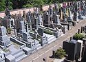
| ⊥ | ○ | Up tack (inverted T-shape) | 22A5 | Cemetery |
| ♨ | ○ | Oval with three vertical wavy lines | 2668 | Onsen (hot springs) |
| ∴ | ○ | Therefore symbol | 2234 | Historical landmark |
| ▴ | ○ | Small black upward-pointing triangle | 25B4 | Summit |
| ж | ○ | Seal script kanji for tree | 0436 | Forestry station |
[edit] See also
| Wikimedia Commons has media related to: Map symbols of Japan |
[edit] External links
- List of symbols
- Children's list from GSI This is a very good reference, it has separate links for each symbol.
- Map Symbol on 2002 Geographical Survey Institute of Japan web site, in Japanese
- sci.lang.japan FAQ: Japanese map symbols

