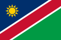
Namibia
From Wikipedia, the free encyclopedia
|
|
This article's introduction section may not adequately summarize its contents. To comply with Wikipedia's lead section guidelines, please consider expanding the lead to provide an accessible overview of the article's key points. |
|
Republic of Namibia (English) Republiek van Namibië (Afrikaans) Republik Namibia (German)
|
||||||
|---|---|---|---|---|---|---|
|
||||||
| Motto: "Unity, Liberty, Justice" | ||||||
| Anthem: Namibia, Land of the Brave |
||||||
 |
||||||
| Capital (and largest city) |
Windhoek |
|||||
| Official languages | English | |||||
| Recognised regional languages | German, Afrikaans, Oshiwambo | |||||
| Demonym | Namibian | |||||
| Government | Republic | |||||
| - | President | Hifikepunye Pohamba | ||||
| - | Prime minister | Nahas Angula | ||||
| Independence | from South Africa | |||||
| - | Date | 21 March 1990 | ||||
| Area | ||||||
| - | Total | 825,418 km2 (34th) 318,696 sq mi |
||||
| - | Water (%) | negligible | ||||
| Population | ||||||
| - | 2008 census | 2,088,669 | ||||
| - | Density | 2.5/km2 (235th) 6.6/sq mi |
||||
| GDP (PPP) | 2007 estimate | |||||
| - | Total | $10.646 billion[1] | ||||
| - | Per capita | $5,249[1] | ||||
| GDP (nominal) | 2007 estimate | |||||
| - | Total | $7.446 billion[1] | ||||
| - | Per capita | $3,671[1] | ||||
| Gini (2003) | 70.7[2] (high) (1st) | |||||
| HDI (2007) | ▲ 0.650 (medium) (125th) | |||||
| Currency | Namibian dollar (NAD) |
|||||
| Time zone | WAT (UTC+1) | |||||
| - | Summer (DST) | WAST (UTC+2) | ||||
| Drives on the | left | |||||
| Internet TLD | .na | |||||
| Calling code | 264 | |||||

Namibia, officially the Republic of Namibia, is a country in southern Africa on the Atlantic coast. It shares borders with Angola and Zambia to the north, Botswana and Zimbabwe to the east, and South Africa to the south and east. It gained independence from South Africa on 21 March 1990 following the Namibian War of Independence. Its capital and largest city is Windhoek (German: Windhuk). Namibia is a member state of the United Nations (UN), the Southern African Development Community (SADC), the African Union (AU), the Commonwealth of Nations and many other international organisations. It has been given many names: The land of contrasts; The land God made in anger; The ageless land. For many years it was known only by its geographical location, but today, its known by its real name: Namibia, named after the Namib Desert and is the second most sparsely populated country in the world (after Mongolia).
It was visited by the British and Dutch missionaries during the late 18th century, but became a German protectorate in 1884. In 1920, the League of Nations mandated the country to South Africa, which imposed their laws and Apartheid-policy without bounds. In 1966, local uprisings and letters sent by traditional African leaders forced the United Nations to assume direct responsibility over the territory, changing the name to Namibia in 1968 and recognizing South West People’s Organisation (SWAPO) as representative of the Namibian people in 1973.
Namibia, however, remained under South African administration during this time. Namibian leaders longed for independence and commenced guerrilla activities, especially in the north. In 1970, SWAPO made alliances with Fidel Castro and Ché Guevara who sent Cuban Troops to join SWAPO-forces in their struggle for independence. These actions forced South Africa to install an interim administration in Namibia in 1985. The Namibian people remained displeased and continued to fight for independence. On 21 March 1990, Namibia obtained full independence from South Africa, in conjunction with South Africa's withdrawal from Angola and became governed by a democratically elected President, Prime Minister, Cabinet and National Assembly. Namibia is one of Africa's most developed and stable countries, with a stable multiparty parliamentary democracy and an estimated population of 1,820,916. Tourism and mining of precious stones and metals form the backbone of Namibia's economy.
The nation has suffered heavily from the effects of HIV and AIDS; One in seven are estimated to be living with AIDS, and the number affected by HIV is feared to be even higher.
Contents |
[edit] History
The dry lands of Namibia were inhabited since early times by Bushmen, Damara, Namaqua, and since about the 14th century AD, by immigrating Bantu who came with the Bantu expansion. The first Europeans to disembark and explore the region were the Portuguese navigators Diogo Cão in 1485 and Bartolomeu Dias in 1486, still the region was not claimed by the Portuguese crown. However, like most of Sub-Saharan Africa, Namibia was not extensively explored by Europeans until the 19th century. Namibia became a German colony and was known as German South-West Africa (Deutsch-Südwestafrika)[3] – apart from Walvis Bay, which was under British control. From 1904 to 1907, the Herero and the Namaqua took up arms against the Germans and in the subsequent Herero and Namaqua genocide, 10,000 Nama (half the population) and 25,000 to 100,000 (possibly 65,000) Herero (three quarters of the population) were killed. South Africa occupied the colony during World War I and administered it as a League of Nations mandate territory. Following the League's supersession by the United Nations in 1946, South Africa refused to surrender its earlier mandate to be replaced by a United Nations Trusteeship agreement, requiring closer international monitoring of the territory's administration. Although the South African government wanted to incorporate 'South-West Africa' into its territory, it never officially did so, although it was administered as the de facto 'fifth province', with the white minority having representation in the whites-only Parliament of South Africa.
In 1966, the South-West Africa People's Organisation (SWAPO) military wing, People's Liberation Army of Namibia, a guerrilla group launched a war of independence, but it was not until 1988 that South Africa agreed to end its administration of Namibia, in accordance with a United Nations peace plan for the entire region. Transition for independence started in 1989 but it was only on 21 March 1990 in which the country officially claimed full independence. Walvis Bay was ceded to Namibia in 1994 upon the end of Apartheid in South Africa.
[edit] Geography

At 825,418 km2 (318,696 sq mi),[4] Namibia is the world's thirty-fourth largest country (after Venezuela). After Mongolia, Namibia is the least densely populated country in the world (2.5 inhabitants per square kilometre (6.5 /sq mi)).
The Namibian landscape consists generally of five geographical areas, each with characteristic abiotic conditions and vegetation with some variation within and overlap between them: the Central Plateau, the Namib Desert, the Escarpment, the Bushveld, and the Kalahari Desert. Although the climate is generally extremely dry, there are a few exceptions. The cold, north-flowing Benguela current of the Atlantic Ocean accounts for some of the low precipitation.


[edit] Central Plateau
The Central Plateau runs from north to south, bordered by the Skeleton Coast to the northwest, the Namib Desert and its coastal plains to the southwest, the Orange River to the south, and the Kalahari Desert to the east. The Central Plateau is home to the highest point in Namibia at Königstein elevation 2,606 meters (8,550 ft).[5] Within the wide, flat Central Plateau is the majority of Namibia’s population and economic activity. Windhoek, the nation’s capital, is located here, as well as most of the arable land. Although arable land accounts for only 1% of Namibia, nearly half of the population is employed in agriculture.[6]
The abiotic conditions here are similar to those found along the Escarpment, described below; however the topographic complexity is reduced. Summer temperatures in the area can reach 40°C, and frosts are common in the winter.
[edit] Namib Desert
The Namib Desert is a broad expanse of hyper-arid gravel plains and dunes that stretches along the entire coastline, which varies in width between 100 to many hundreds of kilometres. Areas within the Namib include the Skeleton Coast and the Kaokoveld in the north and the extensive Namib Sand Sea along the central coast.[7] The sands that make up the sand sea are a consequence of erosional processes that take place within the Orange River valley and areas further to the south. As sand-laden waters drop their suspended loads into the Atlantic, onshore currents deposit them along the shore. The prevailing south west winds then pick up and redeposit the sand in the form of massive dunes in the widespread sand sea, the largest sand dunes in the world. In areas where the supply of sand is reduced because of the inability of the sand to cross riverbeds, the winds also scour the land to form large gravel plains. In many areas within the Namib Desert, there is little vegetation with the exception of lichens found in the gravel plains, and in dry river beds where plants can access subterranean water.
[edit] Great Escarpment
The Great Escarpment swiftly rises to over 2,000 meters (6,562 ft). Average temperatures and temperature ranges increase as you move further inland from the cold Atlantic waters, while the lingering coastal fogs slowly diminish. Although the area is rocky with poorly developed soils, it is nonetheless significantly more productive than the Namib Desert. As summer winds are forced over the Escarpment, moisture is extracted as precipitation.[8] The water, along with rapidly changing topography, is responsible for the creation of microhabitats which offer a wide range of organisms, many of them endemic. Vegetation along the Escarpment varies in both form and density, with community structure ranging from dense woodlands to more shrubby areas with scattered trees. A number of Acacia species are found here, as well as grasses and other shrubby vegetation.
[edit] Bushveld
The Bushveld is found in north eastern Namibia along the Angolan border and in the Caprivi Strip which is the vestige of a narrow corridor demarcated for the German Empire to access the Zambezi River. The area receives a significantly greater amount of precipitation than the rest of the county, averaging around 400 millimetres (15.7") per year. Temperatures are also cooler and more moderate, with approximate seasonal variations of between 10 °C (50 °F) and 30 °C (90 °F). The area is generally flat and the soils sandy, limiting their ability to retain water.[9] Located adjacent to the Bushveld in north-central Namibia is one of nature’s most spectacular features: the Etosha Pan. For most of the year it is a dry, saline wasteland, but during the wet season, it forms a shallow lake covering more than 6000 square kilometres. The area is ecologically important and vital to the huge numbers of birds and animals from the surrounding savannah that gather in the region as summer drought forces them to the scattered waterholes that ring the pan.
[edit] Kalahari Desert
The Kalahari Desert is perhaps Namibia’s best known geographical feature. Shared with South Africa and Botswana, it has a variety of localized environments ranging from hyper-arid sandy desert, to areas that seem to defy the common definition of desert. One of these areas, known as the Succulent Karoo, is home to over 5,000 species of plants, nearly half of them endemic; fully one third of the world’s succulents are found in the Karoo.
The reason behind this high productivity and endemism may be the relatively stable nature of precipitation.[10] The Karoo apparently does not experience drought on a regular basis, so even though the area is technically desert, regular winter rains provide enough moisture to support the region’s interesting plant community. Another feature of the Kalahari, indeed many parts of Namibia, are inselbergs, isolated mountains that create microclimates and habitat for organisms not adapted to life in the surrounding desert matrix.
[edit] Towns
The capital and largest city, Windhoek, is in the centre of the country. It is home to the country's Central Administrative Region, Windhoek Hosea Kutako International Airport and the country's railhead. Other important towns are:
Walvis Bay - sea port, international airport, railhead
Oshakati - main business centre in the North, railhead
Otjiwarongo - main business centre in Central-North, rail junction
Lüderitz - sea port, railhead
Gobabis - farming centre
Keetmanshoop - railhead
Tsumeb - mining
Click here for a list of all towns in Namibia
[edit] Politics

The politics of Namibia takes place in a framework of a presidential representative democratic republic, whereby the president of Namibia is elected to a five-year term and is both the head of state and the head of government, and of a multi-party system. Executive power is exercised by the government. Legislative power is vested in both the government and the bicameral Parliament, the National Assembly and the National Council. The judiciary is independent of the executive and the legislature.[11][12]

[edit] Regions and constituencies
Namibia is divided into 13 regions and subdivided into 102 constituencies.
[edit] Foreign relations
Namibia follows a largely independent foreign policy, with lingering affiliations with states that aided the independence struggle, including Libya and Cuba.
With a small army and a fragile economy, the Namibian Government's principal foreign policy concern is developing strengthened ties within the Southern African region. A dynamic member of the Southern African Development Community, Namibia is a vocal advocate for greater regional integration.
Namibia became the 160th member of the United Nations on 23 April 1990. On its independence it became the fiftieth member of the Commonwealth of Nations.
The Reporters Without Borders' Worldwide Press Freedom Index 2007[13] ranks Namibia as 25th out of 169 countries, as compared with 56th out of 166 in 2003, and 31st out of 139 in 2002.
[edit] International disputes
Namibia is involved in several minor international disputes, including:
- Small residual disputes with Botswana along the Caprivi Strip, including the Situngu marshlands and specifically Kasikili or Sedudu Island.
- A dormant dispute over where the boundaries of Botswana, Namibia, Zambia and Zimbabwe converge.
- Disputes over Angolan rebels and refugees residing in Namibia.
[edit] Population
[edit] Demographics

Among the sovereign countries with the lowest population density, Namibia lies in second place, after Mongolia. The majority of the Namibian population is Black African — mostly of the Ovambo ethnicity, which forms about half of the population — and concentrated in the north of the country. There are also the Herero and Himba people who speak a similar language. In addition to the Bantu majority, there are large groups of Khoisan (e.g. Nama and Bushmen), who are descendants of the original inhabitants of Southern Africa. Blacks of other Bantu descent are descendants of refugees from Angola. There are also two smaller groups of people with mixed racial origins, called "Coloureds" and "Basters", who together make up 6,5% (with the Coloureds outnumbering the Basters two to one). As of 2006 there were as many as 40,000 Chinese in Namibia.[14]
Whites of Portuguese, Dutch, German, British and French ancestry make up about 7% of the population — which is the second largest proportion and number in Sub-Saharan Africa, after South Africa.[15] Most of Namibian whites and nearly all those of mixed race are Afrikaans speakers and share similar origins, culture, religion and genealogy as the white and coloured populations of neighbouring South Africa. A smaller proportion of whites (around 30,000) trace their family origins directly back to German settlers and maintain German cultural and educational institutions.[16] Nearly all Portuguese settlers came to the country from the former Portuguese colony of Angola.[17]
[edit] Religion
| Religion in Namibia | ||||
|---|---|---|---|---|
| religion | percent | |||
| Christian | 80% | |||
| Indigenous | 10% | |||
| Unknown | 10% | |||
The Christian community, makes up at least 80% of the population of Namibia with at least 50% Lutheran. At least 10% of the population hold Indigenous beliefs. The faith of the remaining portion of the population is unknown. [18][19]
Missionary work during the 1800s drew many Namibians to Christianity. While most Namibian Christians are Lutheran, there also are Roman Catholic, Methodist, Anglican, Jewish, African Methodist Episcopal, and Dutch Reformed Christians represented. [20]
[edit] Language
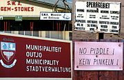
The official language is English. Until 1990, the official languages were German and Afrikaans. When Namibia became independent of South Africa, the new Namibian government wanted to avoid accusations of preferential treatment for either the Afrikaans- or the German-speaking groups. Therefore, English became the sole official language of Namibia. Afrikaans, German, and Oshiwambo became recognised regional languages.
Half of all Namibians speak Oshiwambo as their first language, whereas the most widely understood language is Afrikaans. Among the younger generation, the most widely understood language is English. Both Afrikaans and English are used primarily as a second language reserved for public sphere communication, but small first language groups exist throughout the country.
While the official language is English, most of the white population speaks either German or Afrikaans. Until today, 90 years after the German colonial era, the German language plays a ruling role as a commercial language. Afrikaans is spoken by 60% of the white community, German is spoken by 32%, English is spoken by 7% and Portuguese by 1%.[21]. Portuguese is spoken by blacks and whites from Angola.
[edit] HIV, AIDS and malaria in Namibia
The AIDS epidemic is a large problem in Namibia. Though its rate of infection is substantially lower than that of its eastern neighbor, Botswana, approximately 10% (210,000 people out of 2,063,927) of the Namibian population is infected with the HIV/AIDS. In 2001, there were an estimated 210,000 people living with HIV/AIDS, and the estimated death toll in 2003 was 16,000.[22] The malaria problem seems to be compounded by the epidemic. Research has shown in Namibia, that the risk of contracting malaria is 14.5% greater if a person is also infected with HIV. The risk of death from malaria is also raised by approximately 50% with a concurrent HIV infection.[23] Given infection rates this large as well as a looming malaria problem, it may be very difficult for the government to deal with both the medical and economic impacts of this epidemic.
[edit] Economy

Namibia’s economy consists primarily of mining and manufacturing which represent 8% of the gross domestic product (GDP) respectively.[24] Namibia has a 30-40% unemployment rate and recently passed a 2004 labour act to protect people from job discrimination stemming from pregnancy and HIV/AIDS status. Namibia’s economy is tied closely to South Africa’s due to their shared history.[11][12] The Central Plateau serves as a transportation corridor from the more densely populated north to South Africa, the source of four-fifths of Namibia’s imports.[6] Namibia is the fourth largest exporter of non-fuel minerals in Africa and the world's fifth largest producer of uranium. There has been significant investment in uranium mining and Namibia is set to become the largest exporter of uranium by 2015. Rich alluvial diamond deposits make Namibia a primary source for gem-quality diamonds. Namibia also produces large quantities of lead, zinc, tin, silver, and tungsten.
[edit] Agriculture
About half of the population depends on agriculture (largely subsistence agriculture) for its livelihood, but Namibia must still import some of its food. Although per capita GDP is five times the per capita GDP of Africa's poorest countries, the majority of Namibia's people live in rural areas and exist on a subsistence way of life. Namibia has one of the highest rates of income inequality in the world, due in part to the fact that there is an urban economy and a more rural cash-less economy. The inequality figures thus take into account people who do not actually rely on the formal economy for their survival. Agreement has been reached on the privatisation of several more enterprises in coming years, with hopes that this will stimulate much needed foreign investment. However, reinvestment of environmentally derived capital has hobbled Namibian per capita income.[25] One of the fastest growing areas of economic development in Namibia is the growth of wildlife conservancies. These conservancies are particularly important to the rural generally unemployed population.
[edit] Tourism

Namibia generally attracts eco-tourists with the majority visiting to experience the different climates and natural geographical landscapes such as the great eastern desert and plains. There are many lodges and reserves to accommodate eco-tourists. In addition, extreme sports such as sandboarding and 4x4ing have become popular, and many cities have companies that provide tours.
The most visited places include the Caprivi Strip, Sossusvlei, the Skeleton Coast Park, Sesriem, Etosha Pan and the coastal towns of Swakopmund, Walvis Bay and Lüderitz.
[edit] Child labour
Child labour occurs in Namibia, and key stakeholders including government ministries endorsed the Action Programme towards the Elimination of Child Labour in January 2008.[26] It has been reported that Namibia may be a source and destination also for trafficked children, however, the magnitude of the problem is unknown due to insufficient and unreliable reporting. Low public awareness and inadequate training for law enforcement and social service officials lie as being major factors in combatting the problem. There is evidence that small numbers of children are trafficked within the country for domestic activities, including forced agricultural labour, cattle herding and vending. Laws exist against child labour and trafficking, however, the government has failed to prosecute a single case in human trafficking.
[edit] Military
The constitution of Namibia defined the role of the military as "defending the territory and national interests." Namibia formed the National Defence Force (NDF), comprising former enemies in a 23-year bush war: the People's Liberation Army of Namibia (PLAN) and South West African Territorial Force (SWATF). The British formulated the force integration plan and began training the NDF, which consists of five battalions and a small headquarters element. The United Nations Transitional Assistance Group (UNTAG)'s Kenyan infantry battalion remained in Namibia for three months after independence to assist in training the NDF and to stabilize the north. According to the Namibian Defence Ministry, enlistments of both men and women will number no more than 7,500. Defence and security account for approximately 3.7% of government spending.
[edit] Culture
[edit] Education

Namibia has compulsory free education for 10 years between the ages of 6 and 16 with 7 years of Primary education and 5 years of secondary education. There are four Teacher Training Colleges, three Colleges of Agriculture, a Police Training College, a Polytechnic and a National University[1].[27]
In 1998, there were 400,325 Namibian students in primary school, about 80% of those eligible, and 115,237 students in secondary schools, about 34% of those eligible. The pupil-teacher ratio in 1999 was estimated at 32:1, with about 8% of the GDP being spent on education.[28]
Most schools in Namibia are state-run, however, there are a few private and semi-private schools that serve the country's education system. These are St. Pauls College, Windhoek Afrikaanse Privaatskool and Windhoek Gymnasium. Click here for an incomplete list of schools in Namibia.
[edit] Communal Wildlife Conservancies

Namibia is the only country in the world to specifically address conservation and protection of natural resources in its constitution.[29] Article 95 states, “The State shall actively promote and maintain the welfare of the people by adopting international policies aimed at the following: maintenance of ecosystems, essential ecological processes, and biological diversity of Namibia, and utilization of living natural resources on a sustainable basis for the benefit of all Namibians, both present and future.”[29]
In 1993, the newly formed government of Namibia received funding from the United States Agency for International Development (USAID) through its Living in a Finite Environment (LIFE) Project.[30] The Ministry of Environment and Tourism with the financial support from organizations such as USAID, Endangered Wildlife Trust, WWF, and Canadian Ambassador’s Fund, together form a Community Based Natural Resource Management (CBNRM) support structure. The main goal of this project is promote sustainable natural resource management by giving local communities rights to wildlife management and tourism.[31]
[edit] Sport
The most popular sport in Namibia is football (soccer). The Namibia national football team qualified for the 2008 Africa Cup of Nations. Rugby union and cricket are also popular. Namibia were participants in the 1999, 2003 and 2007 Rugby World Cups. They also played in the 2003 Cricket World Cup. Inline Hockey was first played in 1995 and has also become more and more popular in the last years. The Women's Inline Hockey National Team participated in the 2008 FIRS World Championships.
[edit] Gallery
 Dune in Namibia. |
 Petroglyphs near Twyfelfontein. |
 Roter Kamm crater, in the Namib Desert (Landsat image) |
 Namibian sunset. |
[edit] See also
|
|
[edit] References
- ^ a b c d "Namibia". International Monetary Fund. http://www.imf.org/external/pubs/ft/weo/2008/02/weodata/weorept.aspx?sy=2004&ey=2008&scsm=1&ssd=1&sort=country&ds=.&br=1&c=728&s=NGDPD%2CNGDPDPC%2CPPPGDP%2CPPPPC%2CLP&grp=0&a=&pr.x=82&pr.y=8. Retrieved on 2008-10-09.
- ^ CIA - The World Factbook - Namibia
- ^ "German South West Africa". Encyclopædia Britannica. http://www.britannica.com/eb/article-9036573/German-South-West-Africa. Retrieved on 2008-04-15.
- ^ "Rank Order - Area". CIA World Fact Book. https://www.cia.gov/library/publications/the-world-factbook/rankorder/2147rank.html. Retrieved on 2008-04-12.
- ^ landsat.usgs.gov
- ^ a b World Almanac. 2004.
- ^ Spriggs, A. 2001.(AT1315)
- ^ Spriggs, A. 2001.(AT1316)
- ^ Cowling, S. 2001.
- ^ Spriggs, A. 2001.(AT0709)
- ^ a b (United States Central Intelligence Agency, 2007)
- ^ a b (United States State Department, 2007)
- ^ World Press Freedom Index 2007Reporters Without Borders
- ^ China and Africa: Stronger Economic Ties Mean More Migration, By Malia Politzer, Migration Information Source, August 2008
- ^ Namibia: People: Ethnic Groups. World Factbook of CIA
- ^ Deutschnamibier, economy-point.org
- ^ Flight from Angola, The Economist , August 16, 1975
- ^ the World Factbook
- ^ the World Factbook
- ^ Department of State
- ^ Namibia
- ^ (aidsinafrica.net, 2007)
- ^ (Korenromp, et al. 2005)
- ^ CIA World Factbook 2008, https://www.cia.gov/library/publications/the-world-factbook/geos/wa.html#Econ
- ^ (Lange, 2004)
- ^ Namibia endorses national child labour plan - The Namibian (Nam), 1 Feb 08 — TECL
- ^ Namibian Educational profile
- ^ Encyclopedia of Nations Namibia- Education
- ^ a b (Stefanova 2005)
- ^ (Community Based Natural Resource Management, date unknown)
- ^ (UNEP et al. 2005)
- General references
- AIDSinAfrica.net Web Publication (2007), Retrieved May 20, 2007. From http://www.aidsinafrica.net/
- Christy, S.A. (2007) Namibian Travel Photography
- Community Based Natural Resource Management (CBNRM) Programme Details (n.d.). http://www.met.gov.na/programmes/cbnrm/cbnrmHome.htm
- Cowling, S. 2001. Succulent Karoo (AT 1322) World Wildlife Fund Website: www.worldwildlife.org/wildworld/profiles/terrestrial/at/at1322_full.html
- Korenromp, E.L., Williams, B.G., de Vlas, S.J., Gouws, E., Gilks, C.F., Ghys, P.D., Nahlen, B.L. (2005). Malaria Attributable to the HIV-1 Epidemic, Sub-Saharan Africa. Emerging Infectious Diseases, 11, 9, 1410-1419.
- Lange, Glenn-marie. Wealth, Natural Capital, and Sustainable Development: Contrasting Examples from Botswana and Namibia. Environmental & Resource Economics; Nov 2004, Vol. 29 Issue 3, pp. 257–83, 27 p.
- Fritz, Jean-Claude . La Namibie indépendante. Les coûts d'une décolonisation retardée, Paris, L'Harmattan, 1991.
- Spriggs, A. 2001. Namib Desert (AT1315) World Wildlfe Fund Website: www.worldwildlife.org/wildworld/profiles/terrestrial/at/at1315_full.html
- Spriggs, A. 2001. Namibian Savannah Woodlands (AT1316) World Wildlfe Fund Website: www.worldwildlife.org/wildworld/profiles/terrestrial/at/at1316_full.html
- Spriggs, A. 2001. Namibian Savannah Woodlands (AT0709) World Wildlife Fund Website: www.worldwildlife.org/wildworld/profiles/terrestrial/at/at0709_full.html
- Stefanova K. 2005. Protecting Namibia’s Natural Resources. EjournalUSA.
- UNEP, UNDP, WRI, and World Bank. 2005. Nature in Local Hands: The Case for Namibia’s Conservancies. http://www.wri.org/biodiv/pubs_content_text.cfm?cid=3842
- World Almanac. 2004. World Almanac Books. New York, NY
[edit] External links

![]() Textbooks from Wikibooks
Textbooks from Wikibooks
![]() Quotations from Wikiquote
Quotations from Wikiquote
![]() Source texts from Wikisource
Source texts from Wikisource
![]() Images and media from Commons
Images and media from Commons
![]() News stories from Wikinews
News stories from Wikinews
- WhatsonWindhoek.com Events and venues in Windhoek - updated daily.
- Government
- Republic of Namibia Government Portal
- Constitution of the Republic of Namibia from orusovo.com
- Chief of State and Cabinet Members
- General
- Namibia entry at The World Factbook
- Namibia from UCB Libraries GovPubs
- Namibia at the Open Directory Project
- Namibian Business Directory
- Wikimedia Atlas of Namibia
- Map of Namibia
- Video of Namibia from The New York Times
- Namibia travel guide from Wikitravel
- Debie LeBeau's Development work on Namibia
- Media
- Insight Namibia news in English
|
||||||||||||||||||||||||||
|
||||||||||||||||||||||


|
||||||||
|
|||||||||||||
|
|||||||
|
||||||||||||||||||||||||||||||||||||||||||

