Hawaii
From Wikipedia, the free encyclopedia
| State of Hawaii | |||||||||||||
|
|||||||||||||
| Official language(s) | English, Hawaiian | ||||||||||||
| Demonym | Hawaiian (see notes)[1] | ||||||||||||
| Capital | Honolulu | ||||||||||||
| Largest city | Honolulu | ||||||||||||
| Area | Ranked 43rd in the US | ||||||||||||
| - Total | 10,931 sq mi (28,311 km²) |
||||||||||||
| - Width | n/a miles (n/a km) | ||||||||||||
| - Length | 1,522 miles (2,450 km) | ||||||||||||
| - % water | 41.2 | ||||||||||||
| - Latitude | 18° 55′ N to 28° 27′ N | ||||||||||||
| - Longitude | 154° 48′ W to 178° 22′ W | ||||||||||||
| Population | Ranked 42nd in the US | ||||||||||||
| - Total | 1,288,198 (2008 est.)[2] 1,211,537 (2000) |
||||||||||||
| - Density | 188.6/sq mi (72.83/km²) Ranked 13th in the US |
||||||||||||
| - Median income | $63,746 (5th) | ||||||||||||
| Elevation | |||||||||||||
| - Highest point | Mauna Kea[3] 13,796 ft (4,205 m) |
||||||||||||
| - Mean | 3,035 ft (925 m) | ||||||||||||
| - Lowest point | Pacific Ocean[3] 0 ft (0 m) |
||||||||||||
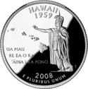
| Admission to Union | August 21, 1959 (50th) | ||||||||||||
| Governor | Linda Lingle (R) | ||||||||||||
| Lieutenant Governor | James Aiona (R) | ||||||||||||
| U.S. Senators | Daniel Inouye (D) Daniel Akaka (D) |
||||||||||||
| Congressional Delegation | 2 Democrats (list) | ||||||||||||
| Time zone | Hawaii: UTC-10 (no daylight saving time) |
||||||||||||
| Abbreviations | HI US-HI | ||||||||||||
| Website | www.hawaii.gov | ||||||||||||


The State of Hawaii (![]() /həˈwaɪ.iː/ (help·info) or /həˈwaɪʔiː/ in English; Hawaiian: Mokuʻāina o Hawaiʻi) is a state in the United States, located on an archipelago in the central Pacific Ocean southwest of the continental United States, southeast of Japan, and northeast of Australia. The state was admitted to the Union on August 21, 1959, making it the 50th state. Its capital is Honolulu on the island of Oahu. The most recent census estimate puts the state's population at 1,283,388.
/həˈwaɪ.iː/ (help·info) or /həˈwaɪʔiː/ in English; Hawaiian: Mokuʻāina o Hawaiʻi) is a state in the United States, located on an archipelago in the central Pacific Ocean southwest of the continental United States, southeast of Japan, and northeast of Australia. The state was admitted to the Union on August 21, 1959, making it the 50th state. Its capital is Honolulu on the island of Oahu. The most recent census estimate puts the state's population at 1,283,388.
This state encompasses nearly the entire volcanic Hawaiian Island chain, which comprises hundreds of islands spread over 1,500 miles (2,400 km). At the southeastern end of the archipelago, the eight "main islands" are (from the northwest to southeast) Niʻihau, Kauaʻi, Oʻahu, Molokaʻi, Lānaʻi, Kahoʻolawe, Maui, and Hawaiʻi. The last is by far the largest, and is often called the "Big Island" or "Big Isle" to avoid confusion with the state as a whole. This archipelago is physiographically and ethnologically part of the Polynesian subregion of Oceania.
In standard American English, Hawaii is generally pronounced /həˈwaɪ.iː/. In the Hawaiian language, it is generally pronounced [həˈwɐiʔi] or [həˈvɐiʔi].
Contents |
Etymology
The Hawaiian language word Hawaiʻi derives from Proto-Polynesian *Sawaiki, with the reconstructed meaning "homeland";[4] cognate words are found in other Polynesian languages, including Māori (Hawaiki), Rarotongan (ʻAvaiki), and Samoan (Savaiʻi). (See also Hawaiki).
According to Pukui and Elbert,[5] "Elsewhere in Polynesia, Hawaiʻi or a cognate is the name of the underworld or of the ancestral home, but in Hawaiʻi the name has no meaning."[6]
Geography and environment
The main Hawaiian Islands are:
| Island | Nickname | Location | Area | Area Rank |
Highest Point | Elevation | Population (as of 2000) |
Density |
|---|---|---|---|---|---|---|---|---|
| Hawaiʻi | The Big Island | 4,028.0 sq mi (10,432.5 km2) | 1st | Mauna Kea | 13,796 ft (4,205 m) | 148,677 | 37/sq mi (14/km²) | |
| Maui | The Valley Isle | 727.2 sq mi (1,883.4 km2) | 2nd | Haleakalā | 10,023 ft (3,055 m) | 117,644 | 162/sq mi (62/km²) | |
| Kahoʻolawe | The Target Isle | 44.6 sq mi (115.5 km2) | 8th | Puʻu Moaulanui | 1,483 ft (452 m) | 0 | 0 | |
| Lānaʻi | The Pineapple Isle | 140.5 sq mi (363.9 km2) | 6th | Lānaʻihale | 3,366 ft (1,026 m) | 3,193 | 23/sq. mi. (9/km²) | |
| Molokaʻi | The Friendly Isle | 260 sq mi (673.4 km2) | 5th | Kamakou | 4,961 ft (1,512 m) | 7,404 | 28/sq mi (11/km²) | |
| Oʻahu | The Gathering Place | 596.7 sq mi (1,545.4 km2) | 3rd | Mount Kaʻala | 4,003 ft (1,220 m) | 876,151 | 1,468/sq mi (567/km²) | |
| Kauaʻi | The Garden Isle | 552.3 sq mi (1,430.5 km2) | 4th | Kawaikini | 5,243 ft (1,598 m) | 58,303 | 106/sq mi (41/km²) | |
| Niʻihau | The Forbidden Isle | 69.5 sq mi (180.0 km2) | 7th | Mount Pānīʻau | 1,250 ft (381 m) | 160 | 2/sq mi (1/km²) |
Topography

An archipelago situated some 2,000 mi (3,200 km) southwest of the North American mainland,[7] Hawaii is the southernmost state of the United States and the second westernmost state after Alaska. Only Hawaii and Alaska are outside the contiguous United States and do not share a border with any other U.S. state.
Hawaii is the only state of the United States that:
- is not geographically located in North America
- grows coffee
- is completely surrounded by water
- is totally an archipelago
- has a royal palace
- does not have a straight line in its state boundary


Hawaii's tallest mountain, Mauna Kea stands at 13,796 ft (4,205 m)[8] but is taller than Mount Everest if followed to the base of the mountain—from the floor of the Pacific Ocean, rising about 33,500 ft (10,200 m).[9]
All of the Hawaiian islands were formed by volcanoes erupting from the sea floor from a magma source described in geological theory as a hotspot. The theory maintains that as the tectonic plate beneath much of the Pacific Ocean moves in a northwesterly direction, the hot spot remains stationary, slowly creating new volcanoes. This explains why only volcanoes on the southern half of the Big Island, and the Loihi Seamount (Lōʻihi) deep below the waters off its southern coast, are presently active, with Loihi being the newest volcano to form.
The last volcanic eruption outside the Big Island occurred at Haleakala on Maui in the late 18th century, though recent research suggests that Haleakala's most recent eruptive activity could be hundreds of years earlier.[10] In 1790, Kīlauea exploded in the deadliest eruption known to have occurred in what is now the United States.[11] As many as 5,405 warriors and their families marching on Kīlauea were killed in an eruption.[12]
The volcanic activity and subsequent erosion created impressive geological features. The Big Island is notable as the world’s second highest island.[citation needed]
Because of the islands' volcanic formation, native life before human activity is said to have arrived by the "3 W's": wind (carried through the air), waves (brought by ocean currents), and wings (birds, insects, and whatever they brought with them). The isolation of the Hawaiian Islands in the middle of the Pacific Ocean, and the wide range of environments to be found on high islands located in and near the tropic, has resulted in a vast array of endemic flora and fauna (see Endemism in the Hawaiian Islands). Hawaii has more endangered species and has lost a higher percentage of its endemic species than anywhere in the United States.[13]


Protected areas

There are several areas in Hawaii under the control and protection of the National Park Service.[14] Two areas are designated as national parks: Haleakala National Park near Kula, Maui, includes Haleakala, the dormant volcano that formed east Maui; and Hawaii Volcanoes National Park in the southeast region of the island of Hawaii, which includes the active volcano Kilauea and its various rift zones.
There are three designated national historical parks: Kalaupapa National Historical Park in Kalaupapa, Molokai, the site of a former colony for leprosy patients; Kaloko-Honokohau National Historical Park in Kailua-Kona on the island of Hawaii; and Pu'uhonua o Honaunau National Historical Park in Honaunau on the island of Hawaii, the site of an ancient Hawaiian place of refuge. Other areas under the control of the National Park Service include Ala Kahakai National Historic Trail on the island of Hawaii and the USS Arizona Memorial at Pearl Harbor on Oahu.
The Papahānaumokuākea Marine National Monument was proclaimed by President George W. Bush on June 15, 2006, under the 1906 Antiquities Act. The monument covers roughly 140,000 square miles (360,000 km²) of reefs, atolls and shallow and deep sea (out to 50 miles (80 km) offshore) in the Pacific Ocean, larger than all of America’s National Parks combined.[15]
Climate


The climate of Hawaii is typical for a tropical area, although temperatures and humidity tend to be a bit less extreme than other tropical locales due to the constant trade winds blowing from the east. Summer highs are usually in the upper 80s °F, (around 31°C) during the day and mid 70s, (around 24 °C) at night. Winter temperatures during the day are usually in the low to mid 80s, (around 28 °C) and (at low elevation) seldom dipping below the mid 60s (18 °C) at night. Snow, although not usually associated with tropics, falls at 4,205 meters (13,796 ft) on Mauna Loa on the Big Island in some winter months. Snow rarely falls on Maui's Haleakala. Mount Waiʻaleʻale, on the island of Kauai, is notable for rainfall, as it has the second highest average annual rainfall on Earth, about 460 inches (11.7 m). Most of Hawaii has only two seasons: summer from May to October, and winter from October to April.[16]
Local climates vary considerably on each island, grossly divisible into windward (Koʻolau) and leeward (Kona) areas based upon location relative to the higher mountains. Windward sides face cloud cover. This fact is utilized by the tourist industry, which concentrates resorts on sunny leeward coasts.
| Monthly Normal High and Low Temperatures (°F) for Various Hawaiian Cities[17] | ||||||||||||
| City | Jan | Feb | Mar | Apr | May | Jun | Jul | Aug | Sep | Oct | Nov | Dec |
|---|---|---|---|---|---|---|---|---|---|---|---|---|
| Hilo | 79/64 | 79/64 | 79/65 | 79/66 | 81/67 | 82/68 | 82/69 | 83/69 | 83/69 | 83/68 | 81/67 | 80/65 |
| Honolulu | 80/66 | 81/65 | 82/67 | 83/68 | 85/70 | 87/72 | 88/74 | 89/75 | 89/74 | 87/73 | 84/71 | 82/68 |
| Kahului | 80/63 | 81/63 | 82/65 | 82/66 | 84/67 | 86/69 | 87/71 | 88/71 | 88/70 | 87/69 | 84/68 | 82/65 |
| Lihue | 78/65 | 78/66 | 78/67 | 79/69 | 81/70 | 83/73 | 84/74 | 85/74 | 85/74 | 84/73 | 81/71 | 79/68 |
Environment
History
| History of Hawaii |
|---|
|
|
|
|
|
|
|
|
|
|
|
|
Hawaii is one of four U.S. states that were independent prior to becoming part of the United States, along with the Vermont Republic (1791), the Republic of Texas (1845), and the California Republic (1846), and one of two (Texas was the other) with formal diplomatic recognition internationally.[18] The Kingdom of Hawaii existed from 1810 until 1893 when the monarchy was overthrown by resident American (and some European) businessmen. It was an independent republic from 1894 until 1898, when it was annexed by the United States, becoming a territory in 1900, and a state in 1959.[19]
Hawaii's greatest historic significance is as the target of surprise attack on Pearl Harbor by imperial Japan on December 7, 1941. The attack on Pearl Harbor and other military and naval installations on Oahu, carried out by aircraft and by midget submarine brought the United States into World War II.
Pre-European contact, before 1778
The earliest habitation supported by archaeological evidence dates to as early as 300 BCE, probably by Polynesian settlers from the Marquesas, followed by a second wave of migration from Raiatea and Bora Bora in the 11th century. The first recorded European contact with the islands was in 1778 by British explorer James Cook.
Polynesians from the Marquesas and possibly the Society Islands may have first populated the Hawaiian Islands between 300 and 500 AD. There is a great deal of debate regarding these dates.[20]
Some archaeologists and historians believe that there had been an early settlement from the Marquesas and a later wave of immigrants from Tahiti, circa 1000, who were said to have introduced a new line of high chiefs, the Kapu system, the practice of human sacrifice and the building of heiaus. This later immigration is detailed in folk tales about Pa'ao. Other authors have argued that there is no archaeological or linguistic evidence for a later influx of Tahitian settlers, and that Pa'ao must be regarded as a myth. However, this seems very unlikely due to the fact that the Kapu system and the practice of human sacrifice were only common in Tahitian culture.

Regardless of the question of Pa'ao and the history of the Royal Hawaiian lineage, historians agree that the history of the islands was marked by a slow but steady growth in population and the size of the Kapu chiefdoms, which grew to encompass whole islands. Local chiefs, called Ali'is, ruled their settlements and fought to extend their sway and defend their communities from predatory rivals. This was conducted in a system of allies of various ranks similar to the tribal systems before Feudalism.
1778 - 1893 -- European arrival and the Kingdom of Hawai'i
The 1778 arrival of British explorer James Cook is usually taken to be Hawaii’s first contact with European explorers. Cook named the islands the Sandwich Islands in honor of one of his sponsors, John Montagu, 4th Earl of Sandwich. He published the geographical coordinates of the islands and reported the native name as Owyhee. This erroneous translation lives on in Owyhee County, Idaho, which was named after three Hawaiian members of a trapping party who were killed in that area.
Cook visited the Hawaiian islands twice. During his second visit—in 1779—he attempted to abduct a Hawaiian chief and hold him as ransom for return of a ship’s boat that was stolen by a different minor chief;[21] the chief’s supporters fought back, and Cook was killed.
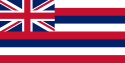
After Cook’s visit and the publication of several books relating his voyages, the Hawaiian islands received many European visitors: explorers, traders, and eventually whalers who found the islands a convenient harbor and source of fresh food. Early British influence can still be seen from the design of the local Flag of Hawaii which has the British Union Flag in the corner.
Visitors introduced diseases to the formerly isolated islands, and the Hawaiian population plunged precipitously.
During the 1780s and 1790s the chiefs were constantly fighting for power. After a series of battles that ended in 1795 and forced cession of the island of Kauai in 1810, all of the inhabited islands were subjugated under a single ruler who would become known as King Kamehameha the Great. He established the House of Kamehameha, a dynasty that ruled over the kingdom until 1872.
Christian missionaries began to arrive in the early 1800s eventually converted many of the population to Christianity. Their influence led Kamehameha II to end the human sacrifice and the Kapu system, and Kamehameha III was the first Christian king.
The most famous and beloved of the missionaries was Father Damien, a Catholic priest who helped bring order and hope to the colony of lepers which had been raised on an isolated part of the island of Molokai. Other well-remembered missionaries who served in the Kingdom of Hawai'i included Protestant Hiram Bingham I and Joseph F. Smith of the Church of Jesus Christ of Latter-day Saints.
Other missionaries, however, are not remembered as fondly. A number who came to Hawai'i during this period took a more Earthly view of the islands and their people, and over the years began to exert influence on politics and society. A number abandoned their callings to seek commercial fortune, and to this day, when a person of any race who was born in Hawaii calls someone a "missionary," it is considered an insult. It is said that "The Protestants came to the islands to do good, and they did right well" (a colloquialism meaning that they had prospered).[citations needed]
The death of the bachelor King Kamehameha V—who did not name an heir—resulted in the popular election of Lunalilo over Kalākaua. Unfortunately, Lunalilo died after only one year and 25 days in office, without naming an heir. Though it was known that he favored Emma, widow of Kamehameha IV, it is believed that "the People's King" desired the people to choose his successor as they had chosen him. In a hotly contested and allegedly fraudulent election by the legislature in 1874 between Kalakaua and Emma, which led to riots and the landing of U.S. and British troops to keep the peace, governance was passed on to the House of Kalākaua.
In 1887, under the influence of Walter M. Gibson, a group of kingdom subjects, members of the Hawaiian government, American and European businessmen forced Kalākaua to sign the 1887 Constitution of the Kingdom of Hawaii which stripped the king of administrative authority, eliminated voting rights for Asians and set minimum income and property requirements for American, European and native Hawaiian voters, essentially limiting the electorate to elite Americans, Europeans and those few native Hawaiians who had amassed wealth. King Kalakaua, though nearly powerless, reigned until his death in 1891. His sister, Liliuokalani (Liliʻuokalani), succeeded him to the throne and ruled until her overthrow in 1893. Today Kalakaua is remembered as "the Merrie Monarch," inspiration for the premier hula festival which is held every year.

In 1893, Queen Liliuokalani announced plans to establish a new constitution that would have replaced the 1887 Constitution of the Kingdom of Hawaii that was established during the reign of King Kalakaua. On January 14, 1893, a group of business leaders and citizens formed a Committee of Safety in opposition to the Queen. United States Government Minister John L. Stevens, responding to a request from the Committee of Safety expressing concern about possible violence directed against American citizens, summoned a company of uniformed U.S. Marines to come ashore. As one historian noted, the presence of these troops effectively made it impossible for the monarchy to enforce its new constitution.[23]
Overthrow -- the Republic of Hawaii
In January 1893, Queen Liliuokalani was replaced by a Provisional Government composed of members of the Committee of Safety. There was much controversy in the following years as the queen tried to re-establish her throne. The administration of President Grover Cleveland commissioned the Blount Report, which concluded that the removal of Liliʻuokalani was illegal. The U.S. Government first demanded that Queen Liliʻuokalani be reinstated, but the Provisional Government refused. Congress responded to Cleveland's referral with another investigation, and submitted the Morgan Report by the U.S. Senate on February 26, 1894, which found all parties (including Minister Stevens) with the exception of the queen "not guilty" from any responsibility for the overthrow.[24] The accuracy and impartiality of both the Blount and Morgan reports has been questioned by partisans on both sides of the historical debate over the events of 1893.[25][26][27][28]
In 1993, a joint Apology Resolution regarding the overthrow was passed by Congress and signed by President Clinton, apologizing for the overthrow of the Hawaiian Kingdom.[28] It is the first time in American history that the United States government has apologized for overthrowing the legitimate government of a sovereign nation.

The Republic of Hawaii was the formal name of Hawaii from 1894 to 1898 when it was run as a republic. The republic period occurred between the administration of the Provisional Government of Hawaii which ended on July 4, 1894 and the adoption of the Newlands Resolution in Congress in which the Republic was annexed to the United States and became the Territory of Hawaii on July 7, 1898.
Annexation -- the Territory of Hawaii
When William McKinley won the presidential election in November 1896, the question of Hawaii’s annexation to the U.S. was again opened. The previous president, Grover Cleveland, was a friend of Queen Liliuokalani. He had remained opposed to annexation until the end of his term, but McKinley was open to persuasion by U.S. expansionists and by annexationists from Hawaii. He agreed to meet with a committee of annexationists from Hawaii, Lorrin Thurston, Francis Hatch and William Kinney. After negotiations, in June 1897, McKinley agreed to a treaty of annexation with these representatives of the Republic of Hawaii.[29] The president then submitted the treaty to the U.S. Senate for approval.
Despite some opposition in the islands, the Newlands Resolution was passed by the House June 15, 1898, by a vote of 209 to 91, and by the Senate on July 6, 1898, by a vote of 42 to 21, annexing Hawaii as a U.S. territory. Its legality continues to be questioned because it was a United States Government resolution, not a treaty of cession or conquest as is required by international law.[citation needed] Both houses of the American Congress carried the measure with two-thirds majorities.
In 1900, Hawaii was granted self-governance and retained ʻIolani Palace as the territorial capitol building. Though several attempts were made to achieve statehood, Hawaii remained a territory for sixty years. Plantation owners and key capitalists, who maintained control through financial institutions, or "factors," known as the Big Five, found territorial status convenient, enabling them to continue importing cheap foreign labor; such immigration was prohibited in various states of the U.S.
The power of the plantation owners was finally broken by activist descendants of original immigrant laborers. Because they were born in a U.S. territory, they were legal U.S. citizens. Expecting to gain full voting rights, they actively campaigned for statehood for the Hawaiian Islands.

1959 - Present -- State of Hawaii
In March 1959, both houses of Congress passed the Hawaii Admission Act and U.S. President Dwight D. Eisenhower signed it into law. (The act excluded Palmyra Atoll, part of the Kingdom and Territory of Hawaii, from the new state.) On June 27 of that year, a referendum was held asking residents of Hawaii to vote on accepting the statehood bill. Hawaii voted at a ratio of 17 to 1 to accept. There has been criticism, however, of the Statehood plebiscite, because the only choices were to accept the Act or to remain a territory, without addressing the issues of legality surrounding the overthrow.[30][31][32] Despite the criticism, the United Nations Special Committee on Decolonization later removed Hawaii from the United Nations list of Non-Self-Governing Territories.
After statehood, Hawaii quickly became a modern state with a construction boom and rapidly growing economy. The Hawaii Republican Party, which was strongly supported by the plantation owners, was voted out of office. In its place, the Democratic Party of Hawaii dominated state politics for 40 years.
In recent decades, the state government has implemented programs to promote Hawaiian culture. The Hawaii State Constitutional Convention of 1978 incorporated as state constitutional law specific programs such as the creation of the Office of Hawaiian Affairs to promote the indigenous Hawaiian language and culture.
Cities and towns


| Historical populations | |||
|---|---|---|---|
| Census | Pop. | %± | |
| 1900 | 154,001 |
|
|
| 1910 | 191,874 | 24.6% | |
| 1920 | 255,881 | 33.4% | |
| 1930 | 368,300 | 43.9% | |
| 1940 | 422,770 | 14.8% | |
| 1950 | 499,794 | 18.2% | |
| 1960 | 632,772 | 26.6% | |
| 1970 | 769,913 | 21.7% | |
| 1980 | 964,691 | 25.3% | |
| 1990 | 1,108,229 | 14.9% | |
| 2000 | 1,211,537 | 9.3% | |
| Est. 2008[2] | 1,288,198 | 6.3% | |
The movement of the Hawaiian royal family from the island of Hawaii to Maui, and subsequently to Oahu, explains why certain population centers exist where they do today. The largest city, Honolulu, was the one chosen by Kamehameha III as the capital of his kingdom because of the natural harbor there, the present-day Honolulu Harbor.
Now the state capital, Honolulu is located along the southeast coast of Oahu. The previous capital was Lahaina, Maui. Some major towns are Hilo, Kāne'ohe (Kāneʻohe), Kailua, Pearl City, Waipahu, Kahului, Kailua-Kona, Kihei (Kīhei), and Lihue (Līhuʻe).
Demographics
Population
As of 2005, Hawaii has an estimated population of 1,275,194, which is an increase of 13,070, or 1.0%, from the prior year and an increase of 63,657, or 5.3%, since the year 2000. This includes a natural increase since the last census of 48,111 people (that is 96,028 births minus 47,917 deaths) and an increase due to net migration of 16,956 people into the state. Immigration from outside the United States resulted in a net increase of 30,068 people, and migration within the country produced a net loss of 13,112 people. The center of population of Hawaii is located directly between the two islands of Oahu and Molokai.[33]
Hawaii has a de facto population of over 1.3 million due to military presence and tourists. Oahu, which is nicknamed "The Gathering Place", is the most populous island (and the one with the highest population density), with a resident population of just under one million in 597 square miles (1,546 km2), about 1,650 people per square mile (for comparison, New Jersey, which has 8,717,925 people in 7,417 square miles (19,210 km2) is the most-densely populated state with 1,134 people per square mile.)[34] Hawaii's 1,275,194 people, spread over 6,423 square miles (including many unpopulated islands) results in an average population density of 188.6 persons per square mile,[35] which makes Hawaii less densely populated than states like Ohio and Illinois.[36]
The average projected lifespan of those born in Hawaii in the year 2000 is 79.8 years (77.1 years if male, 82.5 if female), longer than the residents of any other state.[37]
U.S. military personnel make up approximately 1.3% of the total population in the islands.
Ethnicities
Ethnically, Hawaii is one of only four states in which non-Hispanic whites do not form a majority, and has the largest percentage of Asian Americans. Hawaii was the second majority-minority state in the United States. Both Hawaii and New Mexico have been majority-minority regions since the early 20th century, but New Mexico became a state before Hawaii. Hawaii also has the largest percentage of persons of mixed race, who constitute some 20% of the total population.[38]
| Demographics of Hawaii (csv) | |||||
|---|---|---|---|---|---|
| By race | White | Black | AIAN* | Asian | NHPI* |
| 2000 (total population) | 40.32% | 2.83% | 2.07% | 58.19% | 23.39% |
| 2000 (Hispanic only) | 4.69% | 0.33% | 0.56% | 3.32% | 2.48% |
| 2005 (total population) | 41.26% | 3.33% | 2.03% | 57.53% | 22.10% |
| 2005 (Hispanic only) | 5.51% | 0.39% | 0.51% | 3.32% | 2.36% |
| Growth 2000–05 (total population) | 7.70% | 23.70% | 3.25% | 4.07% | -0.56% |
| Growth 2000–05 (non-Hispanic only) | 5.59% | 23.93% | 6.38% | 4.01% | -0.64% |
| Growth 2000–05 (Hispanic only) | 23.78% | 21.96% | -5.09% | 5.07% | 0.04% |
| * AIAN is American Indian or Alaskan Native; NHPI is Native Hawaiian or Pacific Islander | |||||
Ancestry groups
The largest ancestry groups in Hawaii are:
| Ancestry | Percentage | Main article: |
|---|---|---|
| (16.7%) of Total | See Japanese American | |
| (16%) | See Native Hawaiians | |
| (14.1%) | See Filipino American | |
| (5.8%) | See German American | |
| (4.7%) | See Chinese American | |
| (4.4%) | See Irish American | |
| (4.3%) | See English American | |
| (4.0%) | See Portuguese American | |
| (2.5%) | See Puerto Rican | |
| (1.9%) | See Korean American | |
| (1.8%) | See African American | |
| (1.8%) | See Italian American | |
| (1.6%) | See Mexican American | |
| (1.5%) | See French American | |
| (1.4%) | See British American | |
| (1.1%) | See Scottish American |

The third group of foreigners to arrive upon Hawaii’s shores, after the Polynesians and Europeans, were the Chinese. Chinese employees serving on Western trading ships disembarked and settled starting in 1789. In 1820 the first American missionaries arrived in Hawaii to preach Christianity and teach the Hawaiians what the missionaries considered modern ways. They were instrumental in convincing Chiefs to end the practice of Human sacrifice. A large proportion of Hawaii’s population has become a people of Asian ancestry (especially Chinese, Japanese and Filipino) many of whom are descendants from those waves of early foreign immigrants brought to the islands in the nineteenth century, beginning in the 1850s, to work on the sugar plantations. The first 153 Japanese immigrants arrived in Hawaii on June 19, 1868. They were not "legally" approved by the Japanese government established after the Meiji Restoration because the contract was between a broker and the Tokugawa shogunate, by then terminated. The first Japanese government-approved immigrants arrived in Hawaii on February 9, 1885 after Kalakaua's petition to Emperor Meiji when Kalakaua visited Japan in 1881.
Almost 13,000 Portuguese had come to Hawaii by 1899. They worked on the sugar plantations, as many had done previously. By October 17, 1901, 5,000 Puerto Ricans had made their new homes on the four islands. Currently, there are over 30,000 Puerto Ricans or Hawaiian-Puerto Ricans and almost 50,000 Hawaiian-Portuguese living in Hawaii.
Languages
|
|
This article may be too long to comfortably read and navigate. Please consider splitting content into sub-articles and using this article for a summary of the key points of the subject. (October 2008) |
The State of Hawaii has two official languages recognized in its constitution adopted at the 1978 constitutional convention: English and Hawaiian. Article XV, Section 4, specifies that "Hawaiian shall be required for public acts and transactions only as provided by law" [italic added]. Hawaii Creole English (locally referred to as 'Pidgin') is the native dialect of many born-and-raised residents and is a second dialect for many other residents. After English, the second-, third- and fourth-most spoken individual languages are Tagalog (most are bilingual in Wikang Filipino), Japanese, and Ilokano respectively. Significant European immigrants and descendants also speak their native languages; the most numerous are Spanish, German, Portuguese and French. As of the 2000 Census, 73.44% of Hawaii residents age 5 and older speak only English at home. Tagalog speakers make up 5.37% (which includes non-native speakers of Wikang Filipino, the national co-official Tagalog-based language), followed by Japanese at 4.96%, Ilokano at 4.05%, Chinese at 1.92%, Hawaiian at 1.68%, Spanish at 1.66%, Korean at 1.61%, and Samoan at 1.01%.[40]
Hawaiian is a member of the Polynesian branch of the Austronesian family. It began to develop around 1000 A.D., when Marquesans or Tahitians of that era colonized Hawaii. Those Polynesians remained in the islands, thereby becoming the Hawaiian people. Consequently, their language developed into the Hawaiian language. Before the arrival of Captain James Cook, the Hawaiian language was never written. The written form of Hawaiian was developed mainly by American Protestant missionaries during 1820–1826. They assigned letters from the Latin alphabet that corresponded to the Hawaiian sounds.
Interest in the Hawaiian language increased significantly in the late 20th century. With the help of the Office of Hawaiian Affairs, created by the 1978 constitutional convention, specially designated Hawaiian language immersion schools were established where students would be taught in all subjects using Hawaiian. Also, the University of Hawaii System developed a Hawaiian language graduate studies program. Municipal codes were altered in favor of Hawaiian place and street names for new civic developments.
Hawaiian distinguishes between long and short vowels. In modern written Hawaiian, vowel length can be indicated with a macron (kahakō). Also, Hawaiian has the glottal stop as a consonant. In writing, it can be indicated with the apostrophe, with the opening single quote, or with the (ʻokina).
In Hawaiian-language newspapers published from 1834–1948, the spelling Hawaii was used. However, in texts written mainly for Hawaiian-language pedagogy, especially since 1950, the modern Hawaiian-language spelling used is Hawaiʻi, with an okina written between the final two vowels. The modern spelling is pushed mainly by teachers of Hawaiian language at the University of Hawaii. However, traditional native speakers of Hawaiian generally never use okinas nor kahakos in their own writing. For this reason, some teachers of Hawaiian language, such as NeSmith[citation needed], are advocating greater appreciation for the traditional native spellings with no okinas nor kahakos.
Some locals speak Hawaii Creole English (HCE), often called "pidgin". The lexicon of HCE derives mainly from English but also has words from Hawaiian, Chinese, Japanese, Ilocano and Tagalog from the Philippines and Portuguese. During the 19th century, there was a great increase in immigration from foreign countries (mainly China, Japan, Portugal—especially from the Azores archipelago—and Spain), and a pidgin English developed which by the early 20th century became a creole English, as pidgin speakers had children who acquired the pidgin as their own native language. HCE speakers can use some Hawaiian words without those words being considered archaic. Most place names are retained from Hawaiian, as are some names for plants or animals. For example, tuna fish are often called "ahi". HCE speakers have modified the meanings of certain English words. For example, the terms "auntie" and "uncle" can be used to refer to any adult who is a friend, or a friend to the family. It is also used as a sign of respect for elders. Throughout the surfing boom in Hawaii, HCE has influenced surfer slang. Some HCE expressions, such as brah and da kine, have found their way to other places.
Certain words can be dropped if their meaning is implicit. For example, instead of saying "It is hot today, isn't it?", an HCE speaker is likely to say simply "stay hot, eh?" When a word does not come to mind quickly, the slang term is "Da Kine" which refers to any word you can't think of.
Spelling of state name
A somewhat divisive political issue that has arisen since the constitution of the State of Hawaii added Hawaiian as a second official state language is the exact spelling of the state’s name in official documents. As prescribed in the Hawaii Admission Act that granted Hawaiian statehood, the federal government recognizes Hawaii to be the official state name. Official government publications,[citation needed] as well as department and office titles,[citation needed] use the traditional Hawaiian spelling, that is, with no symbols for glottal stops or vowel length. In contrast, some private entities, including a local newspaper, are using such symbols.
The title of the state constitution is "The Constitution of the State of Hawaii". In Article XV therein, Section 1 uses "The State of Hawaii", Section 2 "the island of Oahu", Section 3 "The Hawaiian flag", and Section 5 specifies the state motto as "Ua mau ke ea o ka aina i ka pono". Since these documents predate the modern use of the ʻokina and the kahakō in Hawaiian orthography, the disputed spelling conventions were not used in these cases.
The nuances in the Hawaiian language debate are often not obvious or well-appreciated among English speakers outside Hawaii. The issue has often been a source of friction in situations where correct naming conventions are mandated, as people frequently disagree over which spelling is correct or incorrect, and where it is correctly or incorrectly applied.
Religion
Religion as distributed among the Hawaiian population are as follows:[41][42][43]
- Christianity: 351,000 (28.9%)
- Buddhism: 110,000 (9%)
- Judaism: 10,000 (0.8%)
- Other: 750,000 (61.1%)
Notes
- ^a Other includes agnostics or atheists, those who are non-religious, followers of the Bahá'í Faith, Confucianism, Daoism, the Hawaiian religion, Hinduism, Islam, Sikhism, Shintoism, Scientology, Unitarian Universalism, Wicca, Zoroastrianism, as well as those of other religions.
Economy
The history of Hawaii can be traced through a succession of dominating industries: sandalwood[44] , whaling[45], sugarcane (see Sugar plantations in Hawaii), pineapple, military, tourism, and education. Since statehood was achieved in 1959, tourism has been the largest industry in Hawaii, contributing 24.3% of the Gross State Product (GSP) in 1997. New efforts are underway to diversify the economy. The total gross output for the state in 2003 was US$47 billion; per capita income for Hawaii residents was US$30,441.
Industrial exports from Hawaii include food processing and apparel. These industries play a small role in the Hawaii economy, however, due to the considerable shipping distance to the ports and population of the West Coast of the United States. Food exports include coffee, macadamia nuts, pineapple, livestock, and sugarcane. Agricultural sales for 2002, according to the Hawaii Agricultural Statistics Service, were US$370.9 million from diversified agriculture, US$100.6 million from pineapple, and US$64.3 million from sugarcane.
Hawaii is known for its relatively high per capita state tax burden. In the years 2002 and 2003, Hawaii residents had the highest state tax per capita at US$2,757 and US$2,838, respectively. This rate can be explained partly by the fact that services such as education, health care and social services are all rendered at the state level, as opposed to the municipal level in all other states.
Millions of tourists contribute to the collection figure by paying the general excise tax and hotel room tax; thus not all the taxes collected come directly from residents. Business leaders, however, have often considered the state's tax burden as being too high, contributing to both higher prices and the perception of an unfriendly business climate.[46] See the list of businesses in Hawaii for more information on commerce in the state.
Until recently, Hawaii was the only state in the U.S. that attempted to control gasoline prices through a Gas Cap Law. The law was enacted during a period when oil profits in Hawaii in relation to the mainland U.S. were under scrutiny, and sought to tie local gasoline prices to those of the mainland. The law took effect in September 2005 amid price fluctuations caused by Hurricane Katrina. The Hawaii state legislature suspended the law in April 2006.
Culture
The aboriginal culture of Hawaii is Polynesian. Hawaii represents the northernmost extension of the vast Polynesian triangle of the south and central Pacific Ocean. While traditional Hawaiian culture remains only as vestiges influencing modern Hawaiian society, there are reenactments of the ceremonies and traditions throughout the islands. Some of these cultural influences are strong enough to have affected the culture of the United States at large, including the popularity (in greatly modified form) of luaus and hula.
Hawaii is also home to numerous cultural events. The annual Merrie Monarch Festival is an international Hula competition.[47] The state is also home to the Hawaii International Film Festival, the premier film festival for pacific rim cinema.[48] Honolulu is also home to the state's long running GLBT film festival, the Rainbow Film Festival.[49][50]
Health
Hawaii's health care system insures over 95% of residents. Under the state's plan, all businesses are required to provide employees who work more than twenty hours per week with health care. Heavy regulation of insurance companies helps keep the cost to employers down. In addition, due in part to the system's emphasis on preventive care, Hawaiians require hospital treatment less frequently than their counterparts in the rest of the United States, while total health care expenses (measured as a percentage of state GDP) are substantially lower. Given these achievements, proponents of universal health care elsewhere in the U.S. have sometimes used Hawaii as a model for proposed federal and state health care plans. Critics, however, claim that Hawaii's success is due at least in part to its mild climate and to its status as a chain of islands whose economy is heavily based on tourism: features that make it more difficult for businesses unhappy with paying the plan's premiums to relocate elsewhere.[51]
Education
Hawaii is currently the only state in the union with a unified school system statewide. Policy decisions are made by the fourteen-member state Board of Education, with thirteen members elected for four-year terms and one non-voting student member. The Board of Education sets statewide educational policy and hires the state superintendent of schools, who oversees the operations of the state Department of Education. The Department of Education is also divided into seven districts, four on Oahu and one for each of the other counties.
The structure of the state Department of Education has been a subject of discussion and controversy in recent years. The main rationale for the current centralized model is equity in school funding and distribution of resources: leveling out inequalities that would exist between highly populated Oahu and the more rural Neighbor Islands, and between lower-income and more affluent areas of the state. This system of school funding differs from many localities in the United States where schools are funded from local property taxes.
Policy initiatives have been made in recent years toward decentralization. Current Republican Governor Linda Lingle is a proponent of replacing the current statewide board with seven elected district boards. The Democratic-controlled state legislature opposed her proposal, instead favoring expansion of decision-making power to the schools and giving schools more discretion over budgeting. Political debate on structural reform is likely to continue for the foreseeable future.
It has been challenging for educators to learn what constitutes effective instruction for the large populations of children of non-native English-speaking immigrants, whose cultures are often different in many ways from that of the mainland U.S., whence most of the course materials come, and where most of the standards for schools are set.
The public elementary, middle, and high school scores in Hawaii tend to be below average on national tests as mandated under the No Child Left Behind Act. Some of this can be attributed to the Hawaii State Board of Education requiring all eligible students to take these tests and reporting all student test scores unlike, for example, Texas and Michigan. Results reported in August 2005 indicate that two-thirds of Hawaii’s schools failed to reach federal minimum performance standards in math and reading (of 282 schools across the state, 185 failed).[52]
On the other hand, results of the ACT college placement tests show that Hawaii class of 2005 seniors scored slightly above the national average (21.9 compared with 20.9) (Honolulu Advertiser, August 17, 2005, p. B1). It should be noted that fewer students take the ACT examination than take the more widely accepted SAT examination. On the SAT, Hawaii’s college bound seniors tend to score below the national average in all categories except math.
Schools and academies
The Hawaii State Department of Education operates all of the public schools in the State of Hawaii. Hawaii has the distinction of educating more students in independent institutions of secondary education than any other state in the United States. It also has four of the largest independent schools: Iolani School, Kamehameha Schools, Mid-Pacific Institute, and Punahou School. The second Buddhist high school in the United States, and first Buddhist high school in Hawaii, Pacific Buddhist Academy, was founded in 2003. (The first Buddhist high school in the United States was Developing Virtue Secondary School founded in 1981 in Ukiah, California.)
Both independent and charter schools can select their students, while the regular public schools must take all students in their district. The Kamehameha Schools are especially notable for being the only schools in the United States that openly grant admission to students based on ancestry and the wealthiest schools in the United States, if not the world, having the support of over nine billion US dollars in estate assets.
Colleges and universities
Graduates of institutions of secondary learning in Hawaii often either enter directly into the work force or attend colleges and universities. While many choose to attend colleges and universities on the mainland or elsewhere, most choose to attend one of many institutions of higher learning in Hawaii. The largest of these institutions is the University of Hawaii System. It consists of: (1) the flagship research university at Manoa (Mānoa); (2) two comprehensive campuses Hilo and West Oahu; and (7) seven Community Colleges. Students choosing private education attend Brigham Young University Hawaii, Chaminade University of Honolulu, Hawaii Pacific University, or University of the Nations. The Saint Stephen Diocesan Center is a seminary of the Roman Catholic Diocese of Honolulu.
Law and government
| Year | Republican | Democratic |
|---|---|---|
| 2008 | 26.58% 120,446 | 71.85% 325,588 |
| 2004 | 45.26% 194,191 | 54.01% 231,708 |
| 2000 | 37.46% 137,845 | 55.79% 205,286 |
| 1996 | 31.64% 113,943 | 56.93% 205,012 |
| 1992 | 36.70% 136,822 | 48.09% 179,310 |
| 1988 | 44.75% 158,625 | 54.27% 192,364 |
| 1984 | 55.10% 185,050 | 43.82% 147,154 |
| 1980 | 42.90% 130,112 | 44.80% 135,879 |
| 1976 | 48.06% 140,003 | 50.59% 147,375 |
| 1972 | 62.48% 168,865 | 37.52% 101,409 |
| 1968 | 38.70% 91,425 | 59.83% 141,324 |
| 1964 | 21.24% 44,022 | 78.76% 163,249 |
| 1960 | 49.97% 92,295 | 50.03% 92,410 |
The state government of Hawaii is modeled after the federal government with adaptations originating from the kingdom era of Hawaiian history. As codified in the Constitution of Hawaii, there are three branches of government: executive, legislative and judicial.
The executive branch is led by the Governor of Hawaii and assisted by the Lieutenant Governor of Hawaii, both elected on the same ticket. The governor, in residence at the grounds of Washington Place, is the only public official elected for the state government in a statewide race; all other administrators and judges are appointed by the governor. The lieutenant governor is concurrently the Secretary of State of Hawaii. Both the governor and lieutenant governor administer their duties from the Hawaii State Capitol. The governor and lieutenant governor oversee the major agencies and departments of the executive of which there are twenty.
The legislative branch consists of the Hawaii State Legislature—the twenty-five members of the Hawaii Senate led by the President of the Senate and the fifty-one members of the Hawaii House of Representatives led by the Speaker of the House. They also govern from the Hawaii State Capitol. The judicial branch is led by the highest state court, the Hawaii State Supreme Court, which uses Aliiolani Hale (Aliʻiōlani Hale) as its chambers. Lower courts are organized as the Hawai'i State Judiciary.
The state is represented in the United States Congress by a delegation of four members. They are the senior and junior United States Senators, the representative of Hawaii's 1st congressional district and the representative of Hawaii's 2nd congressional district. Many Hawaii residents have been appointed to administer other agencies and departments of the federal government by the President of the United States. All federal officers of Hawaii administer their duties locally from the Prince Kuhio Federal Building (Kūhiō) near the Aloha Tower and Honolulu Harbor.
Hawaii has supported Democrats in 10 of the 12 presidential elections in which it has participated with the exception of 1972 and 1984. In 2004, John Kerry won the state’s 4 electoral votes by a margin of 9 percentage points with 54% of the vote. Every county in the state supported the Democratic candidate. In 1964, favorite son candidate, Senator Hiram Fong of Hawaii sought the presidential nomination of the Republican Party while Patsy Mink ran in the Oregon primary in 1972.
Honolulu native Barack Obama, serving as United States Senator from Illinois, was elected President of the United States on November 4, 2008 and sworn into office January 20, 2009. Obama had earlier won the Hawaiian Democratic Caucus on February 19, 2008 with 76% of the vote. Obama was the third Hawaii-born candidate to seek the nomination of a major party and the first presidential nominee to be from Hawaii.
The Prince Kuhio Federal Building also houses agencies of the federal government such as the Federal Bureau of Investigation, Internal Revenue Service and the United States Secret Service. The building is the site of the federal courts and the offices of the United States Attorney for the District of Hawaii, principal police officer of the United States Department of Justice in the United States District Court for the District of Hawaii.
Unique to Hawaii is the way it has organized its municipal governments. There are no incorporated cities in Hawaii except Honolulu County. All other municipal governments are administered at the county level. The county executives are the Mayor of Hawaii, Mayor of Honolulu, Mayor of Kauai and Mayor of Maui. All mayors in the state are elected in nonpartisan races.
The officers of the federal and state governments have been historically elected from the Democratic Party of Hawaii and the Hawaii Republican Party. Municipal charters in the state have declared all mayors to be elected in nonpartisan races.
Transportation
Hawaii has four federal highways: H-1, H-2, H-3, and H-201, all located on Oahu and all part of the Interstate Highway System. With the exception of H-201, which begins and ends on H-1, all the highways have at least one end point at or near a current or former military installation. A system of state highways encircles the other main islands as well as Oahu. Travel can be slow due to narrow winding roads on the coastlines. Travel can be significantly congested during morning and evening commute times in and out of Honolulu, particularly on the leeward side. H1 was constructed after Honolulu was well established, and on/off ramps are diverted throughout the city. Hawaii's public transit system is known as TheBus with over 4,200 stops on Oahu. It was ranked number one in the country for 1994-1995 and again in 2000-2001 by the American Public Transportation Association.[53]
Aviation is an important part of Hawaii’s transportation network, as most interisland travel takes place using commercial airlines. Hawaiian Airlines, Mokulele Airlines, and go! use jets to travel between the larger commercial airports in Honolulu, Lihue, Kahului, Kona, and Hilo, while Island Air and Pacific Wings serve smaller airports. These airlines also provide air freight service between the islands.
A ferry linked to TheBus began service in September 2007 known as TheBoat. Fare for TheBoat is $2.00, and it runs from Barber's Point to Aloha Tower Marketplace daily. It is hoped that linking to TheBus and delivering commuters from Leeward to Honolulu will alleviate traffic. Norwegian Cruise Lines provides American-flagged passenger cruise service between the islands. The Hawaii Superferry is now connecting Maui and Oahu with a ferry system capable of transporting vehicles. Service was scheduled to begin in the second half of 2007 with routes from Oahu to Kauai and Maui. Legal issues over environmental impact statements and protests from residents of Maui and Kauai temporarily delayed the implementation of this service, but service to Maui started in December 2007, and service to Kauai is still delayed. On March 17, 2009, a court ruling prevented the Superferry to continue operations thus shutting it down. [54]
There is a Hawaii Electric Vehicle Demonstration Project (HEVDP) [55]
Media
See also
References
|
|
This article includes a list of references or external links, but its sources remain unclear because it has insufficient inline citations. Please help to improve this article by introducing more precise citations where appropriate. (January 2009) |
|
|
This article's citation style may be unclear. The references used may be clearer with a different or consistent style of citation, footnoting, or external linking. (October 2008) |
- ^ Local usage generally reserves Hawaiian as an ethnonym referring to Native Hawaiians. Hawaii resident or islander is the preferred form to refer to state residents. The Associated Press Stylebook, 42nd ed. (2007), also prescribes this usage under its entry for Hawaii (p. 112).
- ^ a b "Annual Estimates of the Resident Population for the United States, Regions, States, and Puerto Rico: April 1, 2000 to July 1, 2008". United States Census Bureau. http://www.census.gov/popest/states/tables/NST-EST2008-01.csv. Retrieved on 2009-02-06.
- ^ a b "Elevations and Distances in the United States". U.S Geological Survey. April 29, 2005. http://erg.usgs.gov/isb/pubs/booklets/elvadist/elvadist.html#Highest. Retrieved on November 3 2006.
- ^ Pollex—a reconstruction of the Proto-Polynesian lexicon, Biggs and Clark, 1994. The asterisk preceding the word signifies that it is a reconstructed word form.
- ^ Pukui and Elbert 1986, p. 62
- ^ See also: Pukui, Elbert, and Mookini 1974
- ^ "What constitutes the United States, what are the official definitions?". United States Geological Survey. http://interactive2.er.usgs.gov/faq/list_faq_by_category/get_answer.asp?id=795. Retrieved on 2007-07-03.
- ^ Mauna Kea Volcano, Hawai`i
- ^ Unke, Beata (2001). "Height of the Tallest Mountain on Earth". The Physics Factbook. http://hypertextbook.com/facts/2001/BeataUnke.shtml.
- ^ "Youngest lava flows on East Maui probably older than A.D. 1790". United States Geological Survey. September 9, 1999. http://hvo.wr.usgs.gov/volcanowatch/1999/99_09_09.html. Retrieved on 1999-10-04.
- ^ Living on Active Volcanoes—The Island of Hawai'i, U.S. Geological Survey Fact Sheet 074-97
- ^ Human Footprints in Relation to the 1790 Eruption of Kilauea, Swanson, D. A.; Rausch, J., American Geophysical Union.
- ^ Howard Youth. "Hawaii's Forest Birds Sing the Blues". http://nationalzoo.si.edu/Publications/ZooGoer/1995/1/hawaiisforestbirds.cfm(SI). Retrieved on October 31 2008.
- ^ "Hawaii". National Park Service. http://www.nps.gov/state/HI. Retrieved on 2008-07-15.
- ^ Joshua Reichert and Theodore Roosevelt IV. "Treasure Islands". http://www.pewtrusts.org/ideas/ideas_item.cfm?content_item_id=3417&content_type_id=15&page=15&issue=16&issue_name=Protecting%20ocean%20life&name=Op-eds%20(Pew). Retrieved on June 15 2006.
- ^ Climate of Hawaiʻi
- ^ Hawaii Weather|Hawaii Weather Forecast|Hawaii Climate
- ^ US CODE: Title 20,7512. Findings
- ^ Introduction to Hawaii - The United States of America
- ^ Kirch, Patrick Vinton; Colin Renfrew, Clive Gamble (1989). The Evolution of the Polynesian Chiefdoms. Cambridge University Press. pp. 77–79. ISBN 0521273161.
- ^ Kuykendall, "The Hawaiian Kingdom Volume I: Foundation and Transformation", p18 "Cook's plan was to get the king on board the Resolution and keep him there until the stolen boat was returned—a plan that had been effective under similar circumstances in the south Pacific"
- ^ U.S. Navy History site
- ^ Russ, William Adam (1992). The Hawaiian Revolution (1893-94). Associated University Presses. pp. 350. ISBN 0945636431.
- ^ Kuykendall, R.S. (1967) The Hawaiian Kingdom, 1874-1893. Honolulu: University of Hawaii Press. p. 648.
- ^ Russ, William Adam (1992). The Hawaiian Revolution (1893-94). Associated University Presses. ISBN 0945636431.
- ^ Kinzer, Stephen (2006). Overthrow: America's Century of Regime Change From Hawaii to Iraq. Times Books. ISBN 0805078614.
- ^ [1] Media Matters: "Limbaugh repeated false claim that U.S. was "strictly neutral" in overthrow of Hawaiian queen"
- ^ a b Hawaii Divided Against Itself Cannot Stand by Bruce Fein
- ^ 1897 Hawaii Annexation Treaty
- ^ Human Rights differs from Equal Rights
- ^ Support For The Hawaiian Sovereignty Elections Council
- ^ Hawaii Reporter: Hawaii Reporter
- ^ "Population and Population Centers by State - 2000". United States Census Bureau. http://www.census.gov/geo/www/cenpop/statecenters.txt. Retrieved on 2008-12-04.
- ^ New Jersey Quickfacts
- ^ Hawaii Quickfacts
- ^ Top 12 states in population density
- ^ Average life expectancy at birth by state
- ^ "Hawaii QuickFacts from the US Census Bureau". U.S. Census Bureau. August 31, 2007. http://quickfacts.census.gov/qfd/states/15000.html. Retrieved on September 15 2007.
- ^ Hawaii Ancestry
- ^ Language Map Data Center
- ^ State of Hawaii Data Book 2000, Section 1 Population, Table 1.47
- ^ Glenmary Research Center
- ^ Honolulu Advertiser
- ^ [Hawaii sandalwood trade]
- ^ [Whaling in Hawaii]
- ^ Honolulu Star-Bulletin Hawaii News
- ^ http://the.honoluluadvertiser.com/current/il/merriemonarch05
- ^ http://www.honoluluadvertiser.com/apps/pbcs.dll/article?AID=2009902200326
- ^ http://www.hnlnow.com/events/index.php?com=detail&eID=10075&year=2008&month=5
- ^ http://archives.starbulletin.com/2001/05/29/features/index.html
- ^ ""Hawaii Health Care Is Called a Model for U.S."". New York Times. http://query.nytimes.com/gst/fullpage.html?res=9F0CE7DD123BF93AA25756C0A965958260. Retrieved on 1993-05-19.
- ^ Two-Thirds Of Hawaii Schools Do Not Meet Requirements - Education News Story - KITV Honolulu
- ^ Enterprise Honolulu | Public Transportation in Honolulu Oahu Hawaii
- ^ | Ruling shuts down Superferry
- ^ http://www.htdc.org/hevdp/projects.html
Further reading
- The Constitution of the State of Hawaii. Article XV.
- Bushnell, O. A. 1993. The Gifts of Civilization: Germs and Genocide in Hawai'i. ISBN 0824814576. Honolulu: University of Hawaii Press
- Kinzer, Stephen 2007, Overthrow: America's Century of Regime Change from Hawaii to Iraq. ISBN 0805082409. Times Books
- Lyovin, Anatole V. (1997). An Introduction to the Languages of the World. New York: Oxford University Press, Inc. ISBN 0-19-508116-1.
- Pukui, Mary Kawena; Samuel H. Elbert (1986). Hawaiian Dictionary. Honolulu: University of Hawaii Press. ISBN 0-8248-0703-0.
- Schamel, Wynell and Charles E. Schamel. "The 1897 Petition Against the Annexation of Hawaii." Social Education 63, 7 (November/December 1999): 402-408.
- Stokes, John F.G. 1932. "Spaniard and the Sweet Potato in Hawaii and Hawaiian-American Contacts." American Anthropologist, New Series, v, 34, n, 4, pp. 594–600.
External links
![]() Textbooks from Wikibooks
Textbooks from Wikibooks
![]() Quotations from Wikiquote
Quotations from Wikiquote
![]() Source texts from Wikisource
Source texts from Wikisource
![]() Images and media from Commons
Images and media from Commons
![]() News stories from Wikinews
News stories from Wikinews
- Hawaii travel guide from Wikitravel
- Hawaii's Official Tourism Site
- Official state homepage
- Hawaii State Fact Sheet from the U.S. Department of Agriculture
- USGS real-time, geographic, and other scientific resources of Hawaii
- Energy Data & Statistics for Hawaii
- Satellite image of Hawaiian Islands at NASA's Earth Observatory
- http://www.netstate.com/states/intro/hi_intro.htm
- Documents relating to Hawaiian Statehood, Dwight D. Eisenhower President Library
|
|
||||||||||||||
|
|||||||
|
||||||||
|
||||||||||||||||||||||||||||
|
||||||||
| Preceded by Alaska |
List of U.S. states by date of statehood Admitted on August 21, 1959 (50th) |
Succeeded by Most Recent |

