Phantom island
From Wikipedia, the free encyclopedia
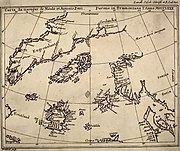
Phantom islands are islands that were believed to exist, and appeared on maps for a period of time (sometimes centuries) during recorded history, but were later removed after they proved nonexistent. In contrast, lost lands are islands or continents believed by some to have existed during prehistory, often associated with ancient myths and legends.
Phantom islands usually stem from the reports of early sailors exploring new realms. Some arose through the mislocation of actual islands, or other errors in geography. For instance, Pepys Island was actually a misidentification of the Falkland Islands. The Baja California peninsula appears on some early maps as an island but was later discovered to be attached to the mainland of North America. Thule was perhaps actually discovered in the 4th century BCE but was lost, and then later reidentified by ancient explorers and geographers as Shetland, Iceland, Scandinavia, or even as nonexistent.
Other phantom islands are probably due to navigational errors, the misidentification of icebergs, fog banks, or to optical illusions. New South Greenland, observed in the Weddell Sea in 1823 but never again seen, may have been the result of a superior mirage, though other explanations, including icebergs, misnavigation and even fabrication have been suggested.[1][2]
Some "errors" were later thought to be intentional. Lake Superior's Isles Phelipeaux and Pontchartrain, which appeared on explorers' maps for many years, were named for Louis Phélypeaux, marquis de La Vrilliere, comte de Pontchartrain. Phélypeaux was a government minister influential in allocating funds for additional voyages of exploration.
While many phantom islands appear never to have existed, a few (such as, perhaps, Thompson Island) may have been actual islands subsequently destroyed by volcanic explosions, earthquakes or submarine landslides, or low-lying lands such as sand banks that are no longer above water.
[edit] See also
[edit] References
- ^ Antarctica, p. 47, Paul Simpson-Housley, 1992
- ^ Exploring Polar Frontiers, p. 435, William James Mills, 2003
- "Thompson Island". Global Volcanism Program. Smithsonian Institution. http://www.volcano.si.edu/world/volcano.cfm?vnum=1806-03-. Retrieved on 2008-12-18.
[edit] Bibliography
- Stommel, Henry Lost Islands: The Story of Islands That Have Vanished from Nautical Charts, University of British Columbia Press, 1984. ISBN 0-7748-0210-3
- Gaddis, Vincent. Invisible Horizons, Chilton Books. New York. 1965.
- Clark Barnaby Firestone, The Coasts of Illusion: A Study of Travel Tales, Harper Books, 1924.
- William Shepard Walsh, A Handy Book of Curious Information, J. B. Lippincott, 1913.
- Ramsay, Raymond (1972). No Longer on the Map. New York: Viking Press. ISBN 0670514330.

