Philadelphia
From Wikipedia, the free encyclopedia
| City of Philadelphia | |||
 |
|||
|
|||
| Nickname(s): "City of Brotherly Love","The City that Loves you Back", "Cradle of Liberty", "The Quaker City", "The Birthplace of America","The City of Neighborhoods", "Phlly" | |||
| Motto: "Philadelphia maneto" ("Let brotherly love endure") | |||
 |
|||
 |
|||
| Coordinates: | |||
| Country | |||
|---|---|---|---|
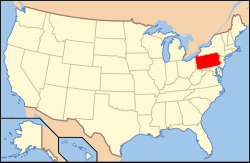
| Commonwealth | |||
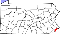
| County | Philadelphia | ||
| Founded | October 27, 1682 | ||
| Incorporated | October 25, 1701 | ||
| Government | |||
| - Mayor | Michael Nutter (D) | ||
| Area | |||
| - City | 135 sq mi (349.6 km2) | ||
| - Land | 127.4 sq mi (326.144 km2) | ||
| - Water | 7.6 sq mi (19.6 km2) | ||
| - Urban | 1,799.5 sq mi (4,660.7 km2) | ||
| - Metro | 4,629 sq mi (11,989 km2) | ||
| Elevation | 39 ft (12 m) | ||
| Population (July 1st, 2008) | |||
| - City | 1,447,395 (6th) | ||
| - Density | 10,721.4/sq mi (4,140.1/km2) | ||
| - Urban | 5,325,000 | ||
| - Metro | 5,838,471 | ||
| Time zone | EST (UTC-5) | ||
| - Summer (DST) | EDT (UTC-4) | ||
| ZIP code | 191xx | ||
| Area code(s) | 215, 267 | ||
| Website | http://www.phila.gov | ||

Philadelphia (pronounced /ˌfɪləˈdɛlfiə/) is the largest city in Pennsylvania and the sixth-most-populous city in the United States.
In 2005, the population of the city proper was estimated to be over 1.4 million,[1] while the Greater Philadelphia metropolitan area's population of 5.8 million made it the country's fifth-largest. The city is the nation's fourth-largest urban area by population, its fourth-largest consumer media market as ranked by the Nielsen Media Research, and the world's 49th-most-populous city.[2] It is the county seat of Philadelphia County (with which it is coterminous). Popular nicknames for Philadelphia include Philly and The City of Brotherly Love (from Greek: Φιλαδέλφεια, [pʰi.la.ˈdel.pʰeː.a], Modern Greek: [fi.la'ðɛl.fi.a], "brotherly love" from philos-φίλος, "love", and adelphos-αδερφός or αδελφός "brother").
A commercial, educational, and cultural center, the city was once the second-largest in the British Empire[3] (after London), and the social and geographical center of the original 13 American colonies. Ben Franklin took a large role in Philadelphia's early rise to prominence. It was in this city that many of the ideas, and subsequent actions, gave birth to the American Revolution and American Independence, making Philadelphia a centerpiece of early American history. It was the most populous city of the young United States, and served as the nation's first capital during much of the Revolutionary War and after. Following the ratification of the U.S. Constitution, it was the temporary national capital from 1790 to 1800 while Washington, DC was under construction.
Contents |
[edit] History
Prior to the arrival of Europeans, the Philadelphia area was the location of the Lenape (Delaware) Indian village Shackamaxon. Europeans arrived in the Delaware Valley in the early 1600s, with the first settlements founded by the Dutch, British and Swedish.
The Swedes sought to expand their influence by creating an agricultural (tobacco) and fur-trading colony to bypass French and British merchants. The New Sweden Company was chartered and included Swedish, Dutch and German stockholders. The first Swedish expedition to North America embarked from the port of Gothenburg in late 1637. It was organized and overseen by Clas Fleming, a Swedish admiral from Finland. Part of this colony, called New Sweden or Nya Sverige eventually included land on the west side of the Delaware River from just below the Schuylkill River: in other words, today's Philadelphia, southeast Pennsylvania, Delaware, and Maryland.
In 1644, New Sweden supported the Susquehannocks in their victory in a war against the English province of Maryland. A series of events led the Dutch — led by governor Peter Stuyvesant — to move an army to the Delaware River in the late summer of 1655. Though New Netherland now nominally controlled the colony, the Swedish and Finnish settlers continued to enjoy a degree of local autonomy, having their own militia, religion, court, and lands. This status lasted officially until the English conquest of the New Netherland colony, in October 1663-1664, and continued unofficially until the area was included in William Penn's charter for Pennsylvania, in 1682.
In 1681, as part of a repayment of a debt, Charles II of England granted William Penn a charter for what would become the Pennsylvania colony. Part of Penn's plan for the colony was to create a city on the Delaware River to serve as a port and place for government. Despite already having been given the land by Charles II, Penn bought the land from the local Lenape to be on good terms with the Native Americans and ensure peace for his colony.[4] According to legend Penn made a treaty of friendship with Lenape chief Tammany under an elm tree at Shackamaxon, in what is now the city's Kensington section.[5] As a Quaker, Penn had experienced religious persecution and wanted his colony to be a place where anyone could worship freely despite their religion. Penn named the city Philadelphia, which is Greek for brotherly love (philos, "love" or "friendship", and adelphos, "brother").[6]

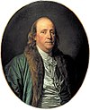
William Penn's plan was that Philadelphia would be like an English rural town instead of a city. The city's roads were designed with a grid plan with the idea that houses and businesses would be spread far apart and surrounded by gardens and orchards. The city's inhabitants didn't follow Penn's plans and crowded by the Delaware River and subdivided and resold their lots.[7] Before Penn left Philadelphia for the last time, he issued the Charter of 1701 establishing Philadelphia as a city. The city soon grew and established itself as an important trading center. Conditions in the city were poor at first, but by the 1750s living conditions had improved. A significant contributor to Philadelphia at the time was Benjamin Franklin. Franklin helped improve city services and founded new ones, such as the American Colonies' first hospital.[8] Due to Philadelphia's central location in the colonies, during the American Revolution the city was used as the location for the First Continental Congress before the war, the Second Continental Congress, which signed the United States Declaration of Independence, during the war, and the Constitutional Convention after the war. A number of battles during the war were fought in Philadelphia and its environs as well. Unsuccessful lobbying after the war to make Philadelphia the United States capital helped make the city the temporary U.S. capital in the 1790s.[9] In 1793, the largest yellow fever epidemic in U.S. history killed as many as 5,000 people in Philadelphia—roughly 10% of the population.[10]
The state government left Philadelphia in 1799 and the federal government left soon after in 1800. However Philadelphia was still the largest city in the United States and a financial and cultural center. New York City soon surpassed Philadelphia in population, but construction of roads, canals, and railroads helped turn Philadelphia into the United States' first major industrial city. Throughout the 19th century Philadelphia had a large variety of industries and businesses, the largest being textiles. Major corporations in the 19th and early 20th centuries included the Baldwin Locomotive Works, William Cramp and Sons Ship and Engine Building Company, and the Pennsylvania Railroad.[11] Industry, along with the U.S. Centennial, was celebrated in 1876 with the Centennial Exposition, the first official World's Fair in the United States. Immigrants, mostly German and Irish, settled in Philadelphia and the surrounding districts. The rise in population of the surrounding districts helped lead to the Act of Consolidation of 1854 which extended the city of Philadelphia to include all of Philadelphia County.[12] In the later half of the century immigrants from Russia, Eastern Europe and Italy and African Americans from the southern U.S. settled in the city.[13]

By the 20th century Philadelphia had become known as "corrupt and contented." Philadelphians were content with the city's lack of change or excitement, and single-party politics, centered on the city's entrenched Republican political machine, allowed corruption to flourish. The machine and corruption permeated in all parts of city government and reformers had little success.[14] The first major success in reform came in 1917 when outrage over the murder of a police officer during that year's election led to the shrinking of the Philadelphia City Council from two houses to just one.[15] In the 1920s the public flouting of Prohibition laws, mob violence, and police involvement in illegal activities led to the appointment of Brigadier General Smedley Butler of the U.S. Marine Corps as director of public safety, but political pressure prevented any long term success in fighting crime and corruption.[16]
After a population peak of over two million residents in 1950 the city's population declined while the suburban neighboring counties grew. Revitalization and gentrification of neighborhoods began in the 1960s and continues into the 21st century, with much of the development in the Center City and University City areas of the city. After many of the old manufacturers and businesses had left Philadelphia or shut down, the city started attracting service businesses and began to more aggressively market itself as a tourist destination. Glass and granite skyscrapers were built in Center City. Historic areas such as Independence National Historical Park located in Society Hill were resuscitated during the reformist mayoral era of the 1950s through the 1980s and are now among the most desirable living areas of Center City. This has slowed the city's forty-year population decline after losing nearly a quarter of its population.[17][18]
[edit] Geography
[edit] Topography

Philadelphia is located at 40° 00′ north latitude and 75° 09′ west longitude. According to the United States Census Bureau, the city has a total area of 142.6 square miles (369.3 km2), of which 135.1 square miles (349.9 km2) is land and 7.6 square miles (19.7 km2), or 5.29%, is water. Bodies of water include the Delaware and Schuylkill Rivers, and Cobbs, Wissahickon, and Pennypack Creeks.
The lowest point is sea level, while the highest point is in Chestnut Hill, at approximately 445 feet (136 m) above sea level (near the intersection of Germantown Avenue and Bethlehem Pike).[19]
Philadelphia is located on the Fall Line separating the Atlantic Coastal Plain from the Piedmont.[20] The rapids on the Schuylkill River at East Falls disappeared after the completion of the Fairmount Dam.[21]
The city is the seat of its own county. The adjacent counties are Montgomery to the north; Bucks to the northeast; Burlington County, New Jersey to the east; Camden County, New Jersey to the southeast; Gloucester County, New Jersey to the south; and Delaware County to the west.
 |
Pennsylvania Main Line | Jenkintown | Bristol |
|
|||
| Upper Darby | Camden, New Jersey | ||||||
| Chester | Glassboro, New Jersey | Cherry Hill, New Jersey |
[edit] Climate
Philadelphia falls in the northern periphery of the humid subtropical climate zone. Summers are typically hot and muggy, fall and spring are generally mild, and winter is cold. Snowfall is variable, with some winters bringing moderate snow and others bringing some snowstorms. Annual snowfall averages 21 inches (534 mm). Precipitation is generally spread throughout the year, with eight to eleven wet days per month,[22] at an average annual rate of 42 inches (1068 mm).
January lows average 25 °F (−4 °C) and highs average 39 °F (4 °C). The lowest officially recorded temperature was −11 °F (−24 °C) on February 9, 1934,[23] but temperatures below 0 °F (−18 °C) occur only a few times a decade. July lows average 70 °F (21 °C) and highs average 86 °F (30 °C),[24] although heat waves accompanied by high humidity are frequent with highs above 95 °F (35 °C) and the heat index running as high as 110 °F (43 °C). The highest recorded temperature was 106 °F (41 °C) on August 7, 1918.[23] Early fall and late winter are generally driest, with February being the driest month, averaging only 2.74 inches (69.8 mm) of precipitation.
| Month | Jan | Feb | Mar | Apr | May | Jun | Jul | Aug | Sep | Oct | Nov | Dec | Year |
|---|---|---|---|---|---|---|---|---|---|---|---|---|---|
| Record high °F (°C) | 74 (23) |
79 (26) |
87 (31) |
95 (35) |
97 (36) |
102 (39) |
104 (40) |
106 (41) |
102 (39) |
96 (36) |
84 (29) |
73 (23) |
106 (41) |
| Average high °F (°C) | 39 (4) |
42 (6) |
51 (11) |
62 (17) |
72 (22) |
81 (27) |
86 (30) |
84 (29) |
77 (25) |
66 (19) |
55 (13) |
44 (7) |
63.3 (17) |
| Average low °F (°C) | 25 (-4) |
28 (-2) |
35 (2) |
44 (7) |
55 (13) |
64 (18) |
70 (21) |
69 (21) |
61 (16) |
49 (9) |
40 (4) |
31 (-1) |
47.6 (9) |
| Record low °F (°C) | -7 (-22) |
-11 (-24) |
5 (-15) |
14 (-10) |
28 (-2) |
44 (7) |
51 (11) |
44 (7) |
35 (2) |
25 (-4) |
8 (-13) |
-5 (-21) |
-11 (-24) |
| Precipitation inches (mm) | 3.52 (89.4) |
2.74 (69.6) |
3.81 (96.8) |
3.49 (88.6) |
3.89 (98.8) |
3.29 (83.6) |
4.39 (111.5) |
3.82 (97) |
3.88 (98.6) |
2.75 (69.9) |
3.16 (80.3) |
3.31 (84.1) |
42.05 (1,068.1) |
| Source: The Weather Channel[25] 2008-09-27 | |||||||||||||
[edit] Cityscape
[edit] Neighborhoods

Philadelphia is divided into large sections — North, Northeast, Northwest, West, South and Southwest Philadelphia — all of which surround Center City, which corresponds largely with the city's limits before consolidation in 1854.
Each of these large areas contains numerous smaller neighborhoods, some of whose boundaries derive from the boroughs, townships, and other communities that made up Philadelphia County before their absorption into the city. Other neighborhoods are defined more by ethnicity, religion, culture, or commercial reasons.[26]
[edit] Architecture


Philadelphia's architectural history dates back to Colonial times and includes a wide range of styles. The earliest structures were constructed with logs, but brick structures were common by 1700. During the 18th century, the cityscape was dominated by Georgian architecture, including Independence Hall.
In the first decades of the 19th century, Federal architecture and Greek Revival architecture were dominated by Philadelphia architects such as Benjamin Latrobe, William Strickland, John Haviland, John Notman, Thomas U. Walter, and Samuel Sloan.[27] Frank Furness is considered Philadelphia's greatest architect of the second half of the 19th century, but his contemporaries included John McArthur, Jr., Addison Hutton, Wilson Eyre, the Wilson Brothers, and Horace Trumbauer. In 1871, construction began on the Second Empire-style Philadelphia City Hall. Despite the construction of steel and concrete skyscrapers in the 1910s, '20s and '30s, the 548 ft (167 m) City Hall remained the tallest building in the city until 1987 when One Liberty Place was constructed.
Numerous glass and granite skyscrapers were built from the late 1980s onwards. In 2007, the Comcast Center surpassed One Liberty Place to become the city's tallest building.[28]
For much of Philadelphia's history, the typical Philadelphia home has been the row house. The row house was introduced to the United States via Philadelphia in the early 1800s and, for a time, row houses built elsewhere in the United States were known as "Philadelphia rows".[29] There is a variety of row houses throughout the city from Victorian-style homes in North Philadelphia to twin row houses in West Philadelphia. While newer homes are scattered throughout the city, much of Philadelphia's housing is from the early 20th century or older. The age of the city's homes has created numerous problems which has led to blight and vacant lots in many parts of the city, while other neighborhoods such as Society Hill, which has the largest concentration of 18th-century architecture in the United States, have been rehabilitated and gentrified.[30][31]
[edit] Culture

Philadelphia contains many national historical sites that relate to the founding of the United States. Independence National Historical Park is the center of these historical landmarks. Independence Hall, where the Declaration of Independence was signed, and the Liberty Bell are the city's most famous attractions. Other historic sites include homes for Edgar Allan Poe, Betsy Ross, and Thaddeus Kosciuszko, early government buildings like the First and Second Banks of the United States, Fort Mifflin, and the Gloria Dei (Old Swedes') Church National Historic Site.[32]
Philadelphia's major science museums include the Franklin Institute, which contains the Benjamin Franklin National Memorial, the Academy of Natural Sciences, and the University of Pennsylvania Museum of Archaeology and Anthropology. History museums include the National Constitution Center, the Atwater Kent Museum of Philadelphia History, the National Museum of American Jewish History, the African American Museum in Philadelphia, the Historical Society of Pennsylvania, the Grand Lodge of Free and Accepted Masons in the state of Pennsylvania and The Masonic Library and Museum of Pennsylvania and Eastern State Penitentiary. Philadelphia is home to the United States' first zoo and hospital.
[edit] Arts

The city contains many art museums such as the Pennsylvania Academy of the Fine Arts and the Rodin Museum, the largest collection of work by Auguste Rodin outside of France. The city’s major art museum, the Philadelphia Museum of Art, is one of the largest art museums in the United States and features the steps made popular by the film Rocky.[33]
The city is home to the Philadelphia Sketch Club, one of the country's oldest artists' clubs; and to a profusion of art galleries, many of which participate in the First Friday event. The first Friday of every month galleries in Old City are open late. Annual events include film festivals and parades, the most famous being the New Year's Day Mummers Parade.
Areas such as South Street and Old City have a vibrant night life. The Avenue of the Arts in Center City contains many restaurants and theaters, such as the Kimmel Center for the Performing Arts, which is home to the Philadelphia Orchestra, and the Academy of Music, the nation's oldest continually operating venue, home to the Opera Company of Philadelphia.[33]

Philadelphia has more public art than any other American city.[34] In 1872, the Fairmount Park Art Association was created, the first private association in the United States dedicated to integrating public art and urban planning.[35] In 1959, lobbying by the Artists Equity Association helped create the Percent for Art ordinance, the first for a U.S. city.[36] The program, which has funded more than 200 pieces of public art, is administered by the Philadelphia Office of Arts and Culture, the city's art agency.[37]
In particular, Philadelphia has more murals than any other U.S. city, thanks in part to the 1984 creation of the Department of Recreation's Mural Arts Program, which seeks to beautify neighborhoods and provide an outlet for graffiti artists. The program has funded more than 2,700 murals by professional, staff and volunteer artists.[38]
Philadelphia has had a prominent role in music. In the 1970s, Philadelphia soul influenced the music of that and later eras. On July 13, 1985, Philadelphia hosted the American end of the Live Aid concert at John F. Kennedy Stadium. The city reprised this role for the Live 8 concert, bringing some 700,000 people to the Ben Franklin Parkway on July 2, 2005.[39] Philadelphia is also home to the world-renowned Philadelphia Boys Choir & Chorale, who have performed their music all over the world. Dr. Robert G. Hamilton, founder of the choir, is a famous Philadelphian. The Philly Pops is another famous Philadelphia music group. The city has played a major role in the development and support of American rock music.
[edit] Cuisine
The city is known for its hoagies, scrapple, soft pretzels, water ice, Tastykake, and is home to the cheesesteak. Its high-end restaurants include Morimoto, run by chef Masaharu Morimoto, who rose to prominence on the Iron Chef television show.
[edit] Sports
Philadelphia's professional sports teams date at least to the 1860 founding of baseball's Athletics, which later moved to Oakland, California. The city is one of 13 U.S. cities to have all four major sports: the Philadelphia Eagles of the National Football League, the Philadelphia Flyers of the National Hockey League, the Philadelphia Phillies in the National League of Major League Baseball, and the Philadelphia 76ers in the National Basketball Association.
The city's professional teams went without a championship from 1983, when the 76ers won the NBA Championship, until 2008, when the Phillies won the World Series. In 2004, ESPN ranked Philadelphia second on its list of The Fifteen Most Tortured Sports Cities.[40] The failure was sometimes attributed in jest to the "Curse of Billy Penn".
Major-sport professional sports teams that originated in Philadelphia but ultimately moved to other cities include the Golden State Warriors basketball team and the Oakland A's baseball team.
Philadelphia is home to professional, semi-professional and elite amateur teams in cricket and other sports. Major sporting events in the city include the Penn Relays, Stotesbury Cup, Philadelphia Marathon, Broad Street Run, Philadelphia International Championship bicycle race, and the Dad Vail Regatta.
Philadelphia is home to the Philadelphia Big 5, a group of five Division I college basketball programs: Big 5 are Saint Joseph's University, University of Pennsylvania, La Salle University, Temple University, and Villanova University. The sixth NCAA Division I school in Philadelphia is Drexel University. At least one of the teams is competitive nearly every year and at least one team has made the NCAA tournament for the past four decades.
In February 2008, Philadelphia beat several other cities in competition for the 16th Major League Soccer franchise. They will enter the league in 2010 calling Chester Stadium their home (a soccer specific stadium) in Chester, PA.
Philadelphia is also home to The Arena, the birthplace of Extreme Championship Wrestling and current home to multiple wrestling and boxing promotions.
Philadelphia is also home to the American national rugby league (AMNRL) team the Philadelphia Fight who reached the grand final in the 1998 and 2000 seasons.
There will be a professional rugby league team in Philadelphia when the new National Rugby League USA competition starts in 2010.
| Club | League | Sport | Venue | Established | Championships |
|---|---|---|---|---|---|
| Philadelphia Phillies | MLB | Baseball | Citizens Bank Park | 1883 | 1980, 2008 |
| Philadelphia 76ers | NBA | Basketball | Wachovia Center | 1963 | 1966-67, 1982-83 |
| Philadelphia Eagles | NFL | American Football | Lincoln Financial Field | 1933 | 1948, 1949, 1960 |
| Philadelphia Soul | AFL | Arena Football | Wachovia Center & Spectrum | 2004 | 2008 |
| Philadelphia Flyers | NHL | Ice Hockey | Wachovia Center | 1967 | 1973-74, 1974-75 |
| Philadelphia Phantoms | AHL | Ice Hockey | Wachovia Spectrum | 1996 | 1997-98, 2004-05 |
| Philadelphia Barrage | MLL | Lacrosse | Villanova Stadium | 2001 | 2004, 2006, 2007 |
| Philadelphia Wings | NLL | Arena Lacrosse | Wachovia Center | 1987 | 1989, 1990, 1994, 1995, 1998, 2001 |
| MLS Philadelphia 2010 | MLS | Soccer | Chester Stadium (in Chester, Pennsylvania) |
2010 | none |
| Philadelphia KiXX | NISL | Arena Soccer | Wachovia Spectrum | 1995 | 2002, 2007 |
| Philadelphia WPS team | WPS | Women Soccer | Chester Stadium (in Chester, Pennsylvania) |
2010 | none |
[edit] Economy

Philadelphia's economic sectors include manufacturing, oil refining, food processing, health care and biotechnology, tourism and financial services. According to a study prepared by PricewaterhouseCoopers, Philadelphia and its surrounding region had the fourth highest GDP among American cities, with a total GDP of $312 billion in 2005.[41] Only New York City ($1,133 billion), Los Angeles ($693 billion), and Chicago ($460 billion) had higher total economic output levels among American cities.[41] Philadelphia ranked below Tokyo ($1,191 billion), Paris ($460 billion), London ($452 billion), Osaka-Kobe ($391 billion), Mexico City ($315 billion), and above Washington, D.C. ($299 billion).[41]
The city is home to the Philadelphia Stock Exchange and several Fortune 500 companies, including cable television and internet provider Comcast, insurance companies CIGNA and Lincoln Financial Group, energy company Sunoco, food services company Aramark, Crown Holdings Incorporated, chemical makers Rohm and Haas Company and FMC Corporation, pharmaceutical companies Wyeth and GlaxoSmithKline, Boeing helicopters division, and automotive parts retailer Pep Boys. Early in the 20th Century, it was also home to the pioneering brass era automobile company Biddle.[42]
The federal government has several facilities in Philadelphia. The city served as the capital city of the United States, before the construction of Washington, D.C. Today, the East Coast operations of the United States Mint are based near the historic district, and the Federal Reserve Bank's Philadelphia division is based there as well. Philadelphia is also home to the U.S. District Court for the Eastern District of Pennsylvania and the U.S. Court of Appeals for the Third Circuit.
With the historic presence of the Pennsylvania Railroad, and the large ridership at 30th Street Station, Amtrak maintains a significant presence in the city. These jobs include customer service representatives and ticket processing and other behind-the-scenes personnel, in addition to the normal functions of the railroad.

The city is a national center of law because of the University of Pennsylvania Law School, Drexel University Earle Mack School of Law, Temple University Beasley School of Law, Rutgers University School of Law - Camden, Villanova University School of Law, and Widener University School of Law. Additionally, the headquarters of the American Law Institute is located in the city.
Philadelphia is an important center for medicine, a distinction that it has held since the colonial period. The city is home to the first hospital in the British North American colonies, Pennsylvania Hospital, and the first medical school in what is now the United States, at the University of Pennsylvania (Penn). Penn, the city's largest private employer, also runs a large teaching hospital and extensive medical system. There are also major hospitals affiliated with Temple University School of Medicine, Drexel University College of Medicine, Thomas Jefferson University, and Philadelphia College of Osteopathic Medicine. Philadelphia also has three distinguished children's hospitals: Children's Hospital of Philadelphia, the nation's first pediatric hospital (located adjacent to the Hospital of the University of Pennsylvania), St. Christopher's Hospital, and the Shriners' Hospital. In the city's northern section are Albert Einstein Hospital, and in the northeast section, Fox Chase Cancer Center. Together, health care is the largest sector of employment in the city. Several medical professional associations are headquartered in Philadelphia.
With Philadelphia's importance a medical research center, the region supports the pharmaceutical industry. GlaxoSmithKline, AstraZeneca, Wyeth, Merck, GE Healthcare, Johnson and Johnson and Siemens Medical Solutions are just some of the large pharmaceutical companies with operations in the region. The city is also home to the nation's first school of pharmacy, the Philadelphia College of Pharmacy, now called the University of the Sciences in Philadelphia.
[edit] Shopping

Shopping options in Center City include, The Gallery at Market East, The Shops at Liberty Place, Jewelers' Row, Philadelphia, South Street, and a variety of standalone independent retailers. "Rittenhouse Row", a four block section of Walnut Street has higher-end clothing chain stores, Hipster-inspired clothing stores. The parallel streets of Sansom and Chestnut in this area have some high end boutiques and clothing retailers. Old City has some emerging boutiques from local, as well as international merchandisers. The Reading Terminal Market includes dozens of take-out restaurants, specialty food vendors, and small grocery store operators, a few of which are operated by Amish farmers from nearby Lancaster County.
Philadelphia also has a few eclectic neighborhood shopping districts, usually consisting of a few blocks along a major neighborhood thoroughfare, such as in Manayunk or Chestnut Hill. The Italian Market in South Philadelphia offers groceries, meats, cheeses and housewares, historically from Italy, but now from many nationalities. Two famed cheesesteak restaurants, Geno's and Pat's, are located nearby.
There are several large shopping malls and strip malls in the region, including Franklin Mills in Northeast Philadelphia, and many in the suburbs, most notably King of Prussia Mall in King of Prussia, Pennsylvania, 19 miles from the heart of the city. The latter is the largest shopping mall on the US East Coast[43] and the largest in the country in terms of leasable retail space.
[edit] Media
Philadelphia's two major daily newspapers are The Philadelphia Inquirer and the Philadelphia Daily News, both of which are owned by Philadelphia Media Holdings L.L.C. The Philadelphia Inquirer, founded in 1829, is the third-oldest surviving daily newspaper in the United States.[44] The Bulletin, another newspaper that operates in Philadelphia, traces its history back to The Philadelphia Bulletin that went defunct in 1982. The Bulletin is locally owned by The Bulletin, Inc.

The first experimental radio license was issued in Philadelphia in August, 1912 to St. Joseph's College. The first commercial radio stations appeared in 1922: first WIP, then owned by Gimbel's department store, on March 17, followed the same year by WFIL, WOO, WCAU and WDAS.[45] The highest-rated stations in Philadelphia include soft rock WBEB, KYW Newsradio, and urban adult contemporary WDAS-FM. Philadelphia is served by three major public radio stations, WHYY-FM (NPR), WRTI (jazz, classical), and WXPN-FM (adult alternative music), as well as several smaller stations.
In the 1930s, the experimental station W3XE, owned by Philco, became the first television station in Philadelphia; it became NBC's first affiliate in 1939, and later became KYW-TV (CBS). WCAU-TV, WPVI-TV, WHYY-TV, WPHL-TV, and WTXF-TV had all been founded by the 1970s.[45] In 1952 WFIL (now WPVI), premiered the television show Bandstand, which later became the nationally broadcast American Bandstand hosted by Dick Clark.[46] Today, as in many large metropolitan areas, each of the commercial networks has an affiliate, and call letters have been replaced by corporate IDs: CBS3, 6ABC, NBC10, FOX29, Telefutura28, Telemundo62, Univision65, plus My PHL 17 and CW Philly 57. The region is served also by public broadcasting stations WYBE-TV (Philadelphia), WHYY-TV (Wilmington, Delaware and Philadelphia), WLVT-TV (Lehigh Valley), and New Jersey Network. In September 2007, Philadelphia approved a public access cable channel.
Rock stations WMMR and WYSP have traditionally been intense rivals. Since 2005, WMMR has played more music after a shift in WYSP's programming from rock (including controversial shock jock Howard Stern) to a Free FM format. WYSP has since returned to the classic rock format it shed in 1995. WYSP also broadcasts all Philadelphia Eagles games. WMMR's The Preston and Steve Show has been the area's top-rated morning show since Howard Stern left for Sirius Radio. In November 2008, WYSP launched a competing show hosted by Philadelphia native Danny Bonaduce. Both stations host regular live music and other events in throughout the region.
Four urban stations (WUSL ("Power 99"), WPHI ("100.3 The Beat"), WDAS and WRNB) are popular choices on the FM dial. WNUW is the city's Adult Contemporary station. The station had been home of "Smooth Jazz" WJJZ after the format was dropped from the 106.1 frequency (now WISX) but the format was dropped once again due to poor ratings.
[edit] Innovation
Philadelphia is home to many "first-in-America" institutions, including:[47][48]
[edit] Demographics
| Historical populations | |||
|---|---|---|---|
| Census | Pop. | %± | |
| 1790 | 28,522 |
|
|
| 1800 | 41,220 | 44.5% | |
| 1810 | 53,722 | 30.3% | |
| 1820 | 63,802 | 18.8% | |
| 1830 | 80,462 | 26.1% | |
| 1840 | 93,665 | 16.4% | |
| 1850 | 121,376 | 29.6% | |
| 1860 | 565,529 | 365.9% | |
| 1870 | 674,022 | 19.2% | |
| 1880 | 847,170 | 25.7% | |
| 1890 | 1,046,964 | 23.6% | |
| 1900 | 1,293,697 | 23.6% | |
| 1910 | 1,549,008 | 19.7% | |
| 1920 | 1,823,779 | 17.7% | |
| 1930 | 1,950,961 | 7.0% | |
| 1940 | 1,931,334 | −1.0% | |
| 1950 | 2,071,605 | 7.3% | |
| 1960 | 2,002,512 | −3.3% | |
| 1970 | 1,948,609 | −2.7% | |
| 1980 | 1,688,210 | −13.4% | |
| 1990 | 1,585,577 | −6.1% | |
| 2000 | 1,517,550 | −4.3% | |
| Est. 2007 | 1,449,634 | −4.5% | |
At the 2007 U.S. Census estimates, the city's population was 43.9% White (39.4% non-Hispanic-White alone), 44.9% Black or African American (43.0% non-Hispanic Black or African American alone), 0.7% American Indian and Alaska Native, 5.7% Asian, 0.1% Native Hawaiian and Other Pacific Islander, 6.7% from other races and 1.6% from two or more races. 10.3% of the total population were Hispanic or Latino, most of which are from Puerto Rico.[49]
As of the census[50] of 2000, there were 1,517,550 people, 590,071 households, and 352,272 families residing in the city. The population density was 11,233.6/square mile (4,337.3/km²). There were 661,958 housing units at an average density of 4,900.1/sq mi (1,891.9/km²). As of the 2004 Census estimations, there were 1,463,281 people, 658,799 housing units, and the racial makeup of the city was 45.0% White, 43.2% African American, 5.5% Asian, 0.3% Native American, 0.1% Pacific Islander, 5.8% from other races, and 2.2% from two or more races. Hispanic or Latino of any race were 8.5% of the population. The top 5 largest ancestries include Irish (13.6%), Italian (9.2%), German (8.1%), Polish (4.3%), and English (2.9%).[51]
Of the 590,071 households, 27.6% have children under the age of 18 living with them, 32.1% were married couples living together, 22.3% had a female householder with no husband present, and 40.3% were non-families. 33.8% of all households were made up of individuals and 11.9% had someone living alone who was 65 years of age or older. The average household size was 2.48 and the average family size was 3.22.
In the city the population was spread out with 25.3% under the age of 18, 11.1% from 18 to 24, 29.3% from 25 to 44, 20.3% from 45 to 64, and 14.1% who were 65 years of age or older. The median age was 34 years. For every 100 females there were 86.8 males. For every 100 females age 18 and over, there were 81.8 males.
The median income for a household in the city was $30,746, and the median income for a family was $37,036. Males had a median income of $34,199 versus $28,477 for females. The per capita income for the city was $16,509. About 18.4% of families and 22.9% of the population were below the poverty line, including 31.3% of those under age 18 and 16.9% of those age 65 or over.
As of 2008 more than 500,000 immigrants call the Philadelphia metropolitan area home.[52] More than one-fifth of these immigrants have arrived since 2000, resulting in an increase of 113,000 immigrants between the years 2000 and 2006.[52] This is nearly the same amount of immigrants that arrived during the decade of the 1990s, of which today comprise of 9% of the city's population.[52] As reported by the Brookings Institution, the Philadelphia area is poised to re-emerge as a destination for immigrants, a longtime characteristic of the region that stalled in the mid-20th century.[53][52]
Philadelphia has the second largest Irish, Italian, and Jamaican populations and the fourth largest African American population in the nation. Philadelphia also has the fourth largest population of Polish residents. In recent years, the Hispanic and Asian American populations have significantly increased. Hispanics have settled throughout the city, especially around El Centro de Oro. Philadelphia is home to the third largest Puerto Rican population in the United States. In recent years many Mexican immigrants have come to areas around the Italian Market. There are an estimated 10,000 Mexicans living in South Philadelphia. Mexicans and Guatemalans also have settled in small communities in North Philadelphia, mainly in the Kensington neighborhood. Colombian immigrants have also come to the Olney neighborhood. The Asian population was once concentrated in the city's thriving Chinatown, but now Korean Americans have come to Olney, and Vietnamese have forged bazaars next to the Italian Market in South Philadelphia. Concentrations of Cambodian American neighborhoods can be found in North and South Philadelphia. Indians and Arabs have come to Northeast Philadelphia along with Russian and Ukrainian immigrants. This large influx of Asians has given Philadelphia one of the largest populations of Vietnamese, Cambodians, Chinese, and Koreans in United States. The Philadelphia region also has the fourth largest population of Indian Americans. The West Indian population is concentrated in Cedar Park. Germans, Greeks, Chinese, Japanese, English, Pakistanis, Iranians, and also immigrants from the former Yugoslavia along with other ethnic groups can be found throughout the city.
[edit] Government

From a governmental perspective, Philadelphia County is a legal nullity, as all county functions were assumed by the city in 1952, which has been coterminous with the county since 1854.
The city uses the "strong-mayor" version of the mayor-council form of government, which is headed by one mayor, in whom executive authority is vested. Elected "at-large," the mayor is limited to two consecutive four-year terms under the city's home rule charter, but can run for the position again after an intervening term. The current city mayor, having taken office in January 2008, is Michael Nutter, replacing John F. Street who served two terms from 1999 to the end of 2007. Nutter, as all Philadelphia mayors have been since 1952, is a member of the Democratic Party, which tends to dominate local politics so thoroughly that the Democratic primary for mayor is often more noticeable than the general mayoral election. The legislative branch, the Philadelphia City Council, consists of ten council members representing individual districts and seven members elected at large. The current council president is Anna C. Verna.
The Philadelphia County Court of Common Pleas, also known as the Court of Common Pleas for the First Judicial District of Pennsylvania, is the trial court of general jurisdiction for Philadelphia. It is funded and operated largely by city resources and employees. The Philadelphia Municipal Court handles matters of limited jurisdiction as well as landlord-tenant disputes, appeals from traffic court, preliminary hearings for felony-level offenses, and the like. Traffic Court is a court of special jurisdiction that hears violations of traffic laws.
Pennsylvania's three appellate courts also have sittings in Philadelphia. The Supreme Court of Pennsylvania, the court of last resort in the state, regularly hears arguments in Philadelphia City Hall. Also, the Superior Court of Pennsylvania and the Commonwealth Court of Pennsylvania sit in Philadelphia several times a year. Judges for these courts are elected at large. Each court has a prothonotary's office in Philadelphia as well.
The Philadelphia Historical Commission was created in 1955 to preserve the cultural, social, political, economic and architectural history of the city. The commission maintains the Philadelphia Register of Historic Places, adding historic buildings, structures, sites, objects and districts as it sees fit.[54]
The Philadelphia Housing Authority is the largest landlord in the entire Commonwealth of Pennsylvania. Established in 1937, it is the nation’s fourth-largest housing authority, housing approximately 84,000 people and employing 1,250. In 2006, its budget was $313 million.[55]
[edit] Politics and elections
| Year | Republican | Democratic |
|---|---|---|
| 2008 | 16.33% 117,221 | 83.01% 595,980 |
| 2004 | 19.3% 130,099 | 80.4% 542,205 |
| 2000 | 18.0% 100,959 | 80.0% 449,182 |
| 1996 | 16.0% 85,345 | 77.5% 412,988 |
| 1992 | 20.9% 133,328 | 68.2% 434,904 |
| 1988 | 32.5% 219,053 | 66.6% 449,566 |
| 1984 | 34.6% 267,178 | 64.9% 501,369 |
| 1980 | 34.0% 244,108 | 58.7% 421,253 |
| 1976 | 32.0% 239,000 | 66.3% 494,579 |
| 1972 | 43.4% 340,096 | 55.1% 431,736 |
| 1968 | 30.0% 254,153 | 61.8% 525,768 |
| 1964 | 26.2% 239,733 | 73.4% 670,645 |
| 1960 | 31.8% 291,000 | 68.0% 622,544 |
As of November 2008, there are 1,126,768 registered voters in Philadelphia.[56]
- Democratic: 880,684 (78.16%)
- Republican: 147,074 (13.05%)
- Other Parties: 99,010 (8.79%)
From the American Civil War until the mid-20th century, Philadelphia was a bastion of the Republican Party, which arose from the staunch pro-Northern views of Philadelphia residents during and after the war. After the Great Depression, Democratic registrations increased, but the city was not carried by Democratic Franklin D. Roosevelt in his landslide victory of 1932 (in which Pennsylvania was one of the few states won by Republican Herbert Hoover). While other Northern industrial cities were electing Democratic mayors in the 1930s and 1940s, Philadelphia did not follow suit until 1951. That is, Philadelphia never had a "New Deal" coalition.
The city is now one of the most Democratic in the country, despite the frequent election of Republicans to statewide offices since the 1930s; in 2008, Democrat Barack Obama drew 83% of the city's vote.
Philadelphia once comprised six congressional districts. However, as a result of the city's declining population, it now has only four: the 1st district, represented by Bob Brady; the 2nd, represented by Chaka Fattah; the 8th, represented by Patrick Murphy; and the 13th, represented by Allyson Schwartz. All four are Democrats. Although they are usually swamped by Democrats in city, state and national elections, Republicans still have some support in the area; a Republican represented a significant portion of Philadelphia in the House as late as 1983. Pennsylvania's Republican Senator, Arlen Specter, is from Philadelphia.
[edit] Crime
Like many American cities, Philadelphia saw a gradual yet pronounced rise in crime in the years following World War II. Murders peaked in 1990 at 525, for a rate of 31.5 per 100,000. There were an average of about 600 murders a year for most of the 1990s. The murder count dropped in 2002 to 288, then surged four years later to 406.[57] Out of the ten most populous cities in the United States in 2006, Philadelphia had the highest homicide rate at 28 per 200,000 people, though the number of murders decreased to 369 in 2007.[58]
In 2004, there were 7,513.5 crimes per 200,000 people in Philadelphia.[59] In 2005, Philadelphia was ranked by Morgan Quitno as the first-most dangerous among 32 American cities with populations over 600,000. Among its neighboring Mid-Atlantic cities in the same population group, Baltimore and Washington, D.C. were ranked second- and third-most dangerous cities in the United States, respectively, and Camden, New Jersey, a city across the Delaware River from Philadelphia, was ranked as the most dangerous city in the United States.[60]
In 2006, Camden was the fifth-most dangerous city in the country, lower than its 2004 ranking, but still high for a city its size, while Philadelphia was ranked 29th.[61]
[edit] Education


Education in Philadelphia is provided by many private and public institutions. The School District of Philadelphia runs the city's public schools. The Philadelphia School District is the eighth largest school district in the United States with 210,432 students in 346 public and charter schools.[62]
Philadelphia is one of the largest college towns in the United States and has the second-largest student concentration on the East Coast with over 120,000 college and university students enrolled within the city and nearly 300,000 in the metropolitan area. There are over 80 colleges, universities, trade, and specialty schools in the Philadelphia region. The city contains three major research universities: the University of Pennsylvania, Drexel University, and Temple University. Other institutions of higher learning within the city's borders include Saint Joseph's University, La Salle University, Peirce College, University of the Sciences in Philadelphia, The University of the Arts, Pennsylvania Academy of Fine Arts, the Curtis Institute of Music, Thomas Jefferson University, Moore College of Art and Design, The Art Institute of Philadelphia, Philadelphia College of Osteopathic Medicine, Philadelphia University, Chestnut Hill College, Holy Family University, the Community College of Philadelphia and Messiah College Philadelphia Campus.
[edit] Infrastructure

Philadelphia is served by the Southeastern Pennsylvania Transportation Authority (SEPTA), which operates buses, trains, rapid transit, trolleys, and trackless trolleys throughout Philadelphia, the four Pennsylvania suburban counties of Bucks, Chester, Delaware, and Montgomery, in addition to service to Mercer County, New Jersey and New Castle County, Delaware. The city's subway, opened in 1907, is the third-oldest in America.
SEPTA's R1 Regional Rail line offers direct service to the Philadelphia International Airport.
Philadelphia's 30th Street Station is a major railroad station on Amtrak's Northeast Corridor, which offers access to Amtrak, SEPTA, and New Jersey Transit lines.
The PATCO Speedline provides rapid transit service to Camden, Collingswood, Westmont, Haddonfield, Woodcrest (Cherry Hill), Ashland (Voorhees), and Lindenwold, New Jersey, from stations on Locust Street between 16th and 15th, 13th and 12th, and 10th and 9th Streets, and on Market Street at 8th Street.
[edit] Airports
Two airports serve Philadelphia: the Philadelphia International Airport (PHL), straddling the southern boundary of the city, and the Northeast Philadelphia Airport (PNE), a general aviation reliever airport in Northeast Philadelphia. Philadelphia International Airport provides scheduled domestic and international air service, while Northeast Philadelphia Airport serves general and corporate aviation. As of March 2006, Philadelphia International Airport was the 10th largest airport measured by "traffic movements" (i.e. takeoffs and landings), and was also a primary hub for US Airways.[63]
[edit] Roads

Interstate 95 runs through the city along the Delaware River as a main north-south artery. The city is also served by the Schuylkill Expressway, a portion of Interstate 76 that runs along the Schuylkill River. It meets the Pennsylvania Turnpike at King of Prussia, Pennsylvania, providing access to Harrisburg, Pennsylvania and points west. Interstate 676, the Vine Street Expressway, was completed in 1991 after years of planning. A link between I-95 and I-76, it runs below street level through Center City, connecting to the Ben Franklin Bridge at its eastern end.
Roosevelt Boulevard and the Roosevelt Expressway (U.S. 1) connect Northeast Philadelphia with Center City. Woodhaven Road (Route 63), built in 1966, and Cottman Avenue (Route 73) serve the neighborhoods of Northeast Philadelphia, running between Interstate 95 and the Roosevelt Boulevard (U.S. 1). The Fort Washington Expressway (Pennsylvania Route 309) extends north from the city's northern border, serving Montgomery County and Bucks County. Route 30, extending east-west from West Philadelphia to Lancaster, is known as Lancaster Avenue throughout most of the city and through the adjacent Main Line suburb.
Interstate 476, commonly nicknamed the "Blue Route" through Delaware County, bypasses the city to the west, serving the city's western suburbs, as well as providing a link to Allentown and points north. Similarly, Interstate 276, the Pennsylvania Turnpike's Delaware River Extension, acts as a bypass and commuter route to the north of the city as well as a link to the New Jersey Turnpike to New York.
However, other planned freeways have been canceled, such as an Interstate 695 running southwest from downtown, two freeways connecting Interstate 95 to Interstate 76 that would have replaced Girard Avenue and South Street and a freeway upgrade of Roosevelt Boulevard.
The Delaware River Port Authority operates four bridges in the Philadelphia area across the Delaware River to New Jersey: the Walt Whitman Bridge (I-76), the Benjamin Franklin Bridge (I-676 and US 30), the Betsy Ross Bridge (Route 90), and the Commodore Barry Bridge (US 322). The Tacony-Palmyra Bridge connects PA Route 73 in the Tacony section of Northeast Philadelphia with New Jersey's Route 73 in Palmyra, Camden County, and is maintained by the Burlington County Bridge Commission.
[edit] Buses
Philadelphia is also a major hub for Greyhound Lines, which operates 24-hour service to points east of the Mississippi River. Most of Greyhound's services in Philadelphia operate to/from the Philadelphia Greyhound Terminal, located at 1001 Filbert Street in Center City Philadelphia. In 2006, the Philadelphia Greyhound Terminal was the second busiest Greyhound terminal in the United States, after the Port Authority Bus Terminal in New York. Besides Greyhound, six other bus operators provide service to the Center City Greyhound terminal. These are Bieber Tourways, Capitol Trailways, Martz Trailways, Peter Pan Bus Lines, Susquehanna Trailways, and the bus division for New Jersey Transit Other services include Megabus and Bolt Bus.


[edit] Rail
Since the early days of rail transport in the United States, Philadelphia has served as hub for several major rail companies, particularly the Pennsylvania Railroad and the Reading Railroad. The Pennsylvania Railroad first operated Broad Street Station, then 30th Street Station and Suburban Station, and the Reading Railroad operated out of Reading Terminal, now part of the Pennsylvania Convention Center. The two companies also operated competing commuter rail systems in the area, known collectively as the Regional Rail system. The two systems today, for the most part still intact but now connected, operate as a single system under the control of the SEPTA, the regional transit authority. Additionally, Philadelphia is linked to southern New Jersey via the PATCO Speedline subway system.
Philadelphia, once home to more than 4,000 trolleys on 65 lines,[64] is one of the few North American cities to maintain streetcar lines. Today, SEPTA operates five "subway-surface" trolleys that run on street-level tracks in West Philadelphia and subway tunnels in Center City. SEPTA also recently reintroduced trolley service to the Girard Avenue Line, Route 15. The route is considered by some a "heritage" line, yet the use of rebuilt 1947 PCC streetcars was primarily for budgetary reasons, not a historic tribute.[citation needed]
Today, Philadelphia is a hub of the semi-nationalized Amtrak system, with 30th Street Station being a primary stop on the Washington-Boston Northeast Corridor and the Keystone Corridor to Harrisburg and Pittsburgh, Pennsylvania. 30th Street also serves as a major station for services via the Pennsylvania Railroad's former Pennsylvania Main Line to Chicago. 30th Street is Amtrak's third-busiest station in numbers of passengers as of fiscal year 2003. It is also a terminus of New Jersey Transit's Atlantic City Line.[65]
[edit] Telecommunications
Southeastern Pennsylvania was, at one time, served only by the 215 area code, beginning in 1947 when the North American Numbering Plan of the "Bell System" went into effect. The area covered by the code was severely truncated when area code 610 was split from 215. Today only the city and its northern suburbs are covered by 215. An overlay area code, 267, was added to the 215 service area in 1997. A plan to introduce area code 445 as an additional overlay in 2001 was delayed and later rescinded.[66]
Philadelphia is now also served by Wireless Philadelphia, a citywide initiative to provide Wi-Fi service. The Proof of Concept area was approved on May 23, 2007, and service is now available in many areas of the city; although discontinued by Earthlink.
[edit] Sister cities
Philadelphia has ten sister cities, as designated by the International Visitors Council of Philadelphia (IVC):[67]
|
|
Philadelphia has dedicated landmarks to its sister cities. Dedicated in June 1976, the Sister Cities Plaza, a one-half-acre site located at 18th and Benjamin Franklin Parkway, honors Philadelphia's relationships with Tel Aviv and Florence which were its first Sister Cities. Another landmark, the Torun Triangle, honoring the Sister City relationship with Toruń, Poland, was constructed in 1976, west of the United Way building at 18th Street and the Benjamin Franklin Parkway. The Triangle contains the Copernicus monument. The Chinatown Gate, erected in 1984 and crafted by artisans of Tianjin, China, stands astride the intersection of 10th and Arch Streets as an elaborate and colorful symbol of the Sister City relationship.
[edit] See also
- 2007 Philadelphia Mayoral Election
- Largest metropolitan areas in the Americas
- List of people from Philadelphia
- United States metropolitan areas
- List of the largest cities in Pennsylvania (Population)
[edit] References
- ^ 2005 listing of population estimates of U.S. cities by the United States Census Bureau Retrieved on October 8, 2006.
- ^ "City Mayors reviews the richest cities in the world in 2005". Citymayors.com. http://www.citymayors.com/statistics/richest-cities-2005.html. Retrieved on 2009-01-05.
- ^ "Philadelphia, Pennsylvania". People and Places. National Geographic. http://www3.nationalgeographic.com/places/cities/city_philadelphia.html. Retrieved on September 21 2007.
- ^ Brookes, Karin; John Gattuso, Lou Harry, Edward Jardim, Donald Kraybill, Susan Lewis, Dave Nelson and Carol Turkington (2005). Zoë Ross. ed. Insight Guides: Philadelphia and Surroundings (Second Edition (Updated) ed.). APA Publications. p. 21. ISBN 1585730262.
- ^ Weigley RF et al (eds) (1982). Philadelphia: A 300-Year History. New York and London: W. W. Norton & Company. pp. 4–5. ISBN 0-393-01610-2.
- ^ Avery, Ron (1999). A Concise History of Philadelphia. Philadelphia: Otis Books. p. 19. ISBN 0-9658825-1-9.
- ^ Philadelphia: A 300-Year History, pages 7, 14 - 16
- ^ Insight Guides: Philadelphia and Surroundings, pages 24 - 25
- ^ Insight Guides: Philadelphia and Surroundings, pages 30 - 33
- ^ Arnebeck, Bob (January 30, 2008). "A Short History of Yellow Fever in the US". Benjamin Rush, Yellow Fever and the Birth of Modern Medicine. http://www.geocities.com/bobarnebeck/history.html. Retrieved on 04-12-2008.
- ^ Philadelphia: A 300-Year History, pages 214, 218, 428 - 429
- ^ "A Brief History of Philadelphia". Philadelphia History. ushistory.org. http://www.ushistory.org/philadelphia/philadelphia.html. Retrieved on December 14 2006.
- ^ Insight Guides: Philadelphia and Surroundings, pages 38 - 39
- ^ Philadelphia: A 300-Year History, pages 535, 537
- ^ Philadelphia: A 300-Year History, pages 563 - 564
- ^ Philadelphia: A 300-Year History, pages 578 - 581
- ^ Insight Guides: Philadelphia and Surroundings, pages 44 - 45
- ^ A Concise History of Philadelphia, page 78
- ^ "USGS Geography: The National Map". http://nationalmap.gov. Retrieved on December 17 2007. (Example coordinates of high point: Latitude: 40° 04′ 37″, Longitude: −75° 12′ 29″.)
- ^ Railsback, Bruce. "The Fall Line." GEOL 1122: Earth's History of Global Change. University of Georgia Department of Geology.
- ^ "Philadelphia Neighborhoods and Place Names, A–K." Philadelphia Information Locator System.
- ^ "Average Days of Precipitation, .01 Inches or more". http://www.met.utah.edu/jhorel/html/wx/climate/daysrain.html. Retrieved on 2006-07-28.
- ^ a b "Philadelphia Record Highs and Lows". http://www.stormfax.com/phlminmax2.html. Retrieved on 2007-04-03.
- ^ "Climate Information for Philadelphia – Pennsylvania – Mid-Atlantic – United States – Climate Zone:". http://www.climate-zone.com/climate/united-states/pennsylvania/philadelphia/. Retrieved on 2007-04-03.
- ^ "Monthly Averages for Philadelphia, PA". Weather.com. 2008. http://www.weather.com/weather/wxclimatology/monthly/USPA1276. Retrieved on 2008-09-27.
- ^ Insight Guides: Philadelphia and Surroundings, page 58
- ^ Philadelphia: A 300-Year History, page 11, 41, 174 - 175, 252 - 253
- ^ Holcomb, Henry J. (June 18 2007). "Comcast Center topped off". The Philadelphia Inquirer. http://www.philly.com/inquirer/multimedia/8055132.html.
- ^ Philadelphia: A 300-Year History, page 251
- ^ Aitken, Joanne (June 3 - 19, 2004). "Breaking Ground". Philadelphia City Paper. http://www.citypaper.net/articles/2004-06-03/cityspace.shtml.
- ^ Mark Alan Hughes (June 1, 2000). "Dirt Into Dollars; Converting Vacant Land Into Valuable Development". Archived from the original on 2007-09-27. http://web.archive.org/web/20070927213052/http://www.pewtrusts.org/news/news_subpage.cfm?content_item_id=265&content_type_id=13&page=nr2. Retrieved on 2007-07-24.
- ^ "Listing of National Historic Landmarks by State (Pennsylvania)" (PDF). National Park Service. March 2004. http://www.cr.nps.gov/nhl/designations/Lists/PA01.pdf. Retrieved on August 8 2006.
- ^ a b Weeks, Jerome (August 4 2006). "Philly goes the distance". The Dallas Morning News. http://www.dallasnews.com/sharedcontent/dws/fea/travel/unitedstates/stories/DN-philly_0806tra.State.Edition1.508ad59.html.
- ^ "Public Art". Greater Philadelphia Tourism Marketing Corporation. http://www.gophila.com/C/Things_to_Do/211/Philadelphia_CultureFiles/210/Public_Art/22.html. Retrieved on 2007-10-16.
- ^ Aitken, Joanne (September 2-8 2004). "Forget Paris". City paper. http://www.citypaper.net/articles/2004-09-02/cityspace.shtml.
- ^ Wetenhall, John. "About A Brief History of Percent-For-Art in America" (PDF). Public Art Review. Archived from the original on 2006-09-01. http://web.archive.org/web/20060901030011/http://www.publicartreview.org/pdf/wetenhall.pdf. Retrieved on 2006-09-24.
- ^ "Office of Art and Culture". Phila.gov. http://www.phila.gov/visitors/arts_office.html#contact. Retrieved on 2006-09-24.
- ^ "Mural Arts Program About page". Archived from the original on 2007-12-08. http://web.archive.org/web/20071208070210/http://www.muralarts.org/about/. Retrieved on 2007-11-27.
- ^ Rodney Kim (July 2, 2005). "Live 8 Philadelphia Review". http://www.live8.us/philadelphia/blog.html. Retrieved on 2007-04-24.
- ^ "ESPN.com: Page 2 : What caused Philly's curse?". Sports.espn.go.com. http://sports.espn.go.com/espn/page2/story?page=paolantonio/tortured_philadelphia. Retrieved on 2009-01-05.
- ^ a b c "The 150 richest cities in the world by GDP in 2005". PricewaterhouseCoopers. City Mayors. 2007-03-11. http://www.citymayors.com/statistics/richest-cities-2005.html. Retrieved on 2008-11-10.
- ^ Clymer, p.176.
- ^ http://web.archive.org/web/20070218200221/http://www.philly.com/mld/philly/living/travel/visitors_guide/9732146.htm
- ^ Wilkinson, Gerry. "The History of the Philadelphia Inquirer". Philadelphia Press Association. Archived from the original on 2006-02-21. http://web.archive.org/web/20060221062916/http://www.geocities.com/phillyppa/inquirer.html. Retrieved on 2006-07-20.
- ^ a b Bishop, Todd (January 7 2000). "The Media: One revolution after another". Philadelphia Business Journal. http://philadelphia.bizjournals.com/philadelphia/stories/2000/01/10/story3.html.
- ^ Ogden, Christopher (1999). Legacy: A Biography of Moses and Walter Annenberg. New York: Little, Brown and Company. ISBN 0-316-63379-8.
- ^ Philadelphia Firsts 1681-1899, ushistory.org
- ^ Philadelphia Firsts, about.com
- ^ American FactFinder, United States Census Bureau. "Philadelphia city, Pennsylvania - ACS Demographic and Housing Estimates: 2005-2007". Factfinder.census.gov. http://factfinder.census.gov/servlet/ADPTable?_bm=y&-context=adp&-qr_name=ACS_2007_3YR_G00_DP3YR5&-ds_name=ACS_2007_3YR_G00_&-tree_id=3307&-redoLog=true&-_caller=geoselect&-geo_id=16000US4260000&-format=&-_lang=en. Retrieved on 2009-01-05.
- ^ "American FactFinder". United States Census Bureau. http://factfinder.census.gov. Retrieved on 2008-01-31.
- ^ American FactFinder, United States Census Bureau. "Philadelphia city, Pennsylvania - QT-P13. Ancestry: 2000". Factfinder.census.gov. http://factfinder.census.gov/servlet/QTTable?_bm=y&-geo_id=16000US4260000&-qr_name=DEC_2000_SF3_U_QTP13&-ds_name=DEC_2000_SF3_U. Retrieved on 2009-01-05.
- ^ a b c d Matza, Michael (2008-11-13). "Once again, Phila. is gateway for immigrants". Philadelphia Inquirer. http://www.philly.com/inquirer/local/20081113_Once_again__Phila__is_gateway_for_immigrants.html. Retrieved on 2008-11-14.
- ^ [1][dead link]
- ^ "Philadelphia Historical Commission". Phila.gov. http://www.phila.gov/historical/. Retrieved on 2009-04-11.
- ^ "Philadelphia Housing Authority". Pha.phila.gov. http://www.pha.phila.gov/. Retrieved on 2009-04-11.
- ^ http://www.dos.state.pa.us/elections/cwp/view.asp?A=1310&Q=446974
- ^ Bewley, Joel; Jan Hefler (December 11 2006). "Four killings put 2006 total over '05 top". The Philadelphia Inquirer. http://findarticles.com/p/articles/mi_kmtpi/is_200612/ai_n16975780.
- ^ "Philadelphia Homicides in 2007". http://inquirer.philly.com/graphics/homicide_map_2007/.
- ^ "Philadelphia PA Crime Statistics (2005 Crime Data)". AreaConnect LLC. http://philadelphia.areaconnect.com/crime1.htm. Retrieved on 2006-12-11.
- ^ "Rankings by Population Group (Top 10/Bottom 10)". Morgan Quitno Awards. http://morganquitno.com/cit06pop.htm#25. Retrieved on 2006-12-11.
- ^ "Death & taxes in Philadelphia". http://www.philly.com/dailynews/opinion/20070328_Death___taxes_in_Philadelphia.html. Retrieved on 2007-04-02.[dead link]
- ^ "Philadelphia School District - About Us". Philadelphia School District. http://www.philsch.k12.pa.us/aboutus. Retrieved on 2007-03-23.
- ^ "Airports Council International". Aci.aero. http://www.aci.aero/cda/aci/display/main/aci_content.jsp?zn=aci&cp=1-5-54-57_9_2__. Retrieved on 2009-04-11.
- ^ "Studio 34's Eponymous Trolley, or, A Short History of Route 34". Studio 34: Yoga Healing Arts. 2008. http://www.studio34yoga.com/trolley.shtml. Retrieved on 2008-03-11.
- ^ http://www.njtransit.com/pdf/rail/r0090.pdfPDF (218 KB)
- ^ PA 445 Implementation for 215/267 NPA Rescinded — 445 NPA Code ReclaimedPDF (64.5 KB)
- ^ "Department of Commerce". Phila.gov. http://www.phila.gov/commerce/comm/lvl_2/mbat_trade_diplomacy.htm. Retrieved on 2009-04-11.
[edit] External links
![]() Textbooks from Wikibooks
Textbooks from Wikibooks
![]() Quotations from Wikiquote
Quotations from Wikiquote
![]() Source texts from Wikisource
Source texts from Wikisource
![]() Images and media from Commons
Images and media from Commons
![]() News stories from Wikinews
News stories from Wikinews
- City of Philadelphia government
- Historic Philadelphia Photographs
- philly.com - Local news
- Visitor Site for Greater Philadelphia
- Philadelphia travel guide from Wikitravel
|
|||||||

|
||||||||||||||

|
||||||||||||||
|
|||||||||||
|
|||||
|
||||||||||
|
|||||
|

|
||||||||||


